Mapbox Blog
Stay informed with insightful content on how Mapbox solutions are revolutionizing industries.

Maps
Featured Blog
From airports to stadiums, maps are elevating the soccer fan experience
From airport wayfinding to stadium maps and local tourism guides, apps are upping their location game.
Thank you! Your submission has been received!
Oops! Something went wrong while submitting the form.

Maps
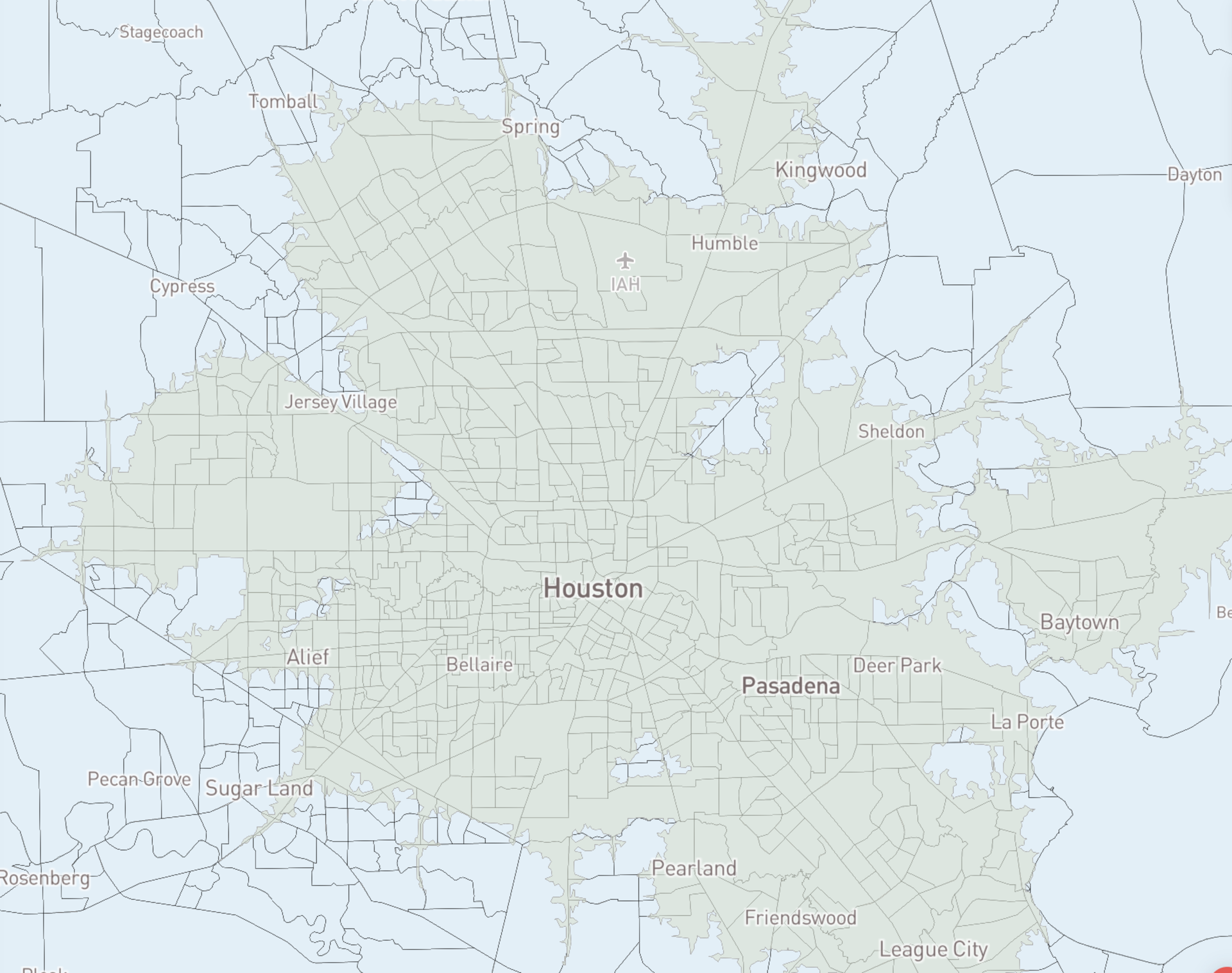
Coast to coast, updated 50 cm satellite imagery for the US
Coast to coast, updated 50 cm satellite imagery for the US
Maps
3D
Data Visualization
Satellite Imagery
Maps

Maps
Continuously update vector tiles as data changes: Mapbox Tiling Service
Continuously update vector tiles as data changes: Mapbox Tiling Service
Maps
MTS

Maps
Outdoor Cartography Textual Labeling in Studio
Outdoor Cartography Textual Labeling in Studio
Maps
Mapbox Studio
3D
GL JS

Maps
3D maps on LandSearch improve sales scouting for 10 million acres of land
3D maps on LandSearch improve sales scouting for 10 million acres of land
Maps
3D
Built With Mapbox
GL JS

Releases
Interactive Storytelling: 3D Maps with Mapbox GL JS v2
Interactive Storytelling: 3D Maps with Mapbox GL JS v2
Releases
Storytelling

2020 Maps in Review
2020 Maps in Review
3D
AR
Automotive
Built With Mapbox
Data Visualization

Maps
3D Maps Showcase: A World of Possibilities
3D Maps Showcase: A World of Possibilities
Maps
3D
Built With Mapbox
GL JS

Maps
3D Satellite Maps: Updating 135 million km² of high-resolution imagery + launching GL JS v2
3D Satellite Maps: Updating 135 million km² of high-resolution imagery + launching GL JS v2
Maps
Satellite Imagery
GL JS
Tiling data from the Census using MTS: How we built it
Tiling data from the Census using MTS: How we built it
Community
Data
Elections
Census
Open Data

Announcing the winners of the Elections Mapping Challenge
Announcing the winners of the Elections Mapping Challenge
Community
Elections

Automotive
Navigation SDK for Automotive: BMW as Launch Partner
Navigation SDK for Automotive: BMW as Launch Partner
Automotive
No items found.

Building with our friends at The Opportunity Project
Building with our friends at The Opportunity Project
Community
Agriculture
Satellite Imagery
Environment
Open Data

Releases
Mapbox GL JS v2: 3D Maps + Camera API + Sky API Launch
Mapbox GL JS v2: 3D Maps + Camera API + Sky API Launch
Releases
GL JS
Developers
Map Design
API

Maps
atlas.co reminds us what it's like to travel
atlas.co reminds us what it's like to travel
Maps
Map Design
Directions API
GL JS
Built With Mapbox
Travel
Navigation
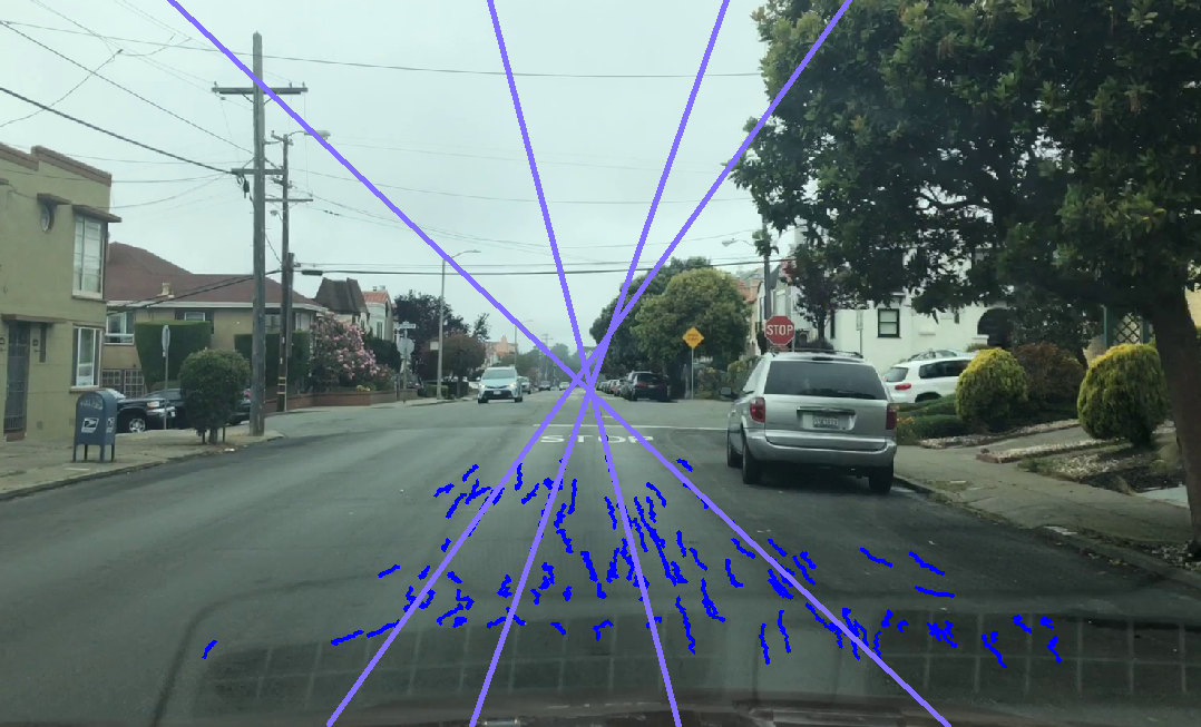
Dynamic Camera Calibration: Accurately positioning and mapping road features using the Vision SDK
Dynamic Camera Calibration: Accurately positioning and mapping road features using the Vision SDK
Navigation
AR
Automotive
SDK

Data
1 Billion Images Mapped and Streamed Live to the Navigation SDK
1 Billion Images Mapped and Streamed Live to the Navigation SDK
Data
Automotive
Data
Location Intelligence
Logistics
Navigation

Toru Takata Appointed as CEO of Mapbox Japan
Toru Takata Appointed as CEO of Mapbox Japan
No items found.

UNESCO builds new maps to experience our world heritage
UNESCO builds new maps to experience our world heritage
Community
Maps
Travel
History
Culture

A map trivia game in memory of Alex Trebek
A map trivia game in memory of Alex Trebek
Built With Mapbox
Boundaries
Data Visualization
Map Design
Open Data

How we built it: Mapping the world’s 250,000 conservation areas
How we built it: Mapping the world’s 250,000 conservation areas
Community
Open Data
Conservation
Environment

Unpredictable global connections to map a Philippine village
Unpredictable global connections to map a Philippine village
Community
Open Data
Disaster

How I Built It: Mapping the Racial Disparities of COVID in Chicago
How I Built It: Mapping the Racial Disparities of COVID in Chicago
Community
Built With Mapbox
Data Visualization
Public Health
.png)
Releases
Approximate Location-iOS 14: Upgrade Navigation SDK v1.0
Approximate Location-iOS 14: Upgrade Navigation SDK v1.0
Releases
Navigation
Data
Automotive
Built With Mapbox
Location Intelligence

Maps
A simple interface to the Mapbox Tiling Service
A simple interface to the Mapbox Tiling Service
Maps
Solutions
Maps
There are no items matching the current filters.
Ready to get started?
Create an account or talk to one of our experts.