
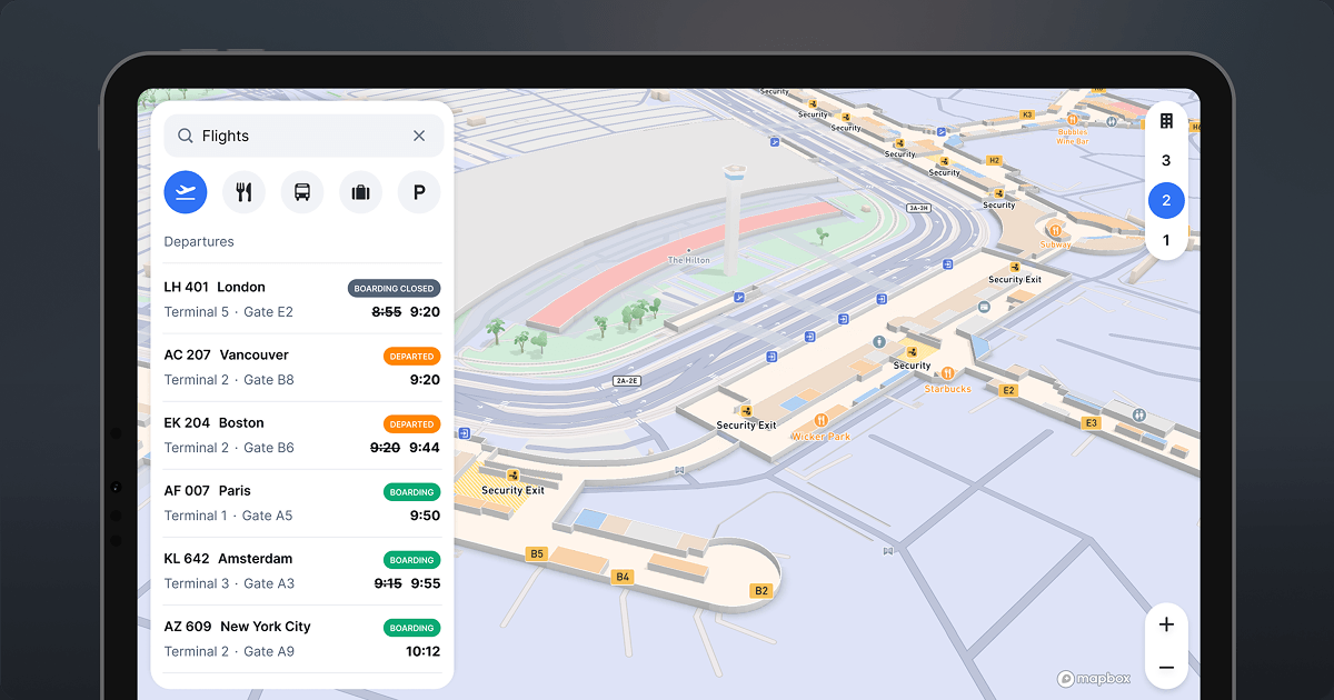
New indoor airport maps for developers
A ready-to-use tileset with detailed indoor airport maps, including terminals, gates, and amenities. With one-click enablement and SDK support across web and mobile, developers can build seamless indoor–outdoor experiences with full customization—while Mapbox handles data maintenance and updates.
Maps for iOS and Android
SDKs for Apple and Android and support for modern tools simplify development and unify maps across devices.
Mobile maps in 3D
3D maps for buildings, landmarks, indoor airports, and terrain enhance location context and raise the bar for map design.
Fast rendering
The Mobile SDKs improve load time by up to 40%, with smooth transitions and offline support.
Build maps for mobile in minutes
The smoothest way to build mobile maps
Intuitively written SDKs and Mapbox styles make mobile map development a delight. Build with native SDKs for iOS and Android or use other development frameworks. It’s simple to get started building maps for your mobile applications.
Tailor maps for unique applications
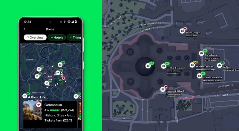
Visualize parking spots, monitor a fleet of vehicles, display real estate listings, or promote nearby hiking trails. The Mobile Maps SDKs offer the flexibility and performance to meet the needs of the end user.
.png)
Engage app users immediately
Industry-leading mobile map rendering ensures maps load fast and transition smoothly, even with dense data layers and game-like graphics. Advanced profiling and debugging tools provide vital rendering performance metrics and help improve performance.
Elevate map experiences on mobile
Mapbox Mobile Maps SDKs delight users with dynamic, real-time rendering and innovative map interface options.
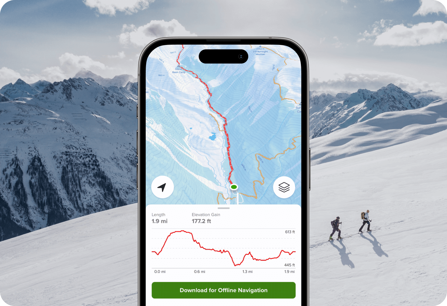
Enhance wayfinding and usability in 3D
Leverage the Mapbox Standard style with a 3D basemap and dynamic lighting. Use globe view for data that is continental in scale. Enable 3D buildings, landmarks, indoor airport maps, and terrain across your applications. The powerful mobile renderer easily handles 3D experiences that drive user engagement.

Optimize from any angle
Use flexible camera and animation capabilities to highlight any map location. Atmosphere properties like stars, haze, and fog improve realism. Integration with native platform animation systems means scenes are performant and seamless.
Solve for offline functionality
Mapbox mobile maps can provide full functionality even in low-bandwidth or offline areas. Deliver a reliable map experience, especially for premium subscribers.

Turn movement into meaningful moments
With Mapbox Geofencing, configure and manage geofenced areas and monitor when a device enters, exits, or remains within that area. Monitored device events can then trigger personalized actions, alerts, and notifications based on a user’s real-time, real-world location for iOS and Android.
Save development time and resources
Provide developers with efficient, modern tools to build highly scalable app features.

Flexible support for industry standards
The Mobile Maps SDKs are built with support for Jetpack Compose, Swift UI, and Kotlin, as well as standards like SPM and Metal and frameworks like Flutter. Developers can work with their tools and languages of choice.
New Flutter Plugin →Streamline custom data workflows
Save time and resources when processing and hosting custom map data. Integrate custom datasets of any scale into maps quickly, affordably, and flexibly.
Upload Data →Customer stories
.svg)
.svg)
Adding an interactive, map-first experience to the 'Nearby' feature of the Tripadvisor mobile app drove a 70% increase in engagement.
Read showcase →
%201.webp)
Reliable map performance, detailed terrain, and advanced offline routing make Mapbox a perfect fit for REVER’s motorcyclist community.
Read showcase →

Custom overlay features built with the Mapbox Mobile Maps SDKs boosted daily active users by 221% for Omnia Fishing.
Read showcase →
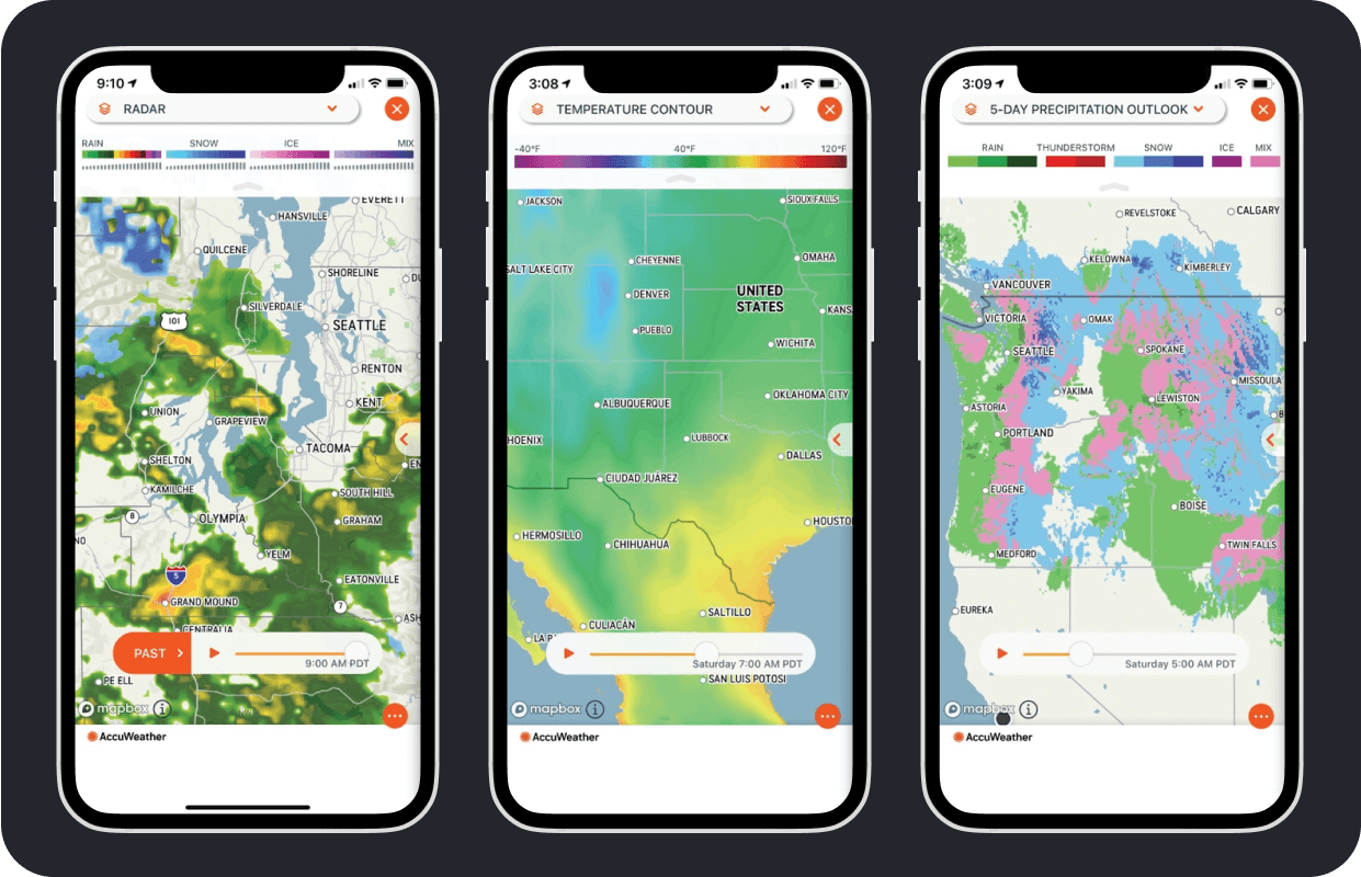
Maps are an integral part of the AccuWeather experience. The Mapbox Mobile Maps SDKs helped streamline development cycles and enabled AccuWeather to consolidate from six different mapping providers to just one.
Read showcase →
Mobile Maps Resources
A comprehensive suite of resources to power in-app mobile maps.
Getting started
Embed custom maps in mobile applications.
Migration Guide
Resources for upgrading an app to v11.
API Docs
Detailed documentation for Android and iOS.
Example Code
A list of recipes for common tasks using the Mapbox Mobile Maps SDKs.
Source Repos
Dig into the SDK code on Github.
Flutter Plugin for Mobile
Build Mapbox maps for Android and iOS using Flutter.
Ready to get started?
Create an account or talk to one of our experts.