Maps
A simple interface to the Mapbox Tiling Service

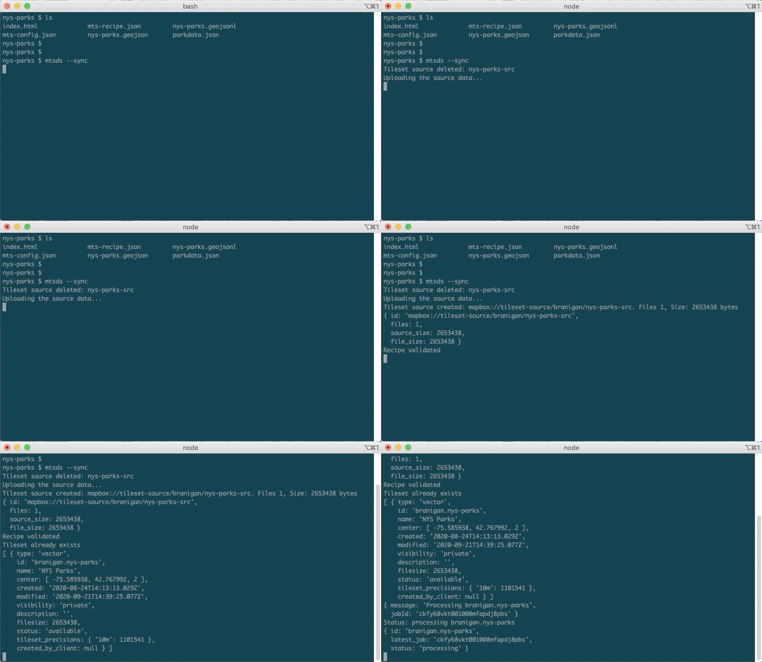
A no-code tool (MTS Data Sync) to publish your GeoJSON data as vector tiles using the new Mapbox Tiling Service (MTS) is now available. With as little as two commands, the tool makes it easy to get started without writing any code and publish map data to Mapbox’s highly scalable infrastructure using the optimized vector tile format.
MTS Data Sync is a command line tool that:
- Converts your GeoJSON data into the required line-delimited GeoJSON format
- Generates a basic recipe to get you started
- Publishes the data with a single command, abstracting the series of API calls required to upload data, validate the recipe, and create and publish the tileset
- Estimates the cost of running a tileset processing job before uploading your data

We built the MTS Data Sync tool to make it even easier to get started with bringing custom data to Mapbox.
"I work in natural resources and use Mapbox Studio layers to help me map invasive plants. I use GIS software regularly in my work to prepare my layers, though I am a beginner when it comes to programming. I only have a bit of experience with the command line, and using the MTSDS was fairly simple. I just run a few commands to configure my layer, adjust zoom levels, estimate cost, and then sync the layers to my Mapbox Studio account and it only takes a few minutes."
Lindsey Karr, Clackamas Soil and Water Conservation District
It’s a convenient tool to get started working with MTS, for everyday publishing jobs, and even as the basis for an automated publishing pipeline. It can make simple jobs a breeze and complex jobs attainable for everyone.
Get started with MTS Data Sync today!


