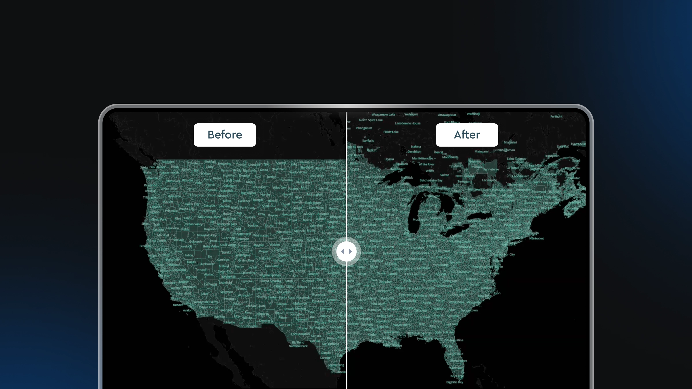
The Mapbox Tiling Service (MTS) now supports incremental data updates — a new feature that makes it significantly faster and easier to keep maps current.
MTS is the go-to tool for turning custom datasets into fast, scalable tilesets. But until now, keeping that data fresh required reprocessing a full tileset, even for the smallest of data changes. Reprocessing meant slower update cycles, more operational overhead, and outdated data for end users.
With MTS incremental updates, developers can skip the heavy lifting of full dataset updates and instead send only delta updates. Preparing and exporting only the data changes takes significantly less time than reprocessing the full dataset, so developers can make updates faster and more frequently. As a result, apps can deliver a better end-user experience by offering the most up-to-date location data available.
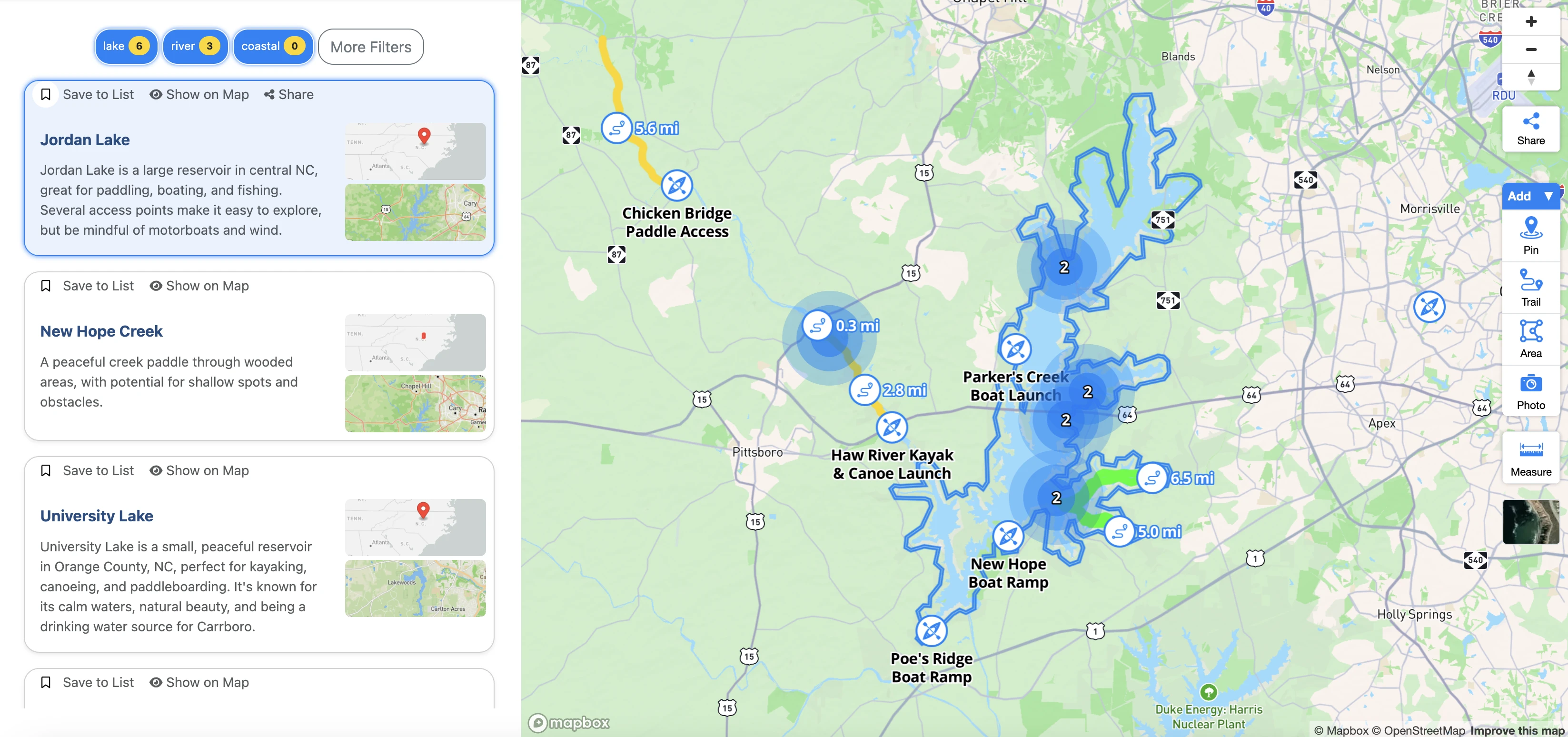
Paddle Guide makes updates to tens of thousands of waterways
Paddle Guide helps people find places to kayak, canoe, and paddleboard. But it is not only about access points and paddling routes. Users are also looking for experiences. So Paddle Guide provides POIs and additional information to help plan adventures, like where the best place is to see manatees, what paddles are family friendly, or where islands, beaches, campgrounds, waterfalls, and even shipwrecks are located.
Users typically begin a trip by searching for a body of water, so Paddle Guide offers a dataset of tens of thousands of lakes, rivers, and streams. Even when simplifying the water geometries first, it was impossible to load this much data with PostGIS. Paddle Guide turned to MTS to tile the data for optimal performance on its map. The underlying water data can be unreliable at times, so Paddle Guide accepts user generated additions and performs internal QA to make accuracy updates to the map. With incremental updates, Paddle Guide can push just the changes instead of reprocessing the full tileset each time.

“Incremental updates have been a game changer for Paddle Guide. Before we were batching updates to our tileset biweekly at best because it was cost and time prohibitive to make more frequent updates. Now we can make updates daily, providing our users the most up-to-date information on lakes, rivers, and streams. We are planning to expand our dataset into Europe and Australia. We wouldn’t be able to expand and keep these areas of the world current without incremental updates. For us, this has also reduced the cost of updating our tilesets by hundreds of dollars a month.” - James Sheppard, Founder, Paddle Guide
RidePal updates mountain bike trails with user submissions
The RidePal app for mountain bikers offers trail discovery, ride tracking, and ride sharing on social media. RidePal is also building the most up-to-date map of mountain biking trails for its riders, enriching the OpenStreetMap trails data that is the foundation for its base tileset. RidePal has a global user base, and mountain biking trails are often under-mapped or missing key trail data, so RidePal needs the ability to easily update its tilesets with new information submitted by users.
To increase global trail coverage and accuracy, the RidePal team added a feature that allows users to upload information about a ride as a new trail submission, including submitting GPS trace and metadata like trail difficulty and ride type. This information goes to an internal tool where the RidePal team reviews and approves it. Then, the new data is exported as a changeset and published to the main trails tileset with MTS incremental updates. Within just a few days, the user submission feature became extremely popular, and global users began submitting local trails to help increase trail coverage within the app.

.webp)
“We often get over 100 trail additions and updates each day. We batch these changes and make incremental updates to our main trails tileset and the map. Each incremental update saves us about 30 minutes of processing time compared to our previous workflow, and ensures our users have the most up-to-date trail information. As our dataset scales and we move to more frequent updates, we’re going to save hours each week in dev and reprocessing time. There wouldn’t be any way for us to build this updated map of mountain bike trails without a tool like Mapbox.” - Jayden Francis, Co-Founder at RidePal

CrashCount maps 1.5 million traffic incidents in New York City
CrashCount is a tool for making the streets of New York City safer. The web application breaks down New York traffic accident data by neighborhood and political district — 562 regions in total — so that advocates, political representatives, journalists, and everyday New Yorkers can campaign for better, safer streets.
Most of the city’s traffic incident data is publicly available, but it is presented in a way that is difficult to consume. The CrashCount map visually represents these incidents in a way that makes the data more understandable and more local. Crashes are categorized by severity and looked at from many geographies including borough, council district, police precinct, or state assembly and state senate districts. CrashCount currently visualizes a dataset of 1.5M crashes and counting, and it uses MTS to tile the data so that it renders performantly on the map. CrashCount recently began making incremental updates to its dataset when new crash data comes in.

“Originally when we needed to make updates to the data, we were reprocessing the entire dataset which was costly, time-consuming, and didn’t feel like an optimal solution. Because of this we were updating the crash data less frequently than we wanted and not getting the most relevant and immediate information to our users. Now we make updates once a week and we’ve reduced our monthly bill by about 150%. The best thing about Mapbox is that it’s just so easy. We were piecing together a map solution with different open source tools and it would take us a week to figure things out. With Mapbox, we can plug our data into the platform, and it just works.” - Michael Freedman, Founder, CrashCount

Cotality maintains a dynamic dataset of commercial property information
Cotality offers data, insights, and workflows across the property ecosystem, analyzing the largest objective commercial real-estate dataset in the U.S. for real-time insights in minutes. Cotality users can analyze the data to identify risks and opportunities for investing in, managing, and selling commercial real estate.
“We process massive datasets to help our clients visualize their portfolios, layered with our comprehensive property and weather data. Mapbox can process and tile these huge 8+ GB datasets quickly, but making updates means we have to export and upload the entire dataset every time. With MTS incremental updates, we will be able to conveniently and efficiently export, upload, and process only the features that have changed. The ability to quickly make incremental updates to our tileset is a game changer that we expect will save us hours of time each week and allow us to update maps more quickly for our customers.” - Mikhail Palatnik, Senior Vice President, Product, Cotality
Fresher data for any vertical
Incremental updates unlocks quicker updates and fresher data for any Mapbox customer that uses MTS. Parking spot locators can update rapidly changing parking locations and the status of spots. An e-scooter rental company can make updates to individual geofenced no-ride zones as cities modify restricted areas. Developers can consolidate multiple tilesets previously managed separately into a single incrementally updated tileset, for example combining several state-level tilesets into a single nationwide tileset.
Additionally, incremental updates pair well with the recently released support for clustering in MTS tilesets. Users typically cluster data when large amounts of point data need to be visualized across a large area. The data informing clusters often need frequent updates, which are now more time-effective to do using incremental changes.

Start using MTS and incremental updates
The incremental updates capability is available right now. To get started with MTS, see the Mapbox docs site. For more specific information about incremental updates, check out this tutorial or the general documentation.


Related articles

Drag, drop, edit, publish: A simplified workflow for custom data
Mission-ready mapping: Securely bring together maps, AI, and response