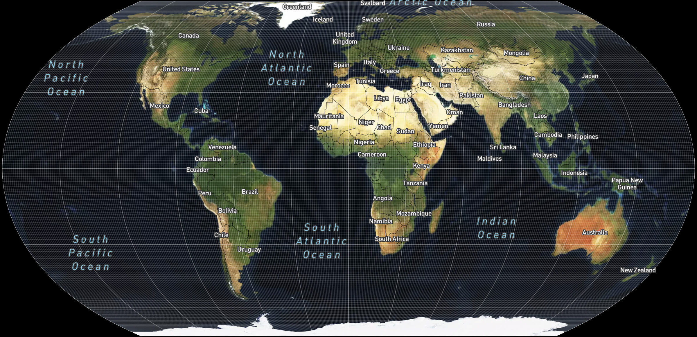
Mapbox Blog
Stay informed with insightful content on how Mapbox solutions are revolutionizing industries.

Data
Featured Blog
Drag, drop, edit, publish: A simplified workflow for custom data
Discover Mapbox Data Workbench, a simplified workflow to drag, drop, edit, and publish custom geospatial data. Go from raw data to production-ready maps faster.
Thank you! Your submission has been received!
Oops! Something went wrong while submitting the form.

Company
Interview with Team Helsinki: Hyvää vuosipäivää, Helsinki!
Interview with Team Helsinki: Hyvää vuosipäivää, Helsinki!
Company
Culture

Company
Celebrating International Women’s Day at Mapbox
Celebrating International Women’s Day at Mapbox
Company
Culture
DEI

Maps
Updated 50 cm imagery in UK, Italy, Finland, Japan, India, and China
Updated 50 cm imagery in UK, Italy, Finland, Japan, India, and China
Maps
Satellite Imagery
Imagery

Logistics
Find The Ideal Location For Your Dark Store with Mapping Technology
Find The Ideal Location For Your Dark Store with Mapping Technology
Logistics
Logistics
Movement Data
Retail

Data
Mobile Device Telemetry as a Sensor
Mobile Device Telemetry as a Sensor
Data
Movement Data
Data

Mapbox: A Year in Review 2021
Mapbox: A Year in Review 2021
No items found.

Maps
Imagery in 2021
Imagery in 2021
Maps
Satellite Imagery

Logistics
Rapid disaster logistics
Rapid disaster logistics
Logistics
Community
Disaster
Movement Data
Data
Logistics
Maps
Reimagining projections for the interactive maps era
Reimagining projections for the interactive maps era
Maps
GL JS
Data Visualization
Maps
Cartography

Measuring the impact of school connectivity in the Giga Initiative: How we built it
Measuring the impact of school connectivity in the Giga Initiative: How we built it
Community
Isochrones
Non-Profit and NGO
Education
Public Health

Company
Adtech Tokyo 2021 Report
Adtech Tokyo 2021 Report
Company
No items found.

Climate visualizations for the people: Probable Futures
Climate visualizations for the people: Probable Futures
Community
Climate
Environment
Data
Data Visualization

Mapmakers take action on climate change
Mapmakers take action on climate change
Community
Environment
Climate
Data Visualization
Maps

Releases
Mapbox GL JS v2.6
Mapbox GL JS v2.6
Releases
3D
Data Visualization
GL JS
Maps

Releases
Realistic 3D experience with Terrain updates
Realistic 3D experience with Terrain updates
Releases
3D
Outdoor

Mapbox commitment to climate action
Mapbox commitment to climate action
Environment
Community
Climate

Maps
Why The Washington Post used MTS (Mapbox Tiling Service) to visualize census data
Why The Washington Post used MTS (Mapbox Tiling Service) to visualize census data
Maps
MTS
Maps
Census
Storytelling

Releases
Maps SDK v10
Maps SDK v10
Releases
Maps

Maps
Updated 50 cm imagery covering Israel and Palestine
Updated 50 cm imagery covering Israel and Palestine
Maps
Satellite Imagery
Imagery

Maps
Novas imagens aéreas para Portugal e França
Novas imagens aéreas para Portugal e França
Maps
Imagery
Satellite Imagery

Maps
Hochauflösende Luftaufnahmen für Deutschland und Österreich
Hochauflösende Luftaufnahmen für Deutschland und Österreich
Maps
Imagery
Satellite Imagery

Maps
Nouvelles images aériennes pour la France et le Portugal
Nouvelles images aériennes pour la France et le Portugal
Maps
Imagery
Satellite Imagery
.png)
Data-driven health logistics in the Indo-Pacific
Data-driven health logistics in the Indo-Pacific
Community
Health
Public Health
Logistics
Business Intelligence
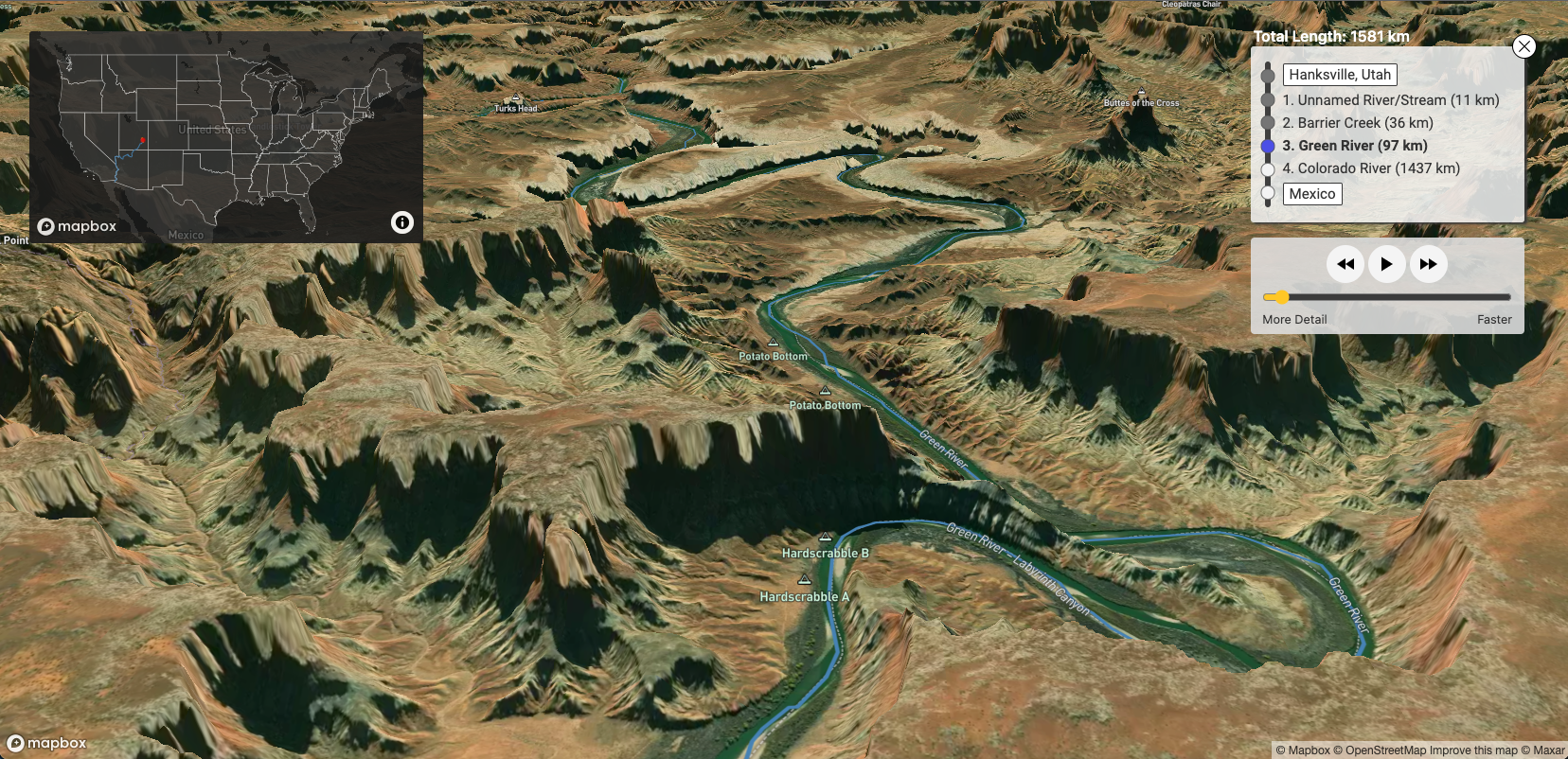
River Runner - How I Built It
River Runner - How I Built It
3D
Community
Environment
Education
GL JS
There are no items matching the current filters.
Ready to get started?
Create an account or talk to one of our experts.