Mapbox adds 10 million sq km of new 30 cm satellite imagery
Vantor partnership provides updated, higher resolution imagery
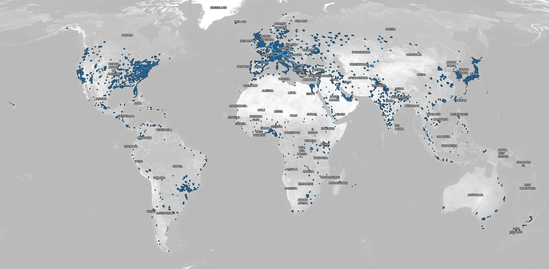
Mapbox has just released 10 million square kilometers of updated satellite imagery on the mapbox.satellite tileset. The update integrates 30 cm satellite imagery basemaps from Vantor (formerly Maxar Intelligence), providing unparalleled resolution and accuracy.

The newly updated imagery covers primarily areas with populations over 500,000 people, but also includes large, uninterrupted swaths of the United States and Europe. Entirely updated countries include England, Italy, Japan, and South Korea.
.webp)
.webp)
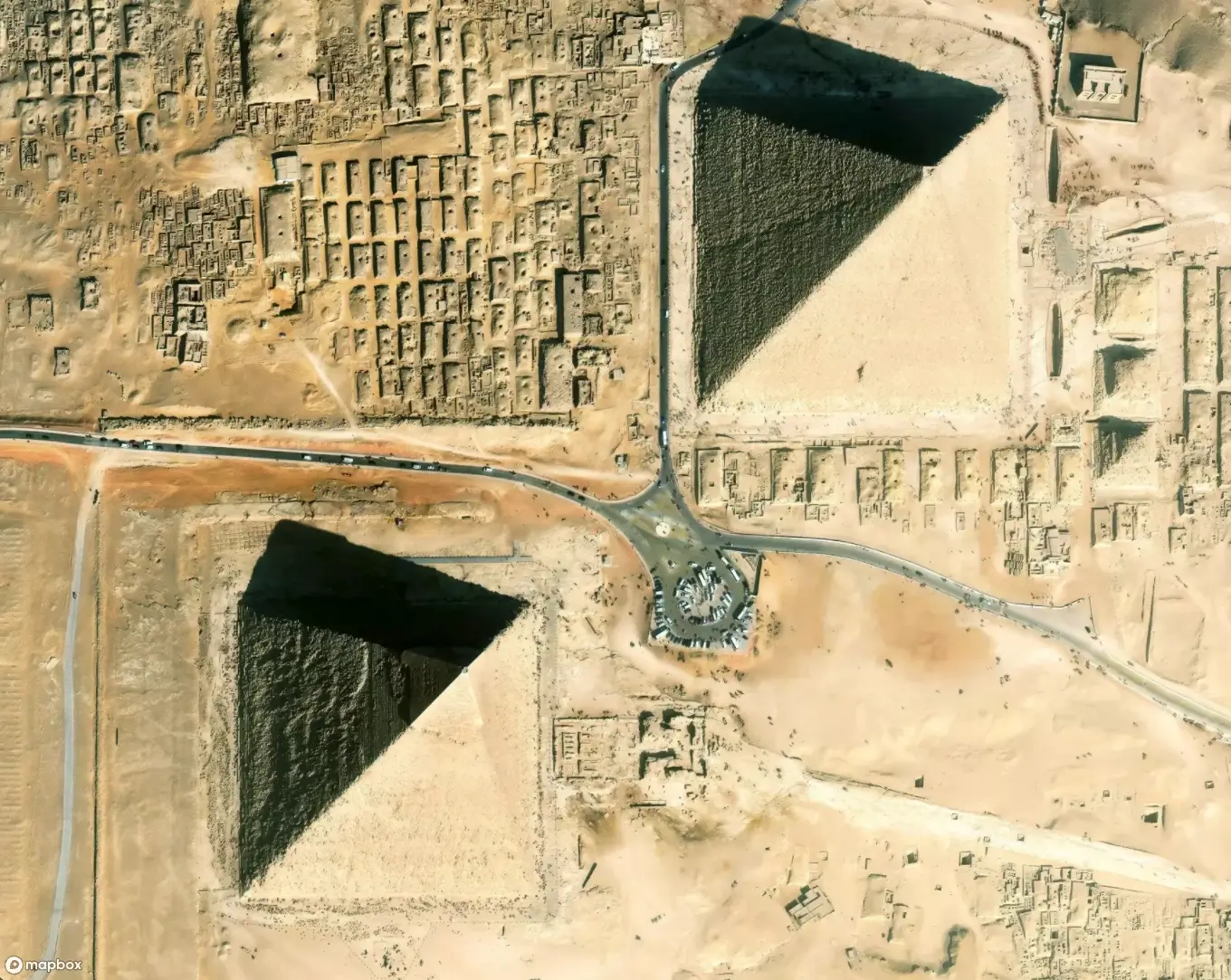
Sharper, more accurate satellite imagery in every Mapbox map
The updated imagery comes from Vantor’s Vivid Mosaic 30 cm imagery product, which provides basemaps composed of millions of individual images that are stitched together and color-balanced to offer a smooth, seamless, and true-to-life representation of Earth.
The new imagery improves spatial resolution from 50 cm to 30 cm and improves accuracy from 8.5 m to <5 m, revealing finer details that moderate resolution imagery can miss. For example, at 30 cm resolution individual buildings are more distinguishable and road details and lane guidance are more clear.


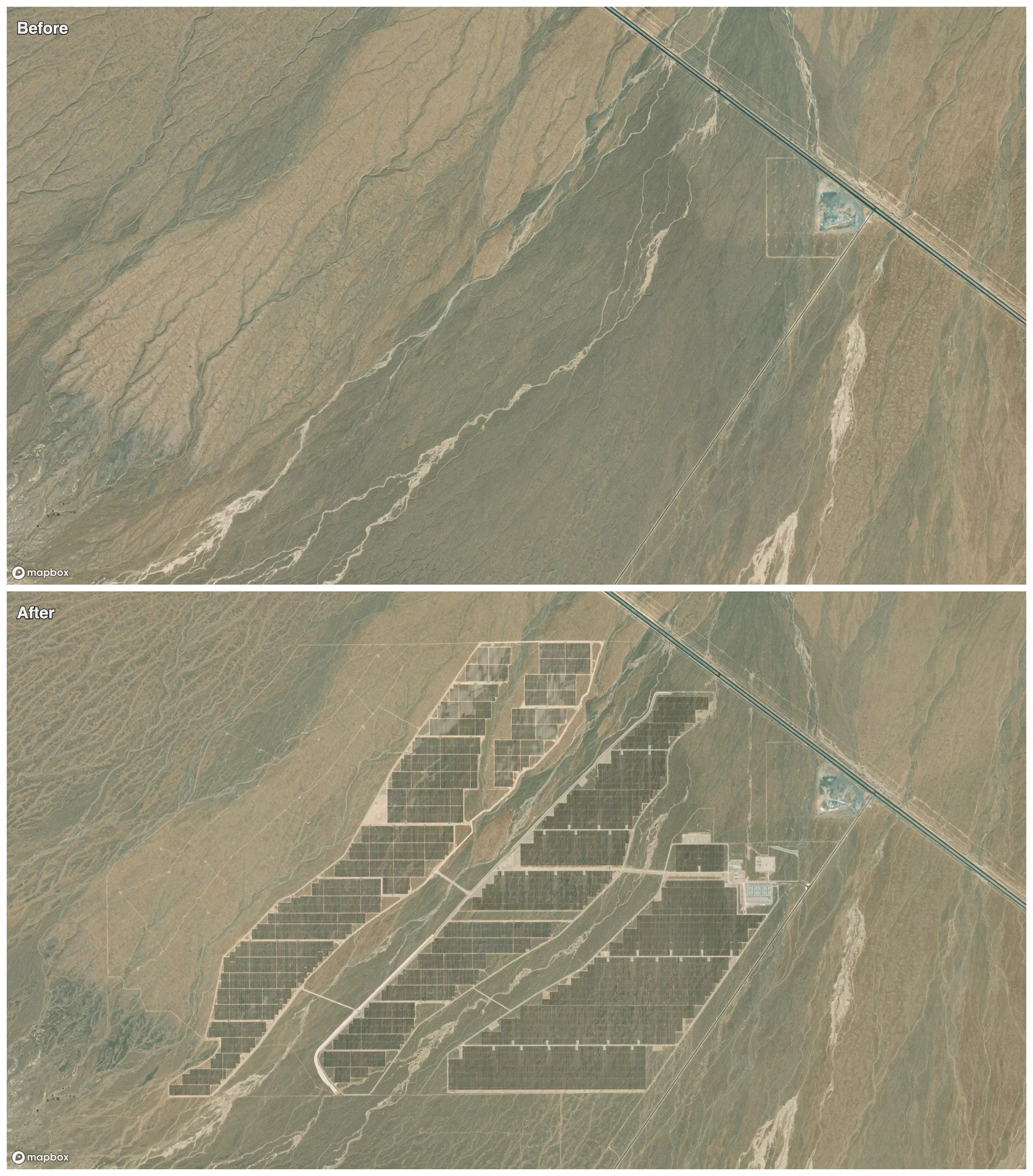
The updated imagery also reflects recent landscape changes, such as the construction of a solar farm in Nevada.
Get started with Mapbox imagery
The latest Mapbox satellite imagery update accompanies the recent aerial imagery update in November 2025. All Mapbox accounts have access to the global mapbox.satellite tileset, which is continuously updated as new imagery is added. No updates are needed to access the latest imagery as any application using the tileset will automatically receive the latest imagery when the map loads. Developers can use the tileset url to add the tileset to any map style, or use it in the curated Mapbox Satellite and Mapbox Satellite Streets styles.


Related articles
Build once, run everywhere: Web support comes to the Mapbox Maps SDK for Flutter

From airports to stadiums, maps are elevating the soccer fan experience
