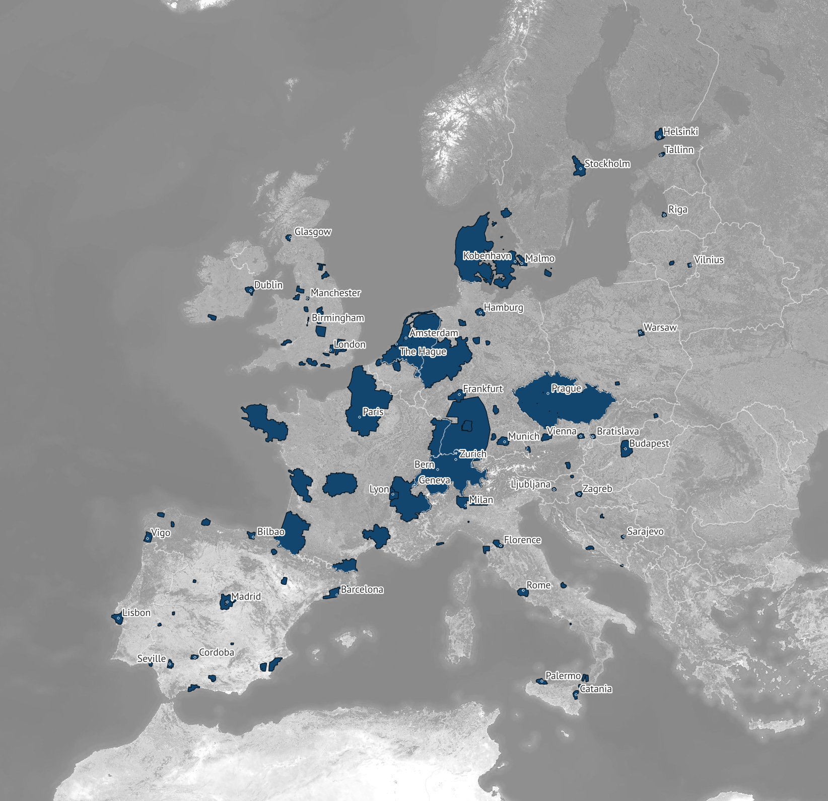
670k sq km of updated aerial imagery for the US and Europe

Mapbox recently added over 670,000 square kilometers of updated aerial imagery covering major cities in the US and Europe. The pixel resolution varies between 10 and 20 cm, resulting in over 4 million new pixels for crisp, highly detailed imagery – perfect for guiding a delivery, planning a trip, or re-living a great route.

Major updates in North America and Europe
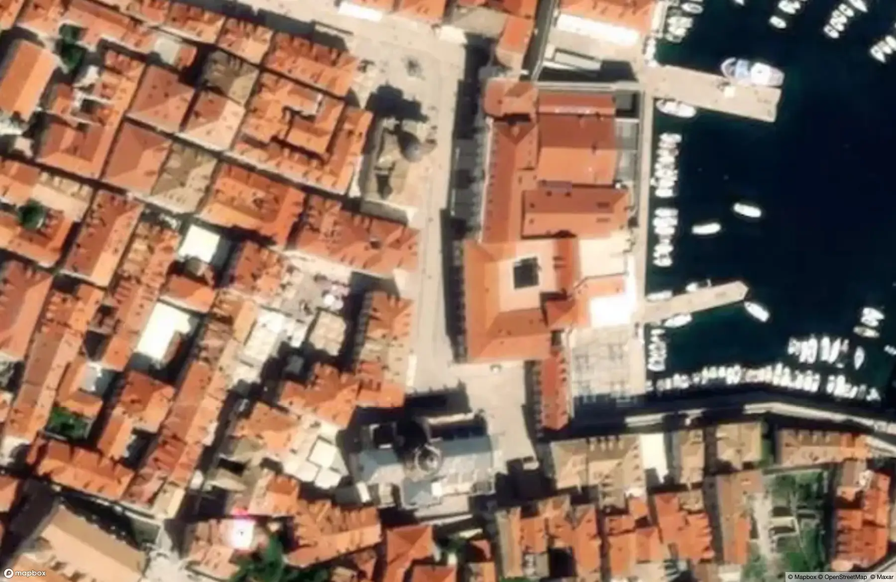
Mapbox partnered with Vexcel Imaging to provide updated 15 cm resolution imagery for cities like Los Angeles, Seattle, Denver, Chicago, Miami, Boston, and Washington, D.C. In Europe, updated coverage includes London, Rome, Madrid, Lisbon, Dublin, Hamburg, and Vienna. Aerial imagery coverage now also includes Baltic and Balkan cities for the first time.

In addition to the previously mentioned European cities, Mapbox also added full country updates of Switzerland, Czechia, Denmark, and the Netherlands by leveraging the open imagery data programs offered by those countries. These governments maintain a commitment to providing their citizens with detailed, recent imagery, and Mapbox developers benefit from their investment.
Since the beginning of 2024, Mapbox has added more than 1.2M square kilometers of Vexcel imagery, with more updates planned by the end of 2025. Ongoing updates help to reflect landscape change and keep the Mapbox Satellite tileset as current as possible. Aerial imagery typically offers higher resolution than satellite imagery, so Mapbox uses aerial imagery whenever possible for the most requested and populated areas, and relies on satellite imagery for locations where aerial is not available.

Updated imagery means more useful maps
Detailed, current imagery is crucial for many businesses that rely on providing end users highly realistic context in map experiences. On-demand delivery and logistics companies often use detailed imagery to plan accurate routes and ensure deliveries and shipments reach the right location. Imagery can be key to the effectiveness of geofencing use cases, such as setting a perimeter around a yard for an invisible pet fence or a security camera. It can also be used to assess roof type and direction and the opportunity to install solar panels.
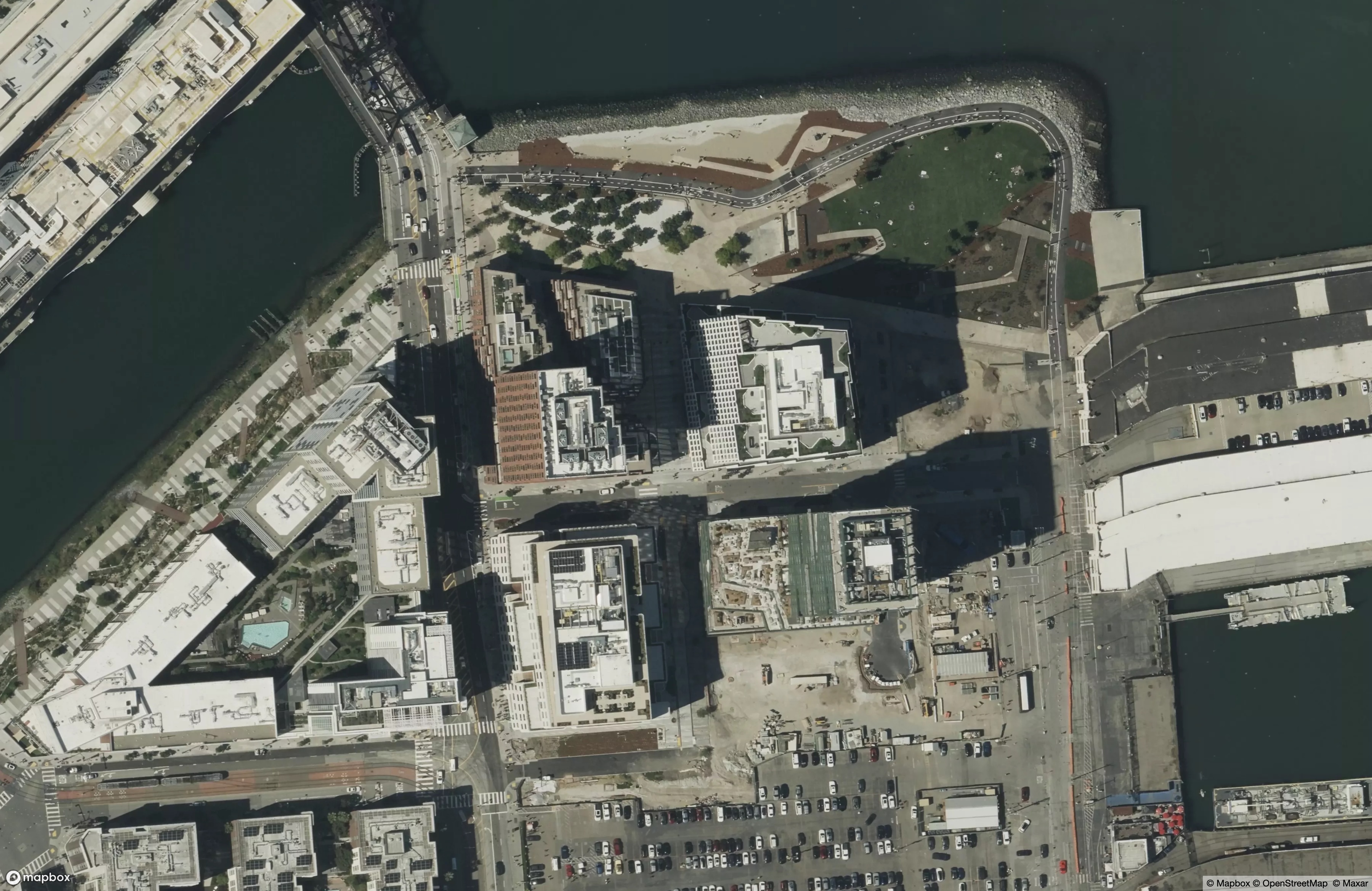
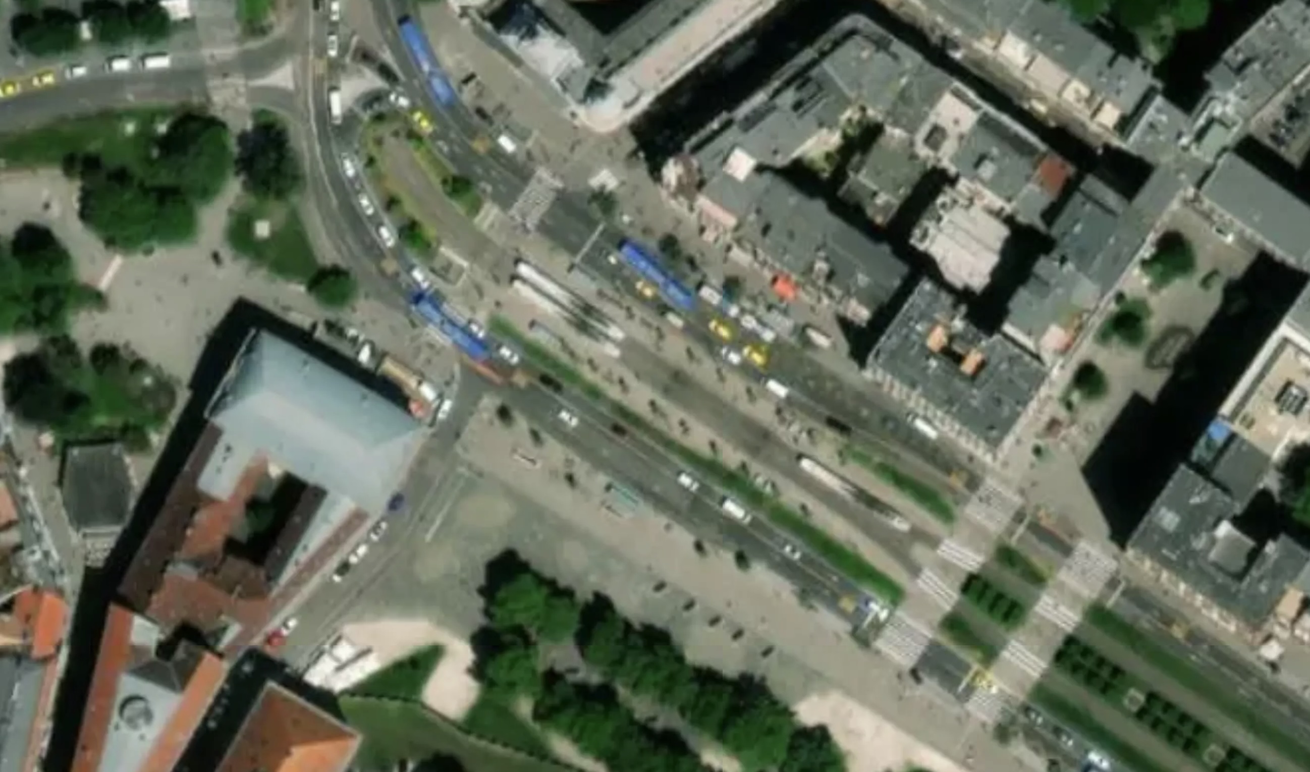
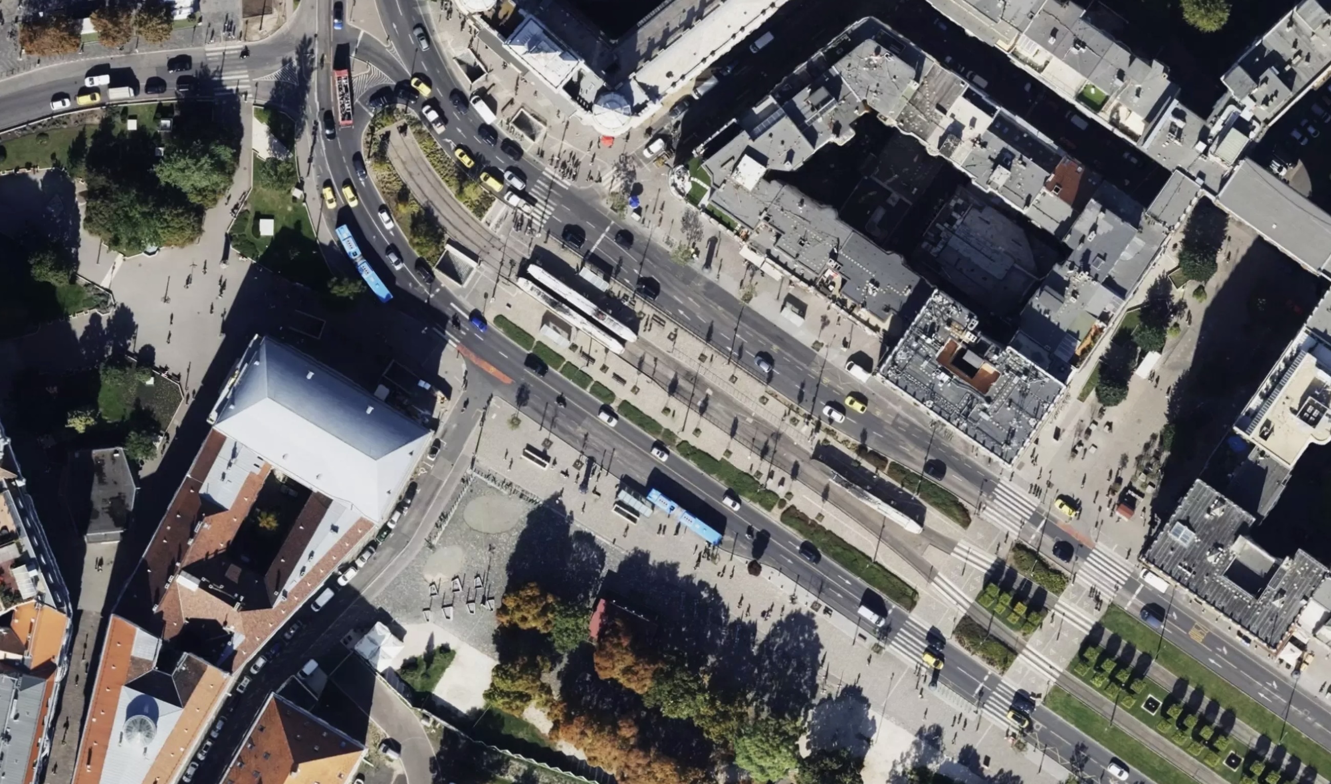
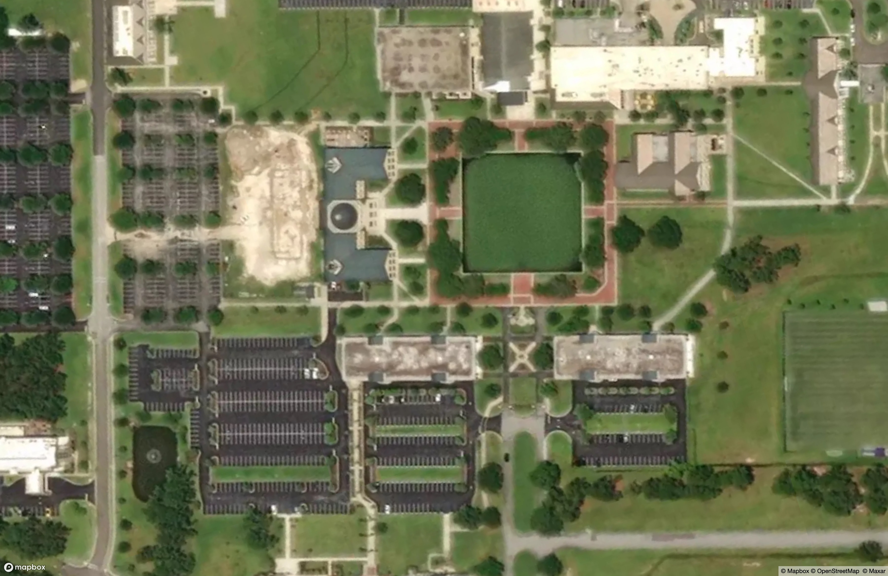
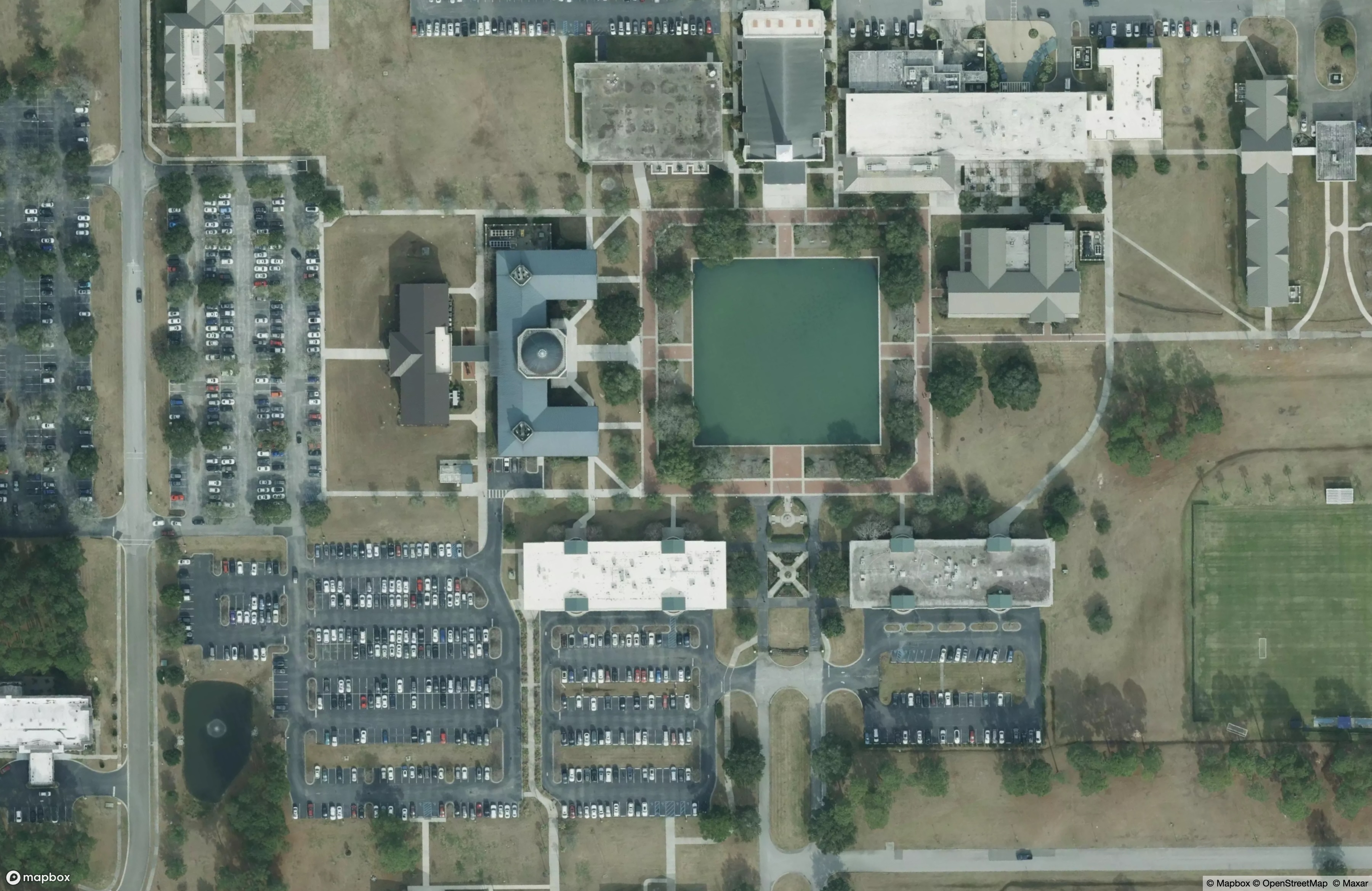
Across the locations with updated imagery it is possible to see sometimes dramatic improvements in the recency and resolution of the imagery, including changes to road networks and completed developments:

Get started with Mapbox imagery
All Mapbox accounts have access to the mapbox.satellite tileset, which is continuously updated as fresh imagery is added. Use the tileset url to add the tileset to any map style, or use it in the curated Mapbox Satellite and Mapbox Satellite Streets styles. No updates are needed to access the latest imagery as any application using the tileset will automatically receive the latest imagery when the map loads.
_________________________________________________________________________________________________
Additional questions about the latest Mapbox imagery updates
Which regions benefit from the latest Mapbox imagery update?
In the second half of 2025, Mapbox added over 670,000 square kilometers of refreshed aerial imagery across major cities in the United States and Europe. Updates include Los Angeles, Denver, Chicago, Miami, Washington, DC, London, Rome, Madrid, Lisbon, Dublin, Hamburg, and Vienna, along with new coverage in Baltic and Balkan cities.
What level of detail does the new imagery provide?
The updated imagery delivers 10–20 cm pixel resolution, with most metropolitan areas captured at 15 cm resolution through our partnership with Vexcel Imaging. The level of detail now available in the updated locations enhances clarity for navigation, analysis, and visualization.
How does updated imagery improve Mapbox products?
Fresh, high-resolution imagery strengthens the accuracy and visual quality of Mapbox maps. Developers and end users benefit from better context for delivery tracking, trip planning, change detection, and visualizing new development.
How current is the imagery Mapbox is using?
Since early 2024, Mapbox has added more than 1.2 million square kilometers of new Vexcel imagery. Ongoing updates ensure customers can rely on Mapbox for some of the most up-to-date aerial coverage available.
How do I use the latest imagery available from Mapbox?
All Mapbox accounts have access to the mapbox.satellite tileset, which is continuously updated as fresh imagery is added. Use the tileset url to add the tileset to any map style, or use it in the curated Mapbox Satellite and Mapbox Satellite Streets styles. No updates are needed to access the latest imagery as any application using the tileset will automatically receive the latest imagery when the map loads.
Will Mapbox expand imagery coverage further?
Yes. Additional updates are planned through the end of the year as Mapbox continues to broaden and refresh aerial coverage across key global regions.


Related articles
Build once, run everywhere: Web support comes to the Mapbox Maps SDK for Flutter

From airports to stadiums, maps are elevating the soccer fan experience
