Mapbox Blog
Stay informed with insightful content on how Mapbox solutions are revolutionizing industries.

Data
Featured Blog
Drag, drop, edit, publish: A simplified workflow for custom data
Discover Mapbox Data Workbench, a simplified workflow to drag, drop, edit, and publish custom geospatial data. Go from raw data to production-ready maps faster.
Thank you! Your submission has been received!
Oops! Something went wrong while submitting the form.

High resolution administrative country polygons in Studio
High resolution administrative country polygons in Studio
Boundaries
Data
Studio

Global Movement data: The World's Largest Privacy-Forward Mobility Data Set
Global Movement data: The World's Largest Privacy-Forward Mobility Data Set
Data
Location Intelligence
Movement Data
.jpeg)
Automotive
Unreal Engine for Auto with Mapbox
Unreal Engine for Auto with Mapbox
Automotive
Built With Mapbox
Mapbox Studio

Releases
Enhanced Location Engine Ships in New Navigation SDKs (Android + iOS)
Enhanced Location Engine Ships in New Navigation SDKs (Android + iOS)
Releases
Navigation
Maps

Releases
Introducing Mapbox Tiling Service
Introducing Mapbox Tiling Service
Releases
No items found.

Election Mapping Challenge: Map contest + speaker series
Election Mapping Challenge: Map contest + speaker series
Community
Elections
Data Visualization
Open Data

Maps
The Tillamook Tillamap Story
The Tillamook Tillamap Story
Maps
Map Design
Built With Mapbox

Illustrating the scale of fires: Open data from the National Interagency Fire Center
Illustrating the scale of fires: Open data from the National Interagency Fire Center
No items found.

The road to carbon-neutral shipping
The road to carbon-neutral shipping
Community
Logistics
Environment
Climate

Logistics
The camera is the interface — delivering 150 packages a day, Straightaway delivery optimization app for drivers
The camera is the interface — delivering 150 packages a day, Straightaway delivery optimization app for drivers
Logistics
Automotive
Navigation
Solutions

3D Animated Hurricane Map from Radar Data
3D Animated Hurricane Map from Radar Data
Weather
Disaster

See through the smoke with SWIR
See through the smoke with SWIR
Community
Satellite Imagery
Weather
Disaster

Store Locators, ‘for when you want to get a little fancy’ — Maison 9
Store Locators, ‘for when you want to get a little fancy’ — Maison 9
No items found.

Logistics
What’s the value of hot food?
What’s the value of hot food?
Logistics
Logistics
Built With Mapbox
Isochrones

Maps
Build a Store Locator in 5 minutes
Build a Store Locator in 5 minutes
Maps
Built With Mapbox
Map Design
Mapbox Studio tips: How to add labels to your map
Mapbox Studio tips: How to add labels to your map
No items found.
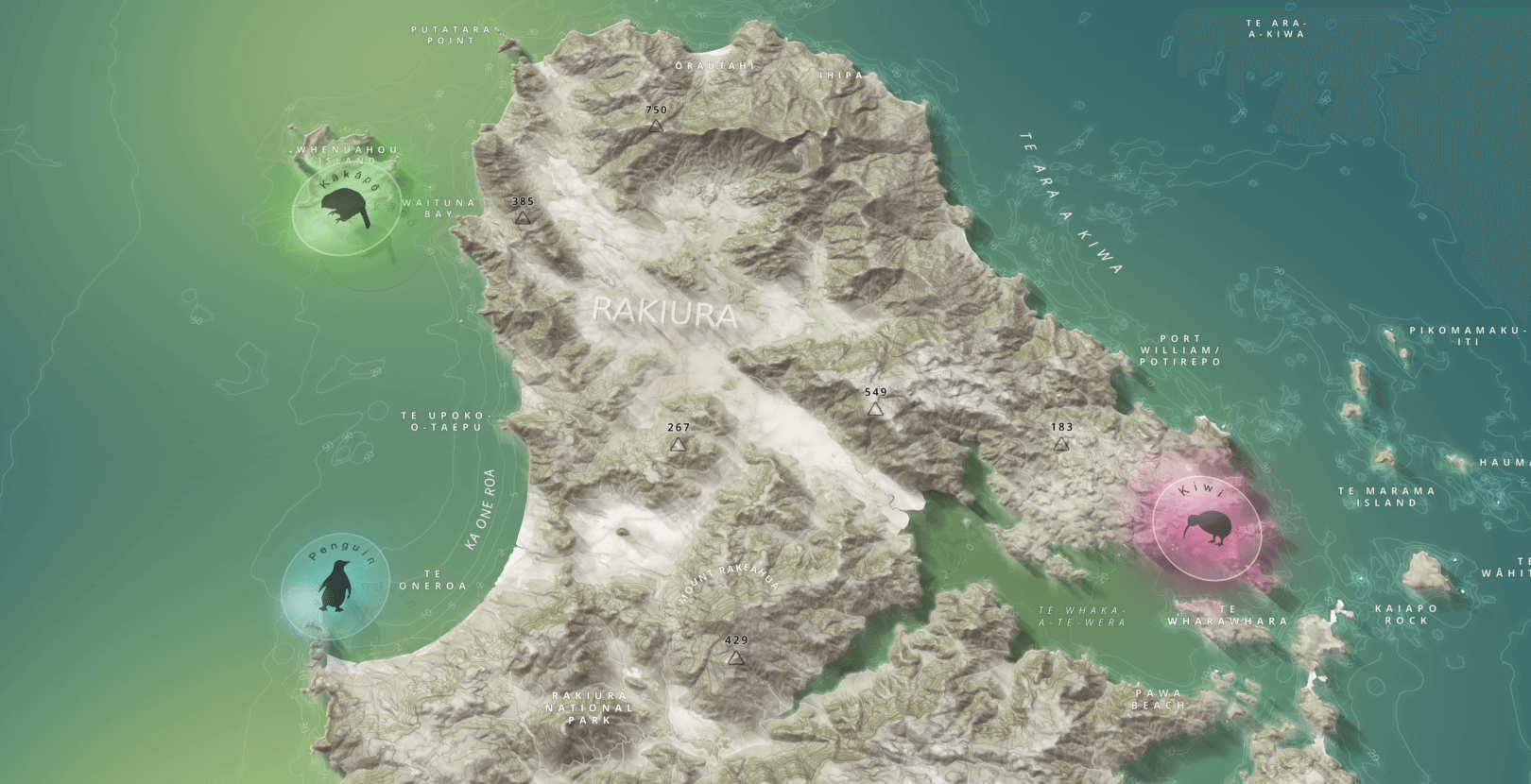
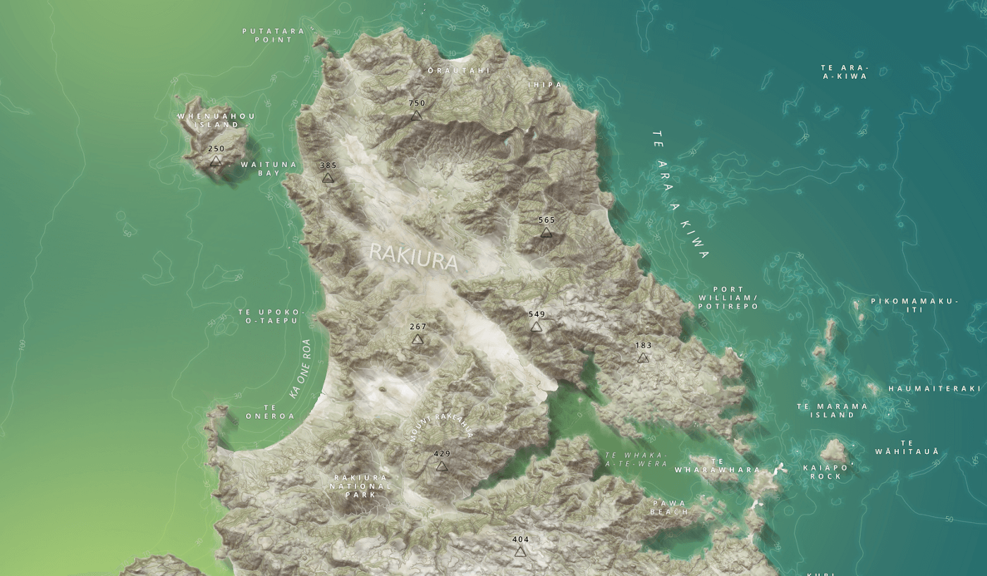
“Glass disc” effect: Experimenting with points of interest in Studio
“Glass disc” effect: Experimenting with points of interest in Studio
Map Design

The New York Times: Mapping COVID-19 cases and deaths in the United States
The New York Times: Mapping COVID-19 cases and deaths in the United States
Public Health

The elephant in the map
The elephant in the map
Community
Environment
Built With Mapbox
Conservation

OpenStreetMap
OpenStreetMap
Community
Open Data

A map of the global Black Lives Matter movement
A map of the global Black Lives Matter movement
Community
Built With Mapbox
Social Justice
Crowdsourcing

Logistics
Curbside pickup for the new reality of retail
Curbside pickup for the new reality of retail
Logistics
Retail
Isochrones

Navigation
Mobile AI Compute Engine (MACE) inference framework — Vision SDK
Mobile AI Compute Engine (MACE) inference framework — Vision SDK
Navigation
Built With Mapbox
AR

Releases
Double the Resolution vs. Computational Load — Vision SDK
Double the Resolution vs. Computational Load — Vision SDK
Releases
SDK
AR
There are no items matching the current filters.
Ready to get started?
Create an account or talk to one of our experts.