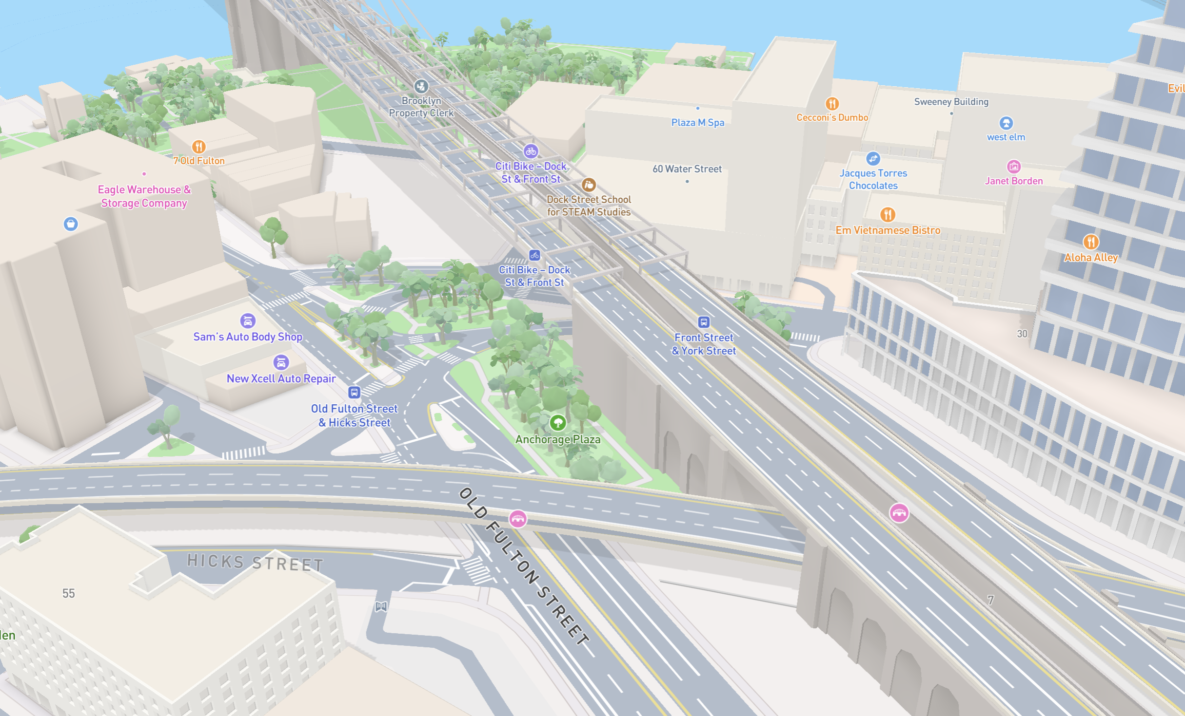
Today, Mapbox has released enhanced road details, elevated roads, 3D bridges and tunnels to Mapbox Standard.
Mapbox Standard now brings more detailed road surfaces, road structures, and markings directly into applications built with Mapbox Maps SDKs. At high zoom, Standard renders lane boundaries, turn arrows, pedestrian crossings and stop lines.
Following the Mapbox approach to symbolic realism, these details reflect the structure of real-world roads while keeping the map clear and legible. Whether users are planning running routes in busy urban arterials, exploring neighborhood real estate, or providing contextual grounding for drone flights, enhanced road details close the gap between what they see on screen and experience in the real world.
The world isn't flat, now roads aren’t either
When users zoom in to explore a dense intersection, drop off a package, or find a hotel entrance, traditional basemaps have historically fallen short. Roads are typically represented as simplified, flat ribbons with no internal structure. In the past, developers had no out-of-the-box way to show:
- How many lanes a busy road actually has.
- Where turning lanes and stop lines begin.
- Where safe pedestrian crossings are located.
- How elevated highways, overpasses, and 3D bridges span across local streets.
To work around this, teams had to go without lane-level detail, or manually overlay custom vector geometry that breaks whenever underlying road networks update. With the new details in the Mapbox Standard Style, high-fidelity road rendering is now a native, plug-and-play part of the Mapbox basemap.
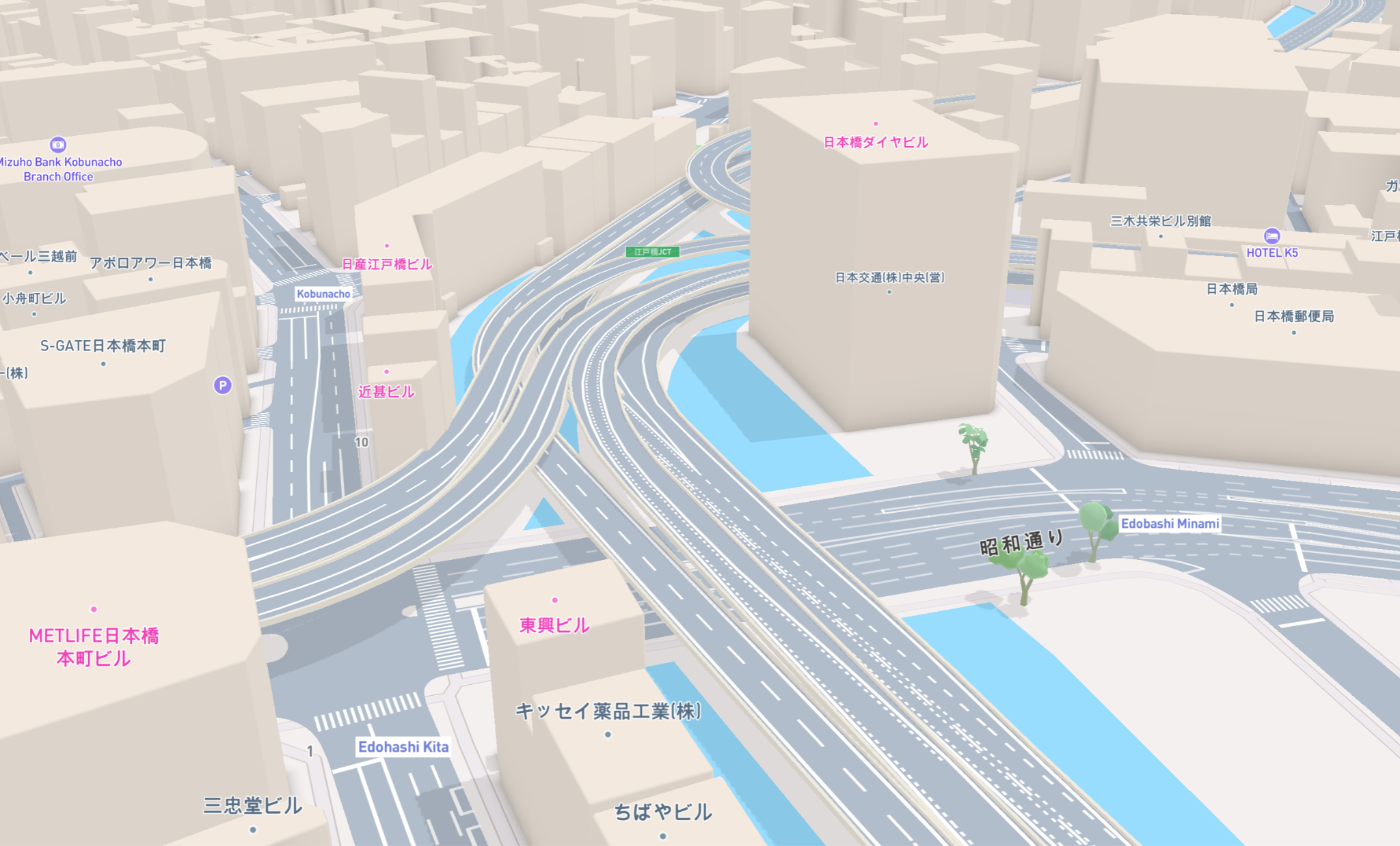
Enhanced road details in Mapbox Standard
Lane-level visual detail
Mapbox Standard dynamically reveals individual lane markings, directional turn arrows, lane types, and stop lines at zoom 16. It gives users immediate, intuitive visual context of street geometry.
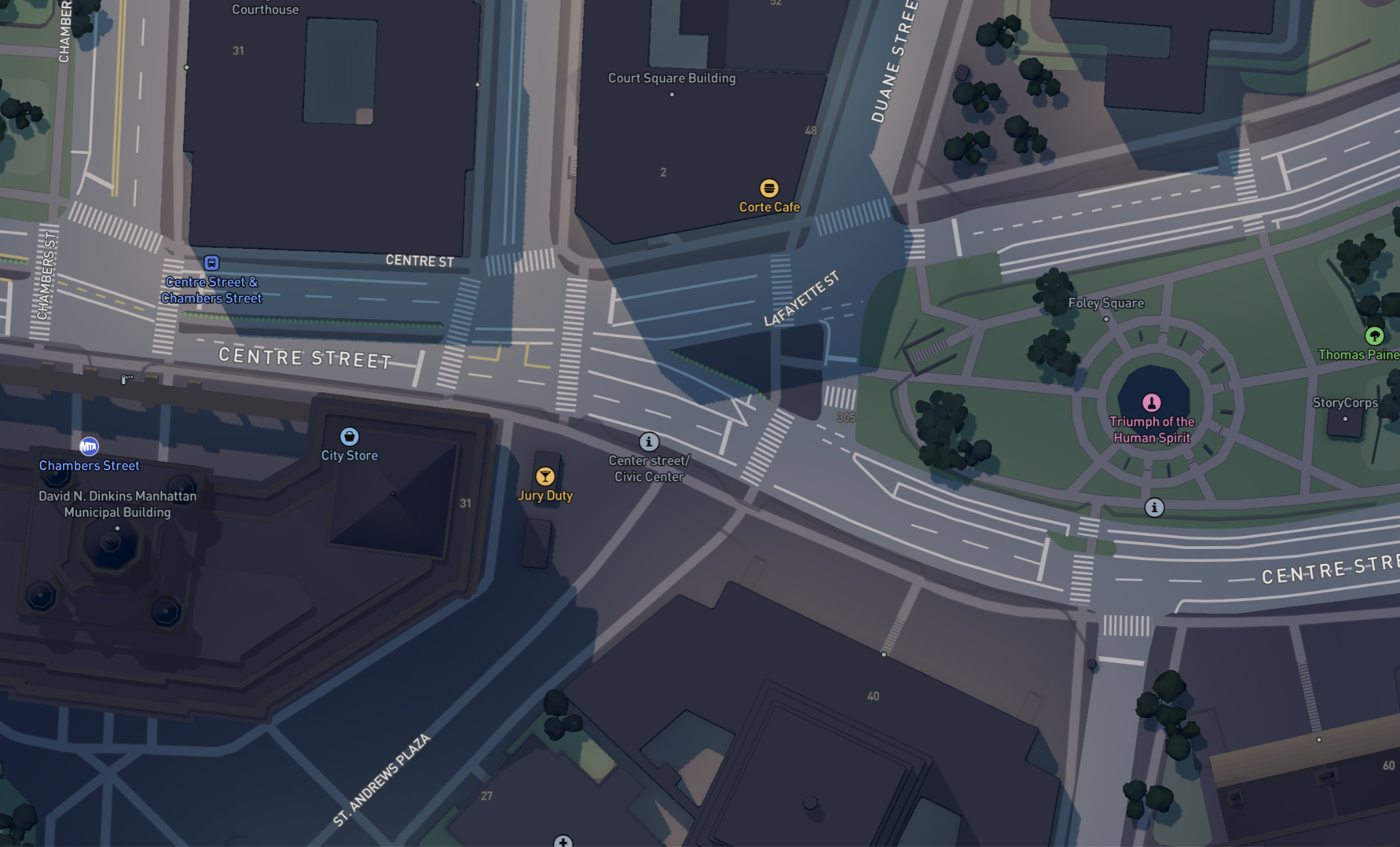
Pedestrian crossings and safety context
Crosswalks and intersections are now explicitly rendered, providing essential spatial context for urban hikers, pedestrians, micromobility riders, and runners.
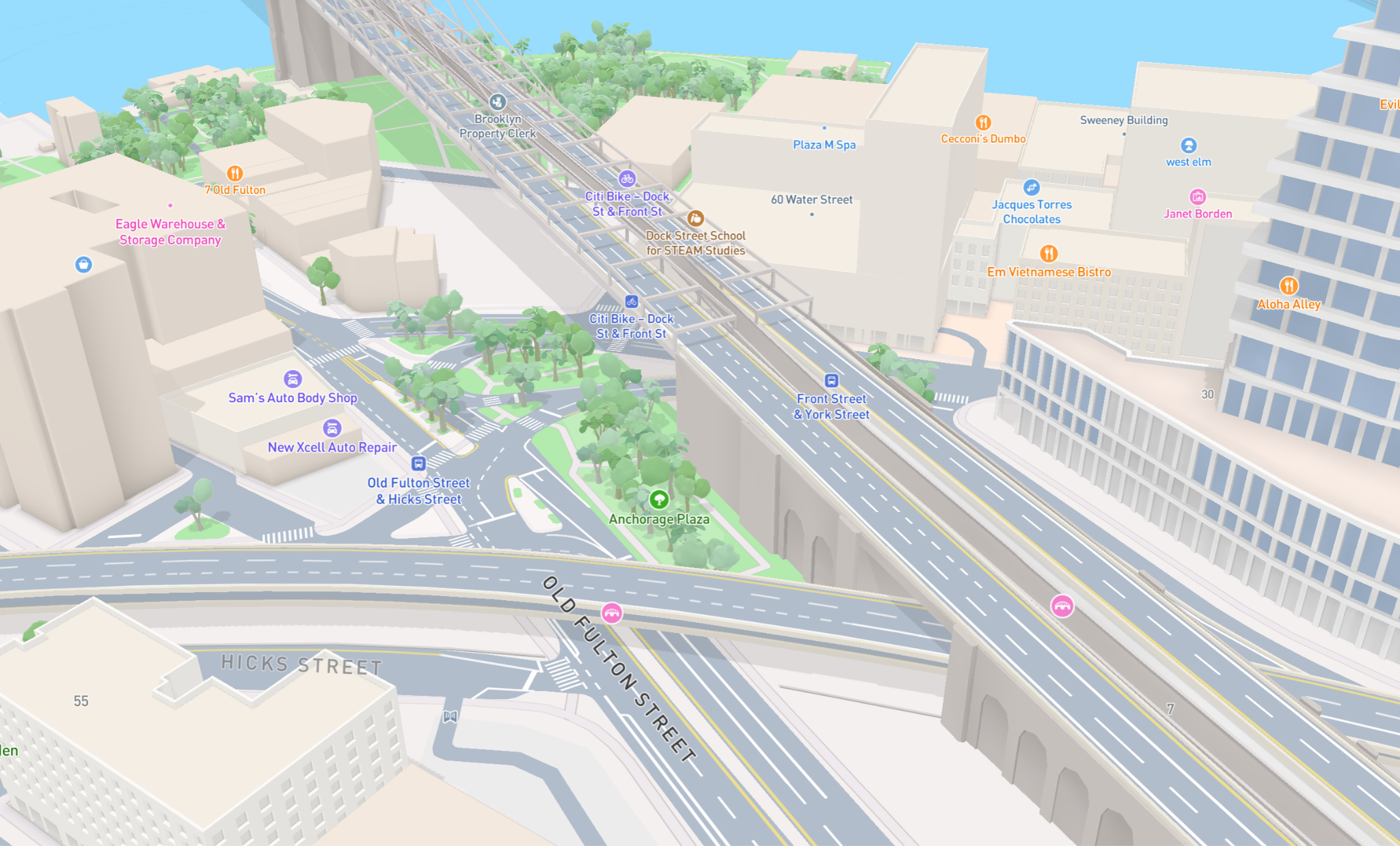
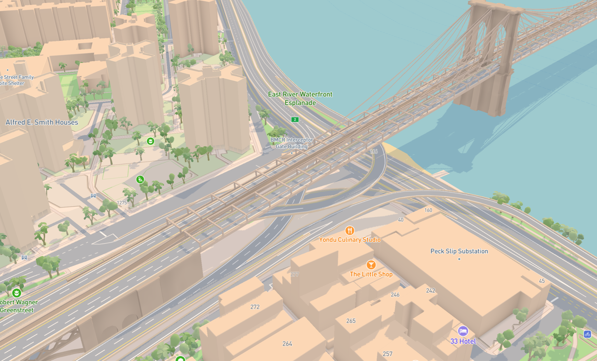
Elevated 3D bridges, tunnels, and overpasses
Complex vertical infrastructure comes to life. From major landmarks like the Brooklyn Bridge to multi-tiered highway interchanges, 3D elevation makes maps both visually stunning and easier to interpret.
Built for next-gen real estate, travel, fitness & beyond
These new enhanced road details can elevate the user experience across a wide range of applications:
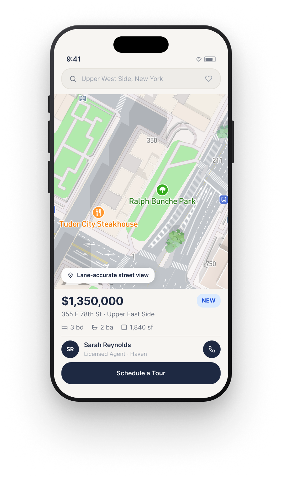
- Real estate and property tech applications can give buyers and renters a true sense of a property’s surroundings. Listings show exact street widths, access lanes, and proximity to elevated highways.
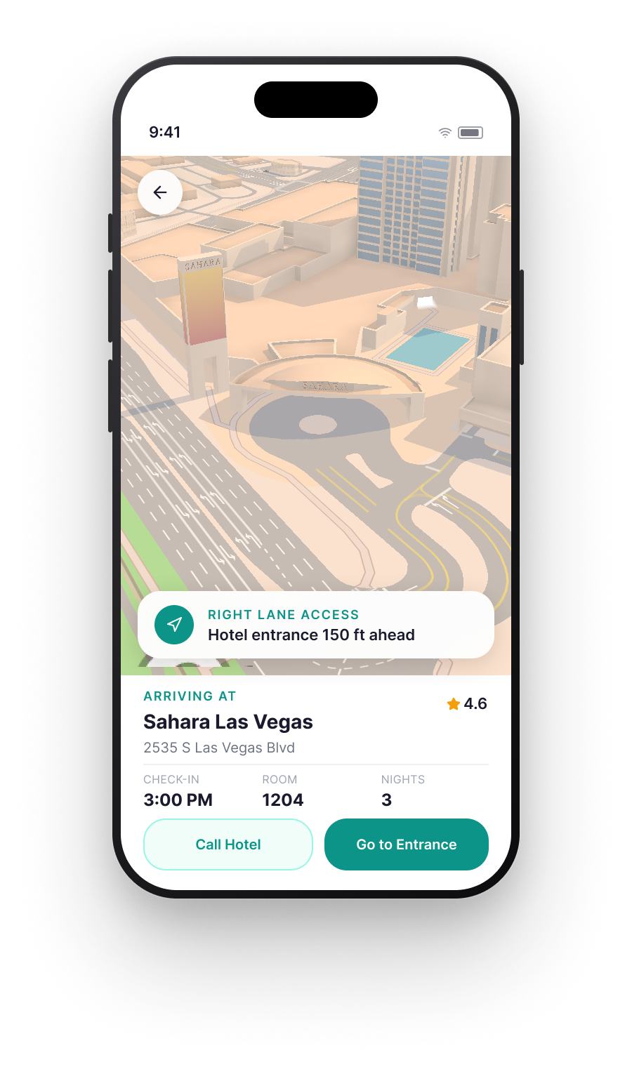
- Travel and hospitality applications can help travelers effortlessly wayfind through busy transit hubs, locate hotel valet drop-offs, and explore unfamiliar cities safely and with confidence.
- Outdoor, fitness and urban exploration applications can give urban hikers and cyclists critical context when trails intersect with complex road networks, overpasses, or bike paths.
- Drone software can provide rich symbolic realism and contextual grounding for autonomous routing, drone imagery overlays, and AI agent interfaces.
Need navigation? 3D Lanes brings lane-level detail to turn-by-turn navigation
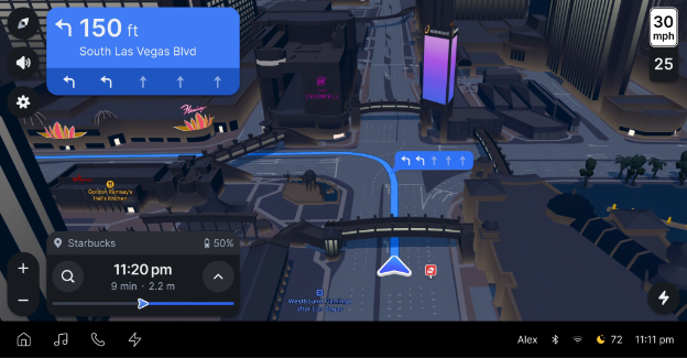
Mapbox 3D Lanes adds new lane-level detail found in Mapbox Standard to turn-by-turn navigation. 3D Lanes shows individual lane markings, directional turn arrows, lane types, and more, lending an intuitive visual context of street geometry to navigation so drivers never miss a turn. 3D Lanes is currently available in limited private preview in the Navigation SDK. Mapbox automotive and mobile customers looking for embedded in-car or mobile app 3D Lanes navigation can express interest in joining the private preview here.
Ready to elevate your basemap?
Enhanced road details are available across 71 major cities in 29 countries, with coverage expanding daily. They are fully integrated into the Mapbox Standard Style basemap. There’s no complex schema work, no custom tilesets, and no layer juggling required. Just upgrade to Mapbox Maps SDK v11.30 (iOS/Android) or Mapbox GL JS v3.30, and enable via Mapbox Studio by turning on “Lane Details” or directly in code using showHdRoads. See documentation for directions.
Frequently asked questions about detailed roads in Mapbox Standard
What are the new road details in Mapbox Standard?
The new road details are a lane-level visual enhancement built directly into the Mapbox Standard Style basemap. At high zoom levels, Standard renders detailed road geometry and markings such as individual lanes, turn arrows, stop lines, pedestrian crossings, elevated roads, 3D bridges, tunnels, and overpasses. The feature is designed to make digital maps more closely reflect the structure of real-world roads while remaining clear and easy to read.
What road details can Mapbox Standard display?
Mapbox Standard displays individual lane boundaries, directional turn arrows, lane types, stop lines, pedestrian crossings, intersections, and elevated road infrastructure. Complex structures such as bridges, tunnels, overpasses, and multi-level highway interchanges are also represented in 3D, giving users more context about both the horizontal and vertical structure of the road network.
Where are enhanced road details available, and how do developers enable them?
As of September 2026, the enhanced road details are available across 71 major cities in 29 countries, with coverage expanding monthly. They are fully integrated into the Mapbox Standard Style, so developers do not need to create custom tilesets or manage separate road layers. Developers need to upgrade to Mapbox Maps SDK v11.30 (iOS/Android) or Mapbox GL JS v3.30, and enable via Mapbox Studio by turning on “Lane Details” or directly in the code using showHdRoads.
What can developers build with more road details in Mapbox Standard?
Mapbox Standard now brings lane-level road detail and greater spatial context to map experiences. Developers can use them to help homebuyers understand street access and nearby infrastructure, guide travelers through complex urban environments, give hikers and cyclists more context at road crossings and overpasses, and provide richer visual grounding for drone, autonomous routing, and AI-powered applications.


Related articles
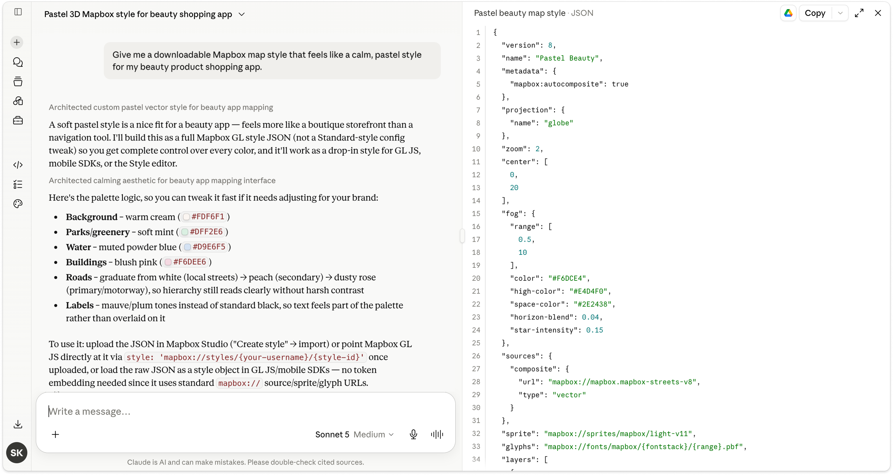
Turn AI-generated map styles into production-ready maps in minutes with Mapbox Studio
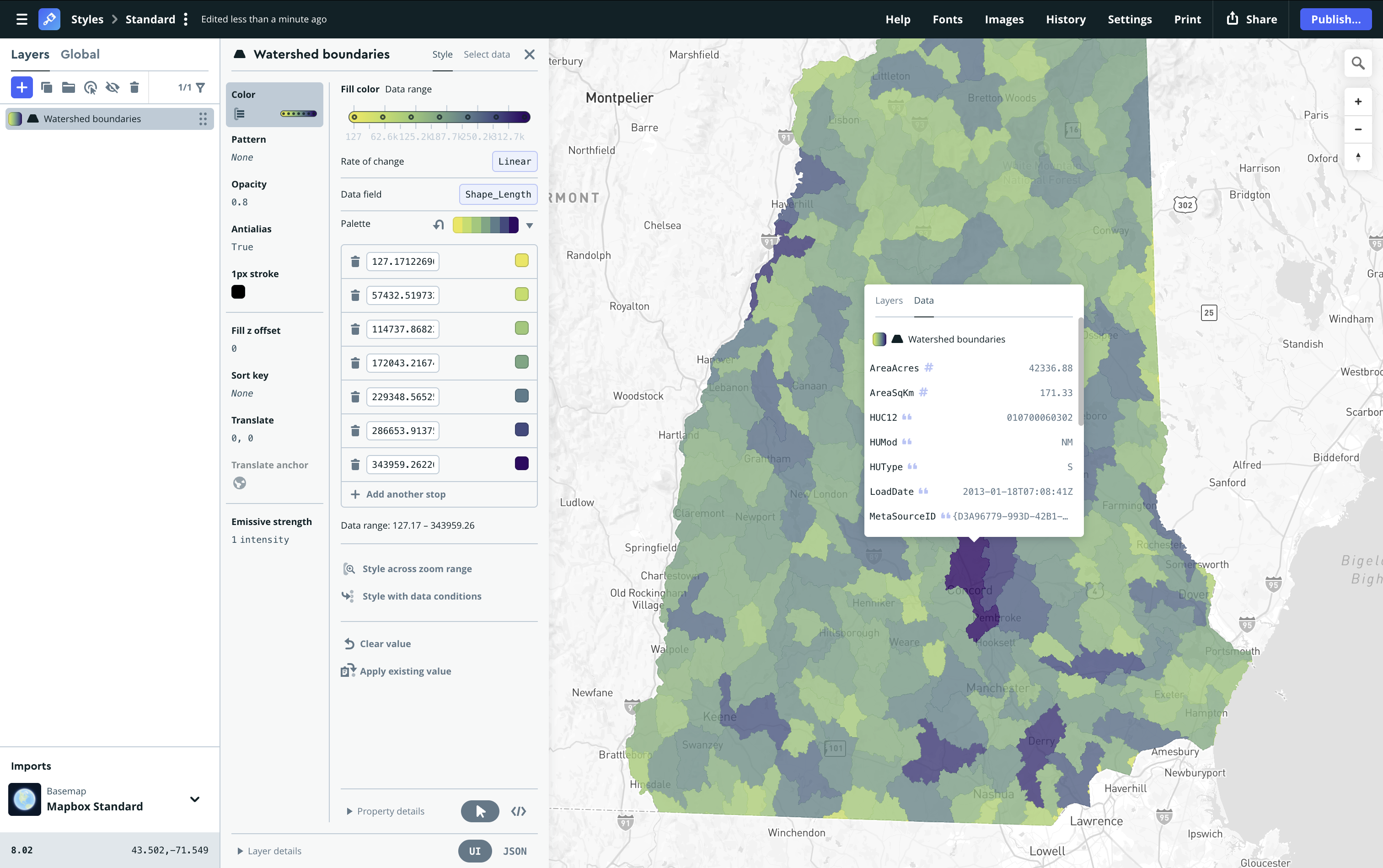
From upload to styled data layers in seconds: Smarter styling defaults in Mapbox Studio
