Maps as Infrastructure, Navigation as Interface: Key Takeaways from Mapbox at The Next Geo 2026
Originally published on Geoawesome. Read the full article.
At this year’s The Next Geo event, held online April 20-24, one theme surfaced repeatedly across discussions about mapping, navigation, and AI: geospatial technology is no longer simply a visualization layer. It is operational infrastructure.
The shift from visualization platform to fundamental infrastructure framed two major sessions with speakers from Mapbox at the event. In the opening keynote, the Senior Vice President of Location Services at Mapbox, Cherie Wong, explored how maps evolved from static visual products into programmable systems underpinning logistics, mobility, AI applications, and modern digital services. Later, in a fireside chat session, Liam Bresnahan and Åsa Forsell discussed the underlying infrastructure and engineering systems required to build navigation experiences for environments where reliability, clarity, and timing directly affect user outcomes.
Together, the sessions offered a compelling snapshot of where the geospatial industry is heading. They also reflected how the boundaries between maps, software infrastructure, real-time systems, and AI are rapidly disappearing.
For longtime geospatial professionals, many of these trends may feel like the culmination of years of technical evolution. For newer developers entering the space, the talks provided a useful framework for understanding why maps increasingly sit at the center of modern software systems rather than at the periphery.
Maps became ‘infrastructure’ when users stopped noticing them
One of the strongest ideas from Cherie Wong’s keynote was deceptively simple: infrastructure succeeds when it becomes invisible.
Wong opened with relatable scenarios. A food delivery driver receives route guidance that already accounts for traffic and road closures. A utility field engineer’s schedule dynamically updates while traveling between appointments. Neither worker actively thinks about the mapping system underneath the experience. They simply expect it to function. That expectation changes the role of mapping entirely.
Historically, maps were treated primarily as visual artifacts. They were products people looked at. Today, they operate more like cloud infrastructure or payment networks: systems other systems depend on. When they fail, the consequences are immediate and operational.
Wong defined “geospatial infrastructure” through three characteristics that shape how Mapbox thinks about building geospatial infrastructure. First, the data must remain continuously maintained and fresh. Second, the platform must be programmable and modular. Third, it must perform under real-world constraints across devices, connectivity conditions, and environments. The framing matters because it moves the conversation away from cartography alone and toward systems engineering.
The keynote emphasized that maintaining modern geospatial infrastructure requires ongoing ingestion, validation, and reconciliation of enormous volumes of data. Wong noted that Mapbox processes more than 1.5 million map changes daily and analyzes sensor data generated from 2.1 billion miles of driving every week. The scale and pace of data ingestion and processing reflects a broader industry transformation. The challenge is no longer simply creating maps. The challenge is maintaining continuously evolving spatial models of the world while keeping them reliable enough for operational decision-making.
Vector tiles changed more than rendering
One of the more historically important moments referenced during the keynote was the introduction of vector tiles, released by Mapbox in 2014. Wong described how before vector tiles early digital maps behaved essentially like static images. Any visual change required rerendering maps server-side. Vector tiles fundamentally altered that relationship by separating data from presentation and shifting rendering to the client.
For many developers today, vector rendering is simply the default assumption. But the fireside discussion highlighted how profound that architectural change actually was. Forsell pointed to 2014 as a major turning point for the industry because vector-based maps enabled dynamic camera movements, flexible styling, and significantly richer real-time experiences. This shift unlocked many of the experiences users now take for granted: smooth 3D navigation, dynamic lighting, perspective changes, real-time overlays, lane-level rendering, and customizable visual systems.
Just as importantly, vector architectures changed who could build mapping experiences. Instead of consuming fixed map products, developers gained the ability to adapt maps to their own products, brands, and workflows. That flexibility surfaced repeatedly throughout both sessions, emphasizing how maps have not only become more visually sophisticated but how they have evolved into programmable environments.
Navigation reveals whether maps actually work
If maps are infrastructure, navigation is where infrastructure faces its most demanding operational test.
That idea anchored much of the fireside chat discussion between Bresnahan and Forsell. Bresnahan described navigation as the point where “the rubber meets the road,” particularly in automotive environments where users depend on maps during stressful, time-sensitive situations.
Unlike exploratory mapping applications, navigation systems cannot tolerate ambiguity very well. Timing, clarity, and errors matter immediately. Forsell expanded on this by contrasting travel discovery experiences with active navigation. An inaccurate roadblock in a tourism app may be inconvenient. During live navigation, the same issue can directly affect a driver’s ability to reach the correct destination safely and efficiently. This operational pressure forces navigation systems to solve a uniquely difficult design problem: representing reality clearly without overwhelming users.
The future of navigation is not photorealism
The demands of navigation contexts and tension between representing reality without distracting users led to one of the most interesting concepts discussed during the session: the “symbolic realism” approach that Mapbox applies to map design.
As mapping technology becomes more visually advanced, there is an understandable temptation to pursue increasingly photorealistic digital twins of the world. Forsell argued against that direction for most navigation use cases. The goal, she explained, is not to reproduce every visual detail of reality. The real world is noisy, cluttered, and visually dense. Instead, navigation systems should selectively surface the details users need at specific moments.
Rather than creating exact replicas of streetscapes, Mapbox maps and navigation systems built using them emphasize a simplified but contextually accurate representation of reality that is optimized for orientation and decision-making. Lane markings, bridge elevations, overpasses, and intersection structures become critical when users approach complex maneuvers. In simpler environments, much less detail may be necessary.
The Mapbox design philosophy also acknowledges a practical truth about real-world environments: they change constantly. Buildings get repainted. Advertisements change. Streets evolve incrementally. Maintaining fully photorealistic synchronization at global scale would be nearly impossible and potentially counterproductive. Instead, modern navigation increasingly focuses on conveying operationally relevant spatial context.
That perspective reflects a notable maturation in geospatial UX thinking. Sophisticated mapping is no longer defined solely by visual fidelity. It is defined by whether users can interpret environments quickly and act confidently.
High-definition maps require entirely new data pipelines
Both sessions with Mapbox speakers also underscored how dramatically modern mapping systems have expanded beyond traditional cartographic data sources.
In the fireside chat, Forsell described the extensive combination of telemetry, satellite imagery, aerial imagery, machine learning models, road elevation data, and sensor fusion required to generate lane-level navigation experiences. The discussion shared a look inside modern mapping infrastructure that increasingly resembles distributed perception systems rather than static geographic databases.
Vehicle telemetry plays a particularly important role here. In the keynote, Wong explained that every connected vehicle effectively becomes both a consumer and contributor to the map ecosystem. The resulting ‘living’ network of real-time sensors creates powerful feedback loops for detecting anomalies, updating road conditions, and maintaining HD lane models. It also fundamentally changes update expectations. In traditional mapping systems, updates might occur quarterly or annually. In modern mobility systems, a construction project can invalidate a lane model immediately.
Forsell and Bresnahan reinforced these operational realities during the fireside chat, while discussing the engineering involved in updating map data every single day and building SDKs and navigation experiences on top of such dynamic data.
For geospatial professionals, this may be one of the most consequential industry shifts currently underway. Mapping is increasingly becoming a live systems problem rather than a publishing problem.
Customization became a competitive requirement
Another recurring theme throughout both Mapbox sessions was customization.
Historically, many digital maps looked and behaved similarly because the underlying systems offered limited flexibility. Today, companies increasingly expect location experiences to reflect their own operational requirements and brand identities. Wong highlighted how Tripadvisor rebuilt its platform using Mapbox infrastructure to create a stronger sense of place and improve user engagement. Similarly, BMW uses Mapbox SDKs to create navigation experiences tailored specifically to its vehicles and driving environments.
The fireside chat reinforced the developer-centric philosophy at Mapbox. Forsell emphasized that developers need complete flexibility to adapt visualization styles dynamically depending on context. A dense 3D navigation view may be appropriate in one scenario, while a simplified 2D representation may work better elsewhere.
Flexibility is increasingly essential because location interfaces are no longer standalone products. They are embedded inside logistics systems, automotive platforms, retail experiences, AI assistants, field operations software, and consumer applications. In this new reality, maps need to adapt to products rather than forcing products to adapt to maps.
AI is changing the role of geospatial systems
Although the sessions focused heavily on mapping and navigation, AI emerged as a major undercurrent throughout both sessions and indeed across the entire The Next Geo event. As Wong described in the keynote, spatial intelligence is rapidly emerging as the “next frontier” for geospatial infrastructure.
Importantly, Wong’s reflections moved beyond generic AI enthusiasm and instead focused on a more concrete idea: AI systems increasingly require reliable spatial reasoning capabilities. Questions such as “Where should the next retail location open?” or “What is the most efficient route balancing terrain, traffic, and connectivity?” depend on infrastructure-grade geospatial systems. AI models alone cannot solve these problems without accurate spatial context.
Wong also referenced the emergence of tools like MCP servers and reusable agent skills designed to help AI systems interact with geospatial infrastructure. For more on practical tools and skills for building with AI and geospatial services, be sure to check out another The Next Geo session: ‘The AI Transformation: From APIs to Conversations’.
One particularly resonant observation from the keynote was that AI increases, rather than reduces, the importance of reliable mapping infrastructure. A hallucinated recommendation inside a chatbot may be inconvenient. A hallucinated route or spatial decision inside a mobility or logistics workflow becomes much more serious. As Wong put it, infrastructure-grade reliability is becoming a prerequisite for the next generation of AI systems. That statement may ultimately become one of the defining insights from the event.
The geospatial stack is becoming multidisciplinary
Perhaps the clearest takeaway across both sessions was that modern geospatial systems now sit at the intersection of many technical disciplines simultaneously.
Computer graphics, distributed systems, machine learning, telemetry pipelines, developer tooling, automotive systems, sensor fusion, mobile SDKs, cloud infrastructure, UX design, and AI orchestration all surfaced repeatedly throughout the discussions.
Even the organizational collaboration at Mapbox described by Bresnahan and Forsell reflected this reality. Navigation teams, rendering teams, data teams, and SDK teams continuously iterate together because modern location systems cannot be developed in isolation.
For developers entering the geospatial field today, this creates enormous opportunity. Geospatial work is no longer confined to traditional GIS workflows or standalone mapping products. It increasingly touches nearly every major area of software engineering.
At the same time, the industry is still early in this transition. Questions around standards, interoperability, autonomous systems, AI-driven interfaces, and precision positioning remain very much in motion. That uncertainty is part of what makes the space so dynamic right now.
Why these conversations matter
One reason that the two Mapbox-led sessions resonated so strongly during The Next Geo 2026 is that they moved beyond surface-level discussions about maps and AI. Instead, they focused on the operational realities of building systems people depend on every day.
The talks also reflected a broader evolution happening across the geospatial industry itself. Location technology is no longer niche infrastructure sitting quietly in the background of specialized applications. It increasingly shapes transportation, commerce, logistics, energy operations, tourism, automotive experiences, and AI systems used by billions of people.
And yet, as Wong observed in her keynote, the best infrastructure remains largely invisible. Users rarely stop to think about the extraordinary technical systems coordinating live traffic flows, updating lane geometry, rendering navigation scenes, or grounding AI responses spatially in real time. They simply expect these systems to work.
For anyone interested in where geospatial technology is heading next, both sessions are well worth watching in full. The keynote provides a wide-angle perspective on how mapping evolved into global digital infrastructure, while the fireside chat offers a detailed and refreshingly candid look at the technical tradeoffs involved in building modern navigation systems at scale.


Related articles
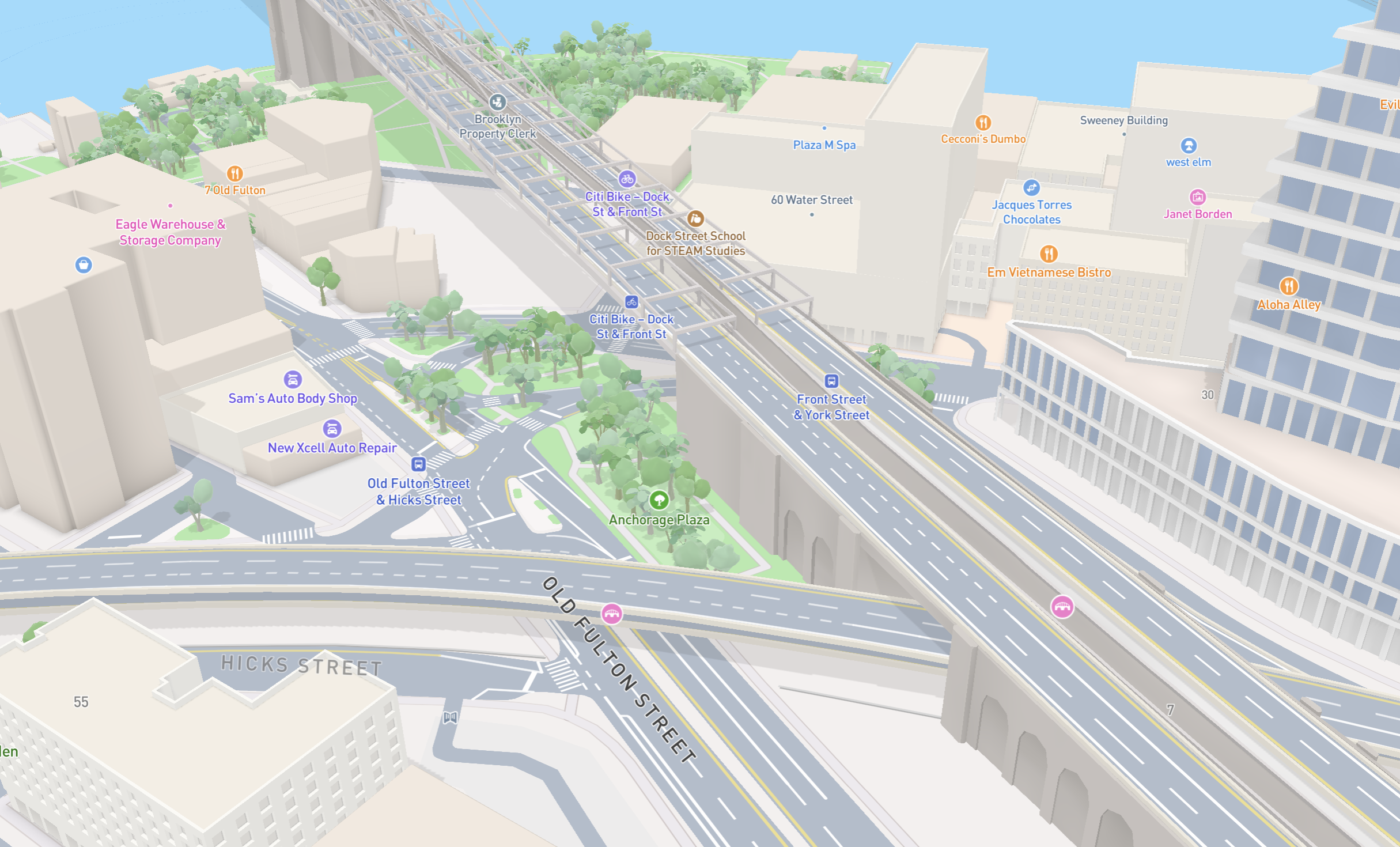
New road detail in Mapbox Standard

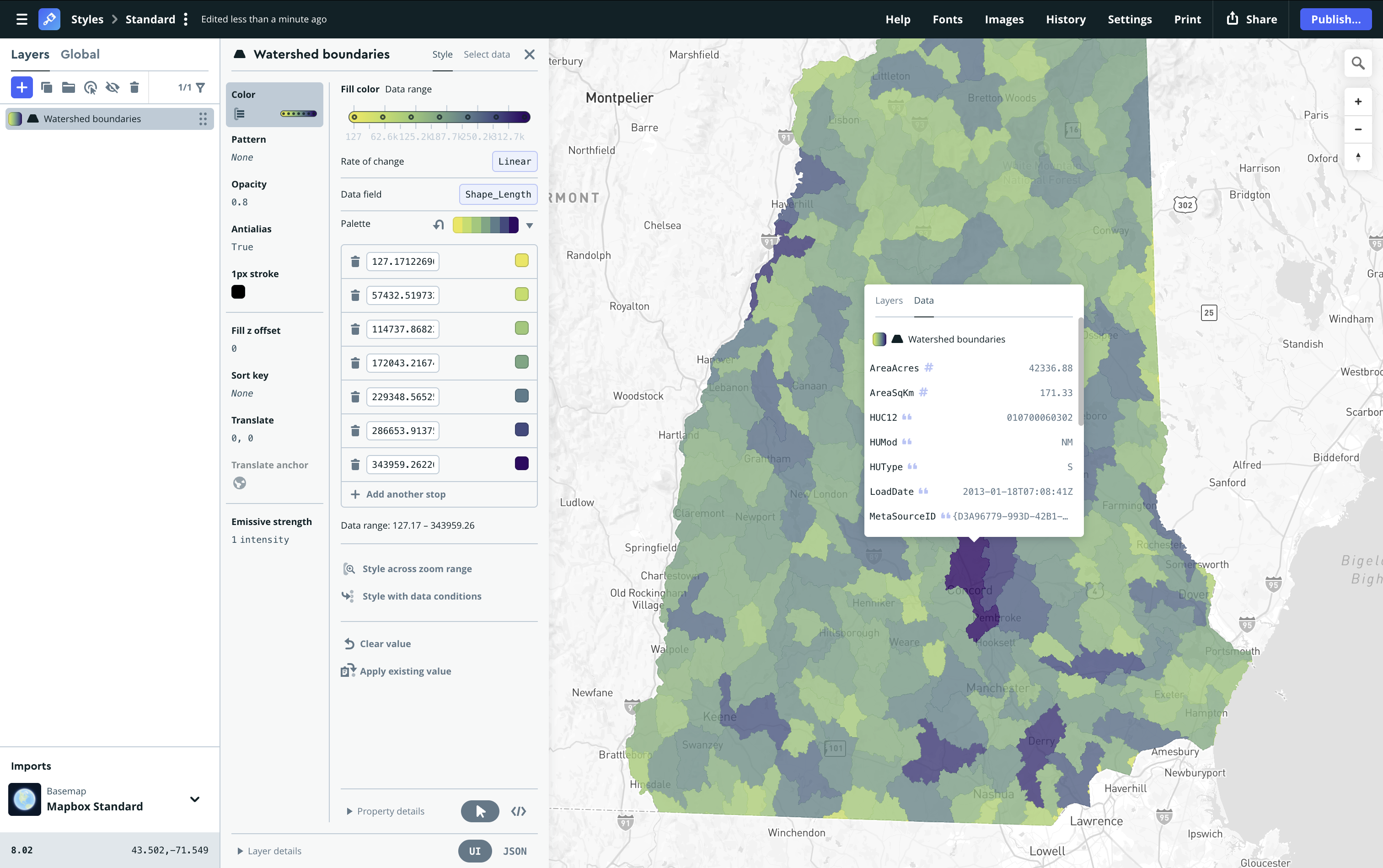
Turn AI-generated map styles into production-ready maps in minutes with Mapbox Studio