Expanded Mapbox Boundaries Coverage to Enhance Applications and Analysis
30,000+ new and updated geographic boundary data coverage for Africa, Oceania, and Island States

At Mapbox we are committed to providing the most versatile and high quality map data, empowering developers and businesses to create impactful solutions in any region of the world.
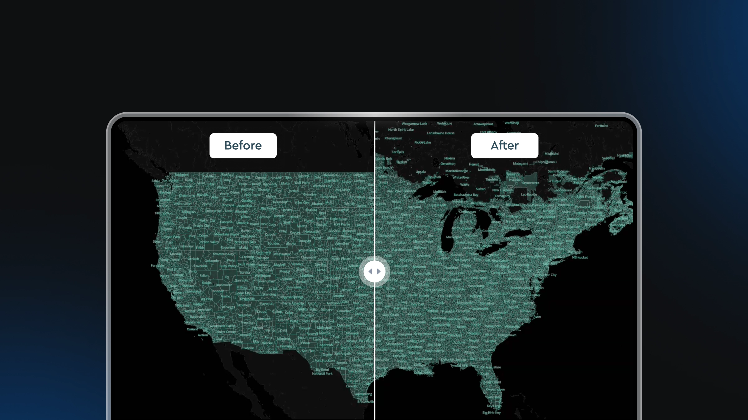
Today, we're thrilled to announce the release of Mapbox Boundaries 4.3, significantly expanding data coverage with 30,000+ new and updated geographic boundaries across Africa, Oceania, and island state regions. These boundaries reflect the latest administrative, postal, statistical, and legislative changes. Additional 40,000+ new and updated features have also been applied in the Philippines, South Korea and Japan, further enhancing data accuracy and user experience.
Connect Boundaries: Building a Global Future
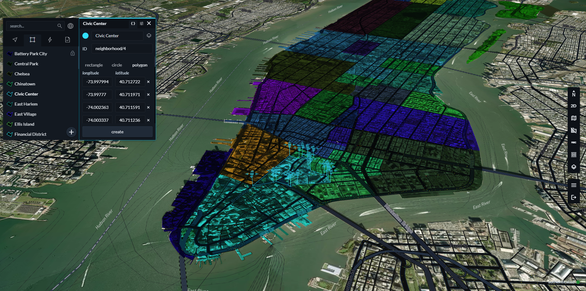
Mapbox Boundaries sets the standard for quality and ease of use, offering the only complete solution to solve business boundary challenges. Empower customer decisions with over 5 million extensively researched and hand-checked geographic boundaries, featuring seamless edge-matching for pixel-perfect accuracy. It is also easy to use. Feature sets driven by Mapbox lightning fast and simple-to-integrate Tile Services can be added to a map with a couple of lines of code. Our comprehensive documentation, with tutorials and code examples, makes adding beautiful visualizations a breeze. All of this means that customers can focus on what matters most: extracting actionable insights and driving effective business decisions.
Top ways to leverage boundaries
- Mapbox for Elections: Ensure accurate voter targeting and polling station allocation with precise electoral district boundaries.
- Sales Territory Planning: Optimize the sales strategy by creating data-driven territories based on accurate administrative and postal boundaries.
- Interactive Maps: Directly embed interactive, hyperlocalized services backed by Mapbox geolocation intelligence.
Unlocking business intelligence power
Whether you're a developer, product owner, data scientist, analyst, or business leader, Mapbox Boundaries and the suite of Mapbox Search tools provide the foundation for unlocking the power of location-based business intelligence.
We empower users through:
- Revenue growth: Fuel revenue growth with simplified territory planning, and handle complex, dynamic rules and hierarchies visually. Explore how Varicent optimizes market coverage and drives revenue growth with Mapbox Boundaries.
- Improved decision-making: Gain deeper insights into service coverage, and resource allocation by accurately overlaying data onto specific geographic areas. See how BuildingConnected utilizes Mapbox Boundaries to provide their users with more relevant invitations to bid via search and recommendation systems.
- Enhanced end-user experiences: Empower business users to make smarter choices with powerful, accessible geospatial tools. Learn how Tableau uses Mapbox to deliver fast and customizable spatial visualizations to enhance their end user experience.
We've got some exciting releases coming soon, stay tuned! In the meantime, explore the expanded data coverage using the Mapbox Boundaries Explorer, or schedule a demo today to find out how Mapbox Boundaries can power your success.


Related articles

Drag, drop, edit, publish: A simplified workflow for custom data
Mission-ready mapping: Securely bring together maps, AI, and response