How Athenium and Cecilian Partners build AI-powered Applications with Mapbox
Combining proprietary business data with Mapbox location infrastructure for AI to power smarter decisions in insurance and real estate.

AI is changing how people find information, make decisions, and complete tasks. Applications and agents can interpret questions, connect business data, and recommend next steps. But when those tasks involve the physical world, AI needs precise location context to make its responses useful.
Assessing storm damage, managing construction projects, dispatching technicians, and coordinating deliveries all depend on understanding where things happen. Business data and language models alone cannot provide the full picture.
Mapbox provides location infrastructure for AI, enabling applications and agents to understand locations, proximity, routes, and changing real-world conditions. Combined with proprietary data and industry expertise, that infrastructure helps companies build specialized AI that delivers more relevant answers and takes more useful actions.
Athenium and Cecilian Partners are putting that approach into practice.
Bringing location context into AI workflows
Companies are already moving beyond AI as a productivity feature and embedding it directly into the core of their products.
Athenium, a provider of weather intelligence for the insurance industry, is one example. Insurance companies rely on Athenium to understand natural hazard exposure before severe weather events and rapidly assess impacts afterward. Its platform combines proprietary weather science with Mapbox to transform complex geospatial data into interactive visualizations that help insurers identify affected properties and begin exposure analysis.
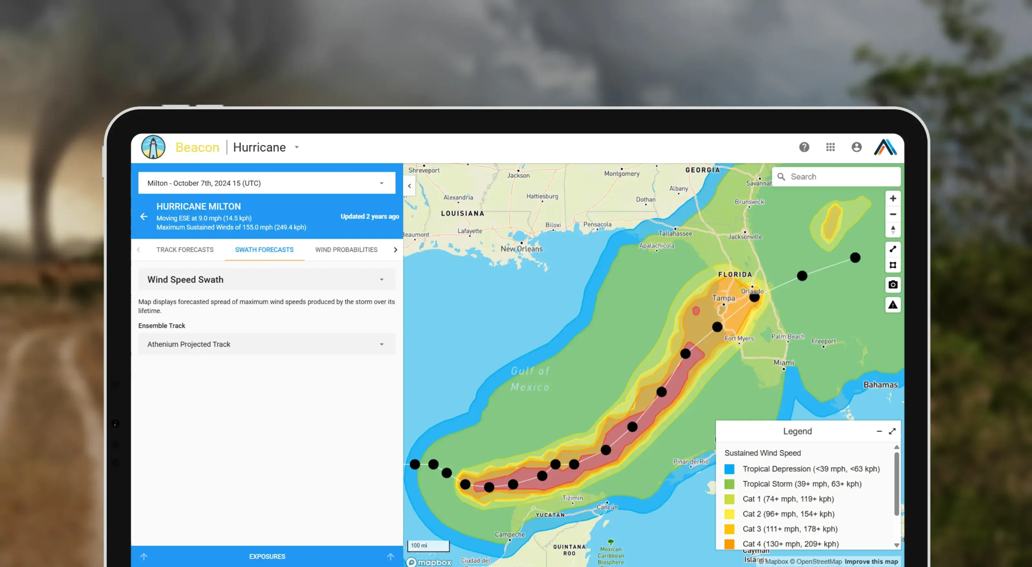
Now, the company is taking the next step. Instead of navigating dashboards, users can ask natural-language questions such as, “Create a map of the hail event in Texas on March 10th, 2026.” Athenium’s weather intelligence MCP, barocline, returns an interactive Mapbox-powered visualization directly within the AI workflow, allowing users to move from a question to geographic understanding in seconds. Watch the BUILD with Mapbox session recording.
Today, barocline generates live, interactive Mapbox-rendered maps on demand, embedded directly inside AI agent responses.
Mojtaba Dyanati, Vice President of Data Science & Engineering at Athenium
A similar transformation is taking shape in residential real estate, where development, construction, and sales have long run on disconnected systems. Since 2019, Cecilian Partners has built its Residential OS® to give developers and homebuilders a shared operating picture of lot inventory, construction status, approvals, and sales across hundreds of projects. Mapbox-powered maps tie that information to individual lots, homes, and communities, putting every decision on the map.
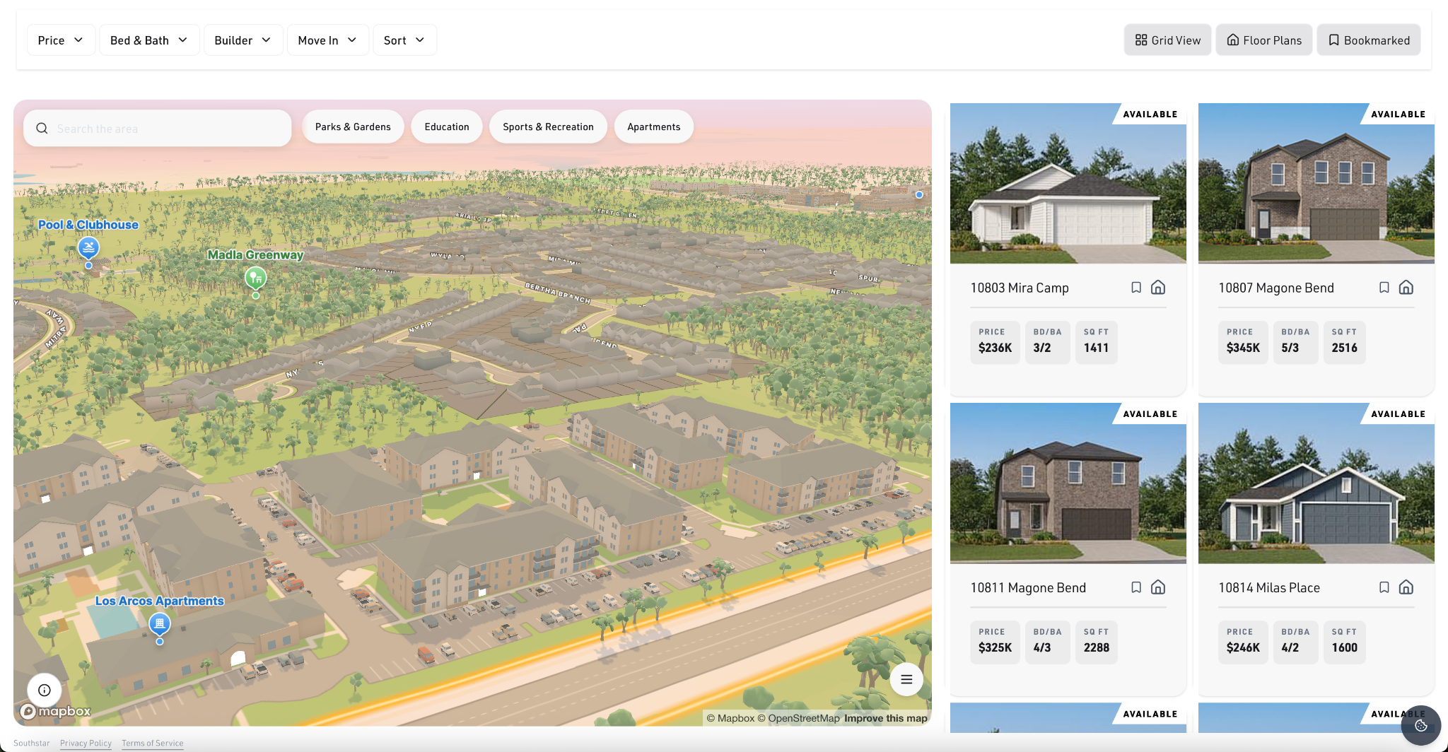
Every day, as teams work in the platform, they create standardized data grounded in real community development activity. Cecilian is building Centralized Development Intelligence™ on that foundation, connecting operational data, industry expertise, and geographic context to answer questions, automate workflows, and surface emerging risks and opportunities. Customers already query their XO data conversationally, building reports in minutes, and Cecilian is extending that intelligence across the development lifecycle, from understanding current conditions to anticipating what comes next. Watch Cecilian Partners BUILD session recording
“Useful AI starts with understanding how this industry actually works. Our platform connects lot inventory, construction, and sales activity, while Mapbox gives that information geographic context. Together, that foundation allows us to build intelligence that helps developers and builders answer questions in the moment, reduce manual work, and make more informed decisions.” — Phil Worland, Co-founder & Chief Product Officer, Cecilian Partners
These examples show how proprietary data, industry expertise, and location infrastructure work together. Athenium brings weather intelligence into AI workflows. Cecilian Partners connects residential operations with the geography of development. In both cases, location helps make specialized AI more useful for the people making decisions.
Specialized AI needs location infrastructure
AI can summarize documents, search knowledge bases, and generate content. But tasks involving the physical world require more than an understanding of language and business records.
An address needs to resolve to the right location. A route needs to reflect the road network and traffic conditions. A property needs to be understood in relation to a storm’s path or a development project. Without that context, AI can produce answers that overlook the conditions that determine whether an action is useful.
Location infrastructure connects digital intelligence to physical action. It gives applications and agents access to the geographic information they need to interpret a task in context and support the next step.
Combined with proprietary business data and operational workflows, this foundation helps companies build AI tailored to the decisions their customers need to make.
Turning location context into useful action
With location infrastructure, applications and agents can help users anticipate problems, coordinate operations, and act on changing conditions.
A logistics platform could identify deliveries likely to fail before a driver ever leaves the warehouse, automatically requesting more precise address information or asking a customer to confirm the correct entrance. With verified and precise delivery details, such a system could reduce order errors and failed deliveries, which are painful for merchants, buyers, and the operator alike.
A field service platform could continuously optimize technician schedules based on where technicians are at a given moment, their expected travel times, and current and anticipated traffic patterns. At the same time, the system could allow customers to schedule or reschedule appointments and view their technician’s status live on their app. Together such changes can help field services achieve higher efficiency and lower cost to serve, which become even more meaningful as the fleet scales.
An insurance platform could identify the risk exposure and expected financial impact of weather events on specific properties within minutes, prioritize claims, and recommend the next actions for adjusters.
Each workflow depends on connecting business intent with physical context: where a driver should arrive, when a technician can reach a customer, or which properties sit within an affected area. Location infrastructure makes that connection possible.
Building AI grounded in the physical world
As AI takes on more real-world tasks, its usefulness will depend on how well it understands the circumstances surrounding each decision. Proprietary data supplies business context. Industry expertise guides the workflow. Location infrastructure grounds both in the physical world.
Mapbox provides location infrastructure for AI to agents and applications, helping companies turn specialized knowledge into more relevant answers and useful actions.
We are partnering with organizations to build that future. Learn more about location infrastructure for AI or get in touch with the Mapbox team to explore what you can build.


Related articles

New Mapbox CLI for coding agents
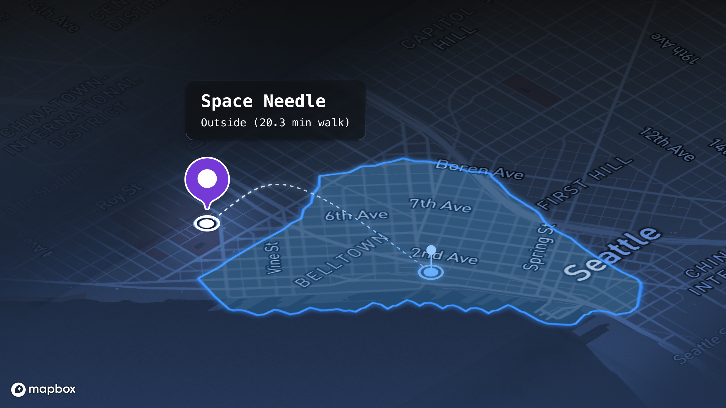
From answers to addresses: Grounding an LLM for location
