Back to all cases
Hyperplan reduced their loading time by 20% and decreased their scaling times from days to seconds with Mapbox GL JS, Geocoding, and the flat file Boundaries

Key benefits of building with Mapbox
- The flat file option for Mapbox Boundaries enabled more detailed data analyses while faster loading time
- The Mapbox Geocoding API compliments the SaaS with the precise search functionality
- Mapbox GL JS guarantees high-performance, modern, and user-friendly web maps
products used
About Hyperplan
Hyperplan empowers stakeholders with insights for exceptional visibility on agricultural production. With a pioneering platform, users across the spectrum can dive into analytics, assured they're aligning with a forward-thinking and dependable innovation ally. Whether they are enhancing operational security, boosting sales process, or driving sustainable practices, Hyperplan stands as a model of data-driven precision for the agri-food landscape.
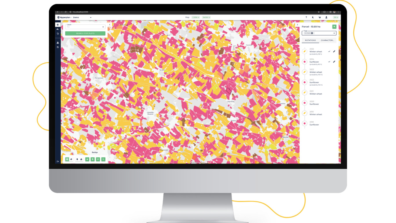
A hallmark of Hyperplan is its unwavering commitment to transparency and granularity in agricultural data. By combining cutting-edge remote sensing with AI, it carefully controls and delivers farm-to-fork analytics, establishing a direct line of sight to each parcel of land. This enables stakeholders to pinpoint their place in the eco-friendly future of farming, from organic methodologies to cyclic crop strategies.
The challenges of transforming parcel-level data into insights
Hyperplan was focused on creating a customer-centric, comprehensive solution aimed at transforming data into actionable insights. To achieve this goal, it was necessary to provide detailed geospatial analysis in the most easily accessible and manageable form, ensuring seamless integration with enterprise resource planning, flexible manufacturing, and customer relationship management systems.
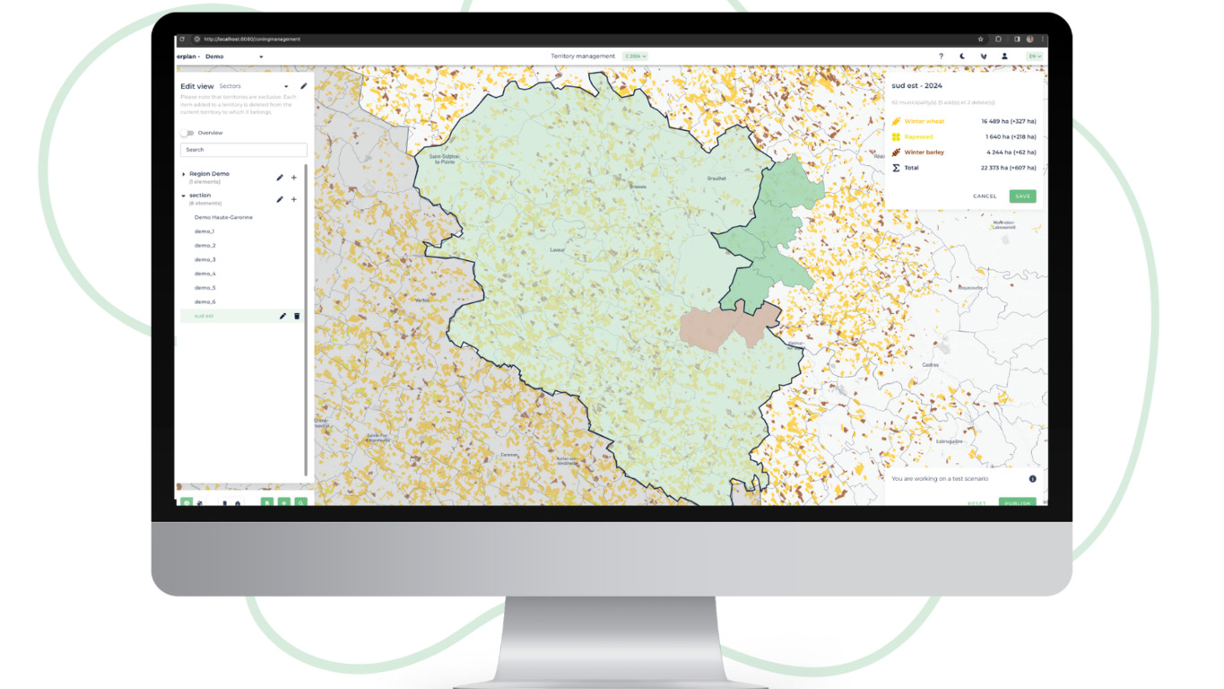
Hyperplan struggled to find a solution to smoothly display an aggregate summary of a geographic characteristic within municipalities in France. Additionally, the necessity to display a huge number of geographical areas at the same time affected software performance. The Hyperplan team quickly understood they needed a flexible solution that could single-handedly manage large datasets, ensure implementation of custom boundaries, guarantee precise search functionality, and speed-up loading time. The rich set of development tools and previous positive experience building with the Mapbox Maps for visualizations led to identifying Mapbox as a technology Hyperplan was looking for.
Mapbox provides a comprehensive set of tools for agricultural Production
The Hyperplan team quickly identified that the combination of Mapbox GL JS, Mapbox Boundaries, and Search products like Mapbox Geocoding was the solution they needed to equip users with the most precise location sights.
Leveraging Mapbox GL JS for web map rendering, Hyperplan enables users with a stable, accurate, and easy-to-use map experience. Large datasets can be seamlessly added and managed in real-time, providing users with reliable access to the most up-to-date agricultural insights.
Mapbox customization features, including the ability to shape the visual style of the map, add and design markers and pop-ups, as well as various interaction options enhance the map experience.
Using the Mapbox Geocoding API lets users search for locations, points, or parcels of interest. In addition to enabling precise search functionality, Hyperplan provides a modern and interactive experience with corresponding map zoom with the area of interest.
Mapbox is a central piece of technology at Hyperplan. On the technical side – Mapbox Boundaries reduced our loading time by 20% and improved our operations. For users – enabled seamless map visualizations, deeper data analyses, and precise search functionality.
Jean-Baptiste Kopecky, Co-founder and CTO, Hyperplan
Deeper analyses with the flat file option for Mapbox Boundaries
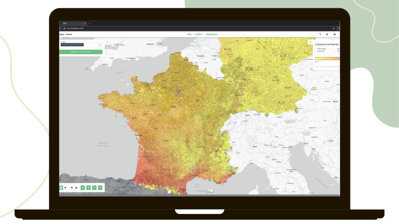
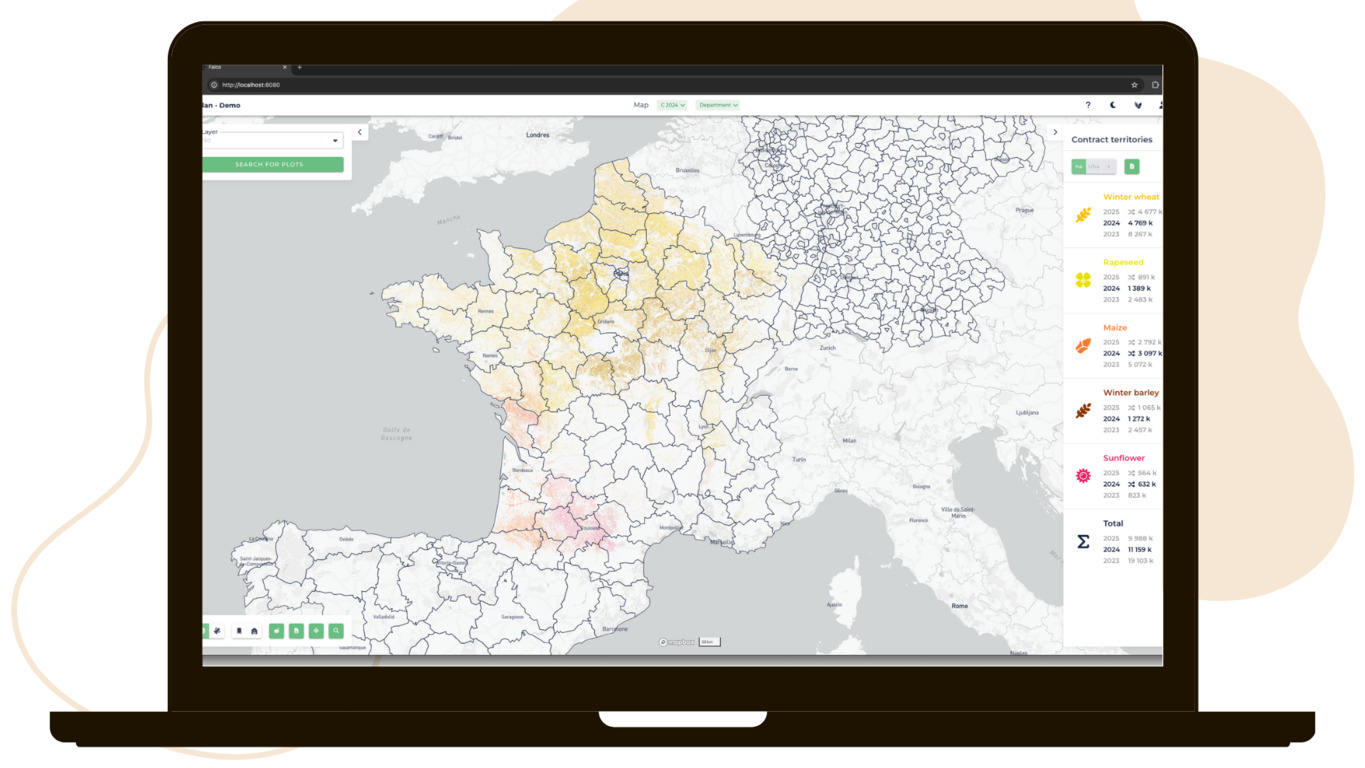
The Mapbox flat file Boundaries provide access to the raw geometry of boundaries features, offering deeper geospatial analysis with greater versatility in data integration. This enabled Hyperplan to showcase every tier of administrative borders for each country in the scope. The Flat files granted the SaaS the capability to present various map choropleth visualizations, including rainfall, temperature accumulation, crop yields, and areas measured in hectares, among others. Furthermore, they facilitated in-depth analyses of specific territories, enhancing geographical and data-driven strategies.
The Mapbox flat file boundaries enabled us to do calculations on our backend side by checking intersections that perfectly match boundaries we display on our app. Doing so on all administrative levels made our job easier, and decreased the scaling times to map new countries we target from days to seconds.
Clement Routier, Director of UX Design & Front-end Development at Hyperplan
The initial interest in the Mapbox flat file Boundaries came out of close collaboration with Mapbox. The product team analyzed Hyperplan’s use case and identified flat files as the key to unlocking its potential. The Mapbox Documentation helped with implementation and resolving technical issues. Close collaboration between Mapbox and the Hyperplan engineering team was instrumental in ensuring the successful development of the project.
Improved efficiency and operational process with the Mapbox Boundaries flat file
Hyperplan reports that customers enjoy the speed of the SaaS and the user-centric experience it provides. Through insightful analysis and precise data, clients grow alongside the software, continuously aiming for new frontiers. This drive for expansion leads them to frequently request new geographic connections for the analysis of their territories.
Since implementing the Mapbox Boundaries API the initial Hyperplan loading time was reduced by 20%. At the same time, scaling times to map new countries decreased from days to seconds. Now, the Hyperplan team doesn't have to spend time searching for and processing public boundaries data. Using the Mapbox Boundaries flat file format, the team just uses a new flat file to scale to another country.
Сonfidence in data now and room for development in the future
Hyperplan presents continuously evolving AI technology that enables customers with precise and custom geographical data, timely and reliable insights, and accurate parcel-level search service for advanced crop rotation analysis. After testing, the SaaS confirmed that Mapbox provided not only a reliable solution, but enabled deeper location analysis with less time spent on data processing. Thinking ahead as an international and growing platform, Hyperplan builds with Mapbox to ensure that the SaaS will scale across territories and new customer groups with the flexibility needed to ensure the deepest analysis and unparalleled visibility of agricultural production.
Maps are an essential visualization tool for the Agriculture industry. Without it, our clients would have to fly blind. We choose to build our maps with Mapbox as it enables Hyperplan to display various types of data: administrative outlines, custom clients’ areas, and parcel-level geographical data.
Jean-Baptiste Kopecky, Co-founder and CTO, Hyperplan