Back to all cases

Citizen enhances real-time safety insights with Mapbox, driving +6.8% higher user engagement
Key benefits of building with Mapbox
- Richer POI context and enhanced map styling drove stronger engagement, with +6.8% more map interactions, +3.2% higher time spent, and a +6% lift in conversion
- Interactive 3D maps with rotation increased incident understanding, driving +4.8% more time spent on incident details and higher overall exploration
products used
About Citizen
Citizen is a real-time safety platform that keeps people informed about what is happening around them. The app delivers instant alerts about nearby incidents, provides access to live police radio, and gives users the tools to stay aware and protect themselves during emergencies.
Citizen’s mission is to make personal safety simple, transparent, and accessible for everyone. The team is proud that millions of people rely on the platform during the moments that matter most, from local neighborhood emergencies to citywide incidents. By combining fast alerts, live community reports, and multiple real-time data sources, Citizen offers a depth and clarity of situational awareness unmatched in the industry.
Delivering real-time clarity during high-stakes moments
To provide users with accurate and actionable information during emergencies, Citizen needed a mapping solution capable of supporting real-time incident updates at massive scale while remaining fast, legible, and visually intuitive. The platform had to process thousands of rapidly updating incident markers and present them with rich visual context including POIs, street names, landmarks, and 3D buildings that offer instant clarity the moment the map loads. Just as importantly, it required a rendering engine that could handle high-volume updates without lag, delivering a smooth and dependable experience even during major citywide incidents.
Citizen’s previous mapping stack, based on MapLibre, provided a solid foundation but lacked the performance, rich POI data, and customization needed to support the company’s evolving roadmap. Without the right map technology, incidents could appear delayed, unclear, or visually cluttered – undermining user trust at the very core of the Citizen experience.
Mapbox provides the performance, customization, and context Citizen needs
Citizen chose Mapbox because it offers a deeply customizable location platform designed for dynamic data, real-time responsiveness, and high-performance rendering.
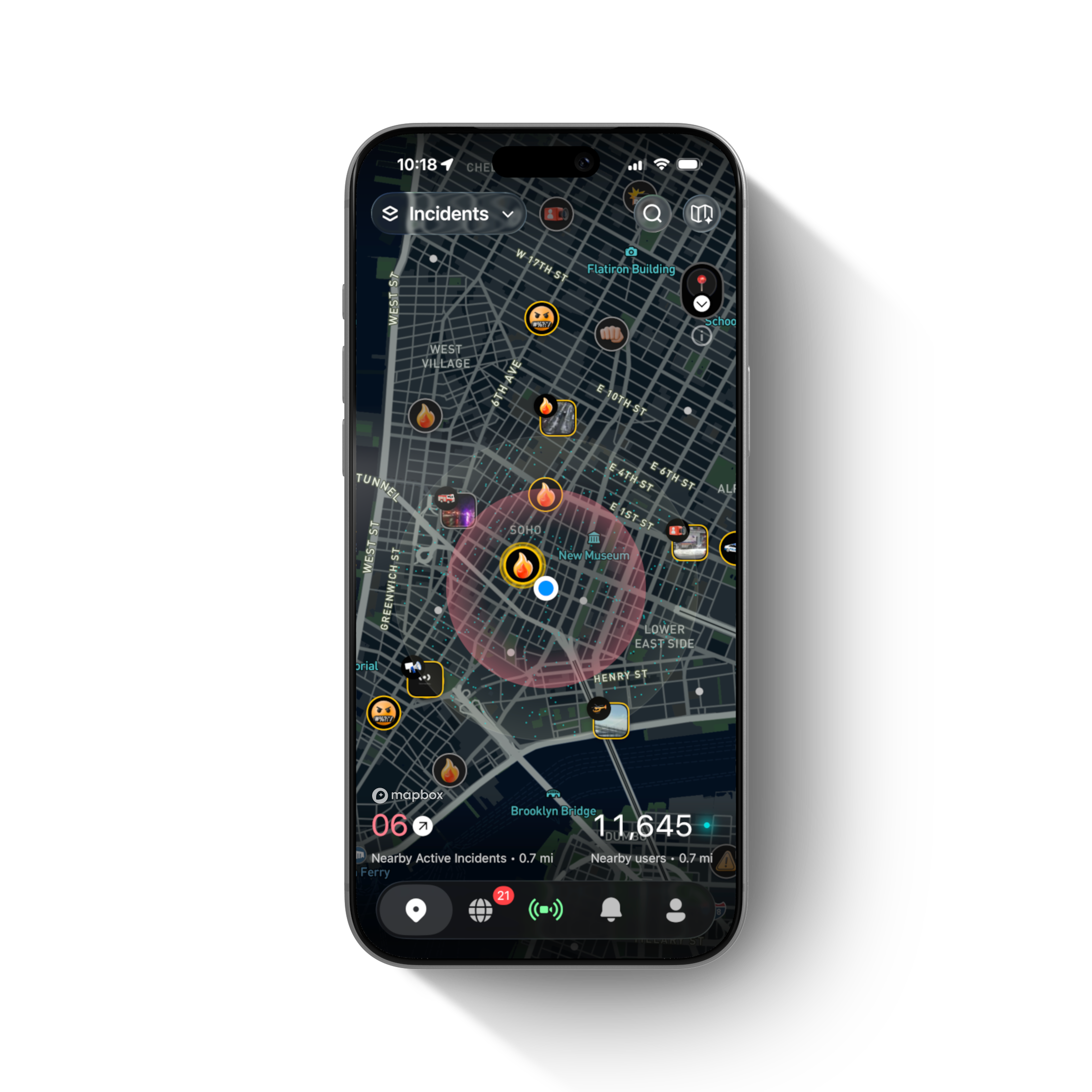
With Mapbox, Citizen can render thousands of live incidents simultaneously and highlight danger zones, heatmaps, and 3D building environments — all while maintaining consistently fast load times even during citywide surge events. The app delivers precise location context of real-time events with landmarks, schools, businesses, or other relevant POIs through the Search Box reverse endpoint, which provides rich information on POIs nearby.

The Mapbox modular tools — Maps SDKs, Search Box API, and Mapbox Studio — fit seamlessly into Citizen’s product architecture, supporting everything from incident placement to high-fidelity 3D visualization.
Mapbox strengthens Citizen’s competitive edge by enabling a faster and more intuitive safety map than other providers. The ability to render thousands of real-time incidents, visualize 3D environments, and style every layer to match our safety hierarchy gives us a unique level of clarity. Our users can interpret danger faster and navigate confusing moments with greater confidence.
Andres Canal, Senior iOS Engineer, Citizen
Building a safety-first map with real-time intelligence
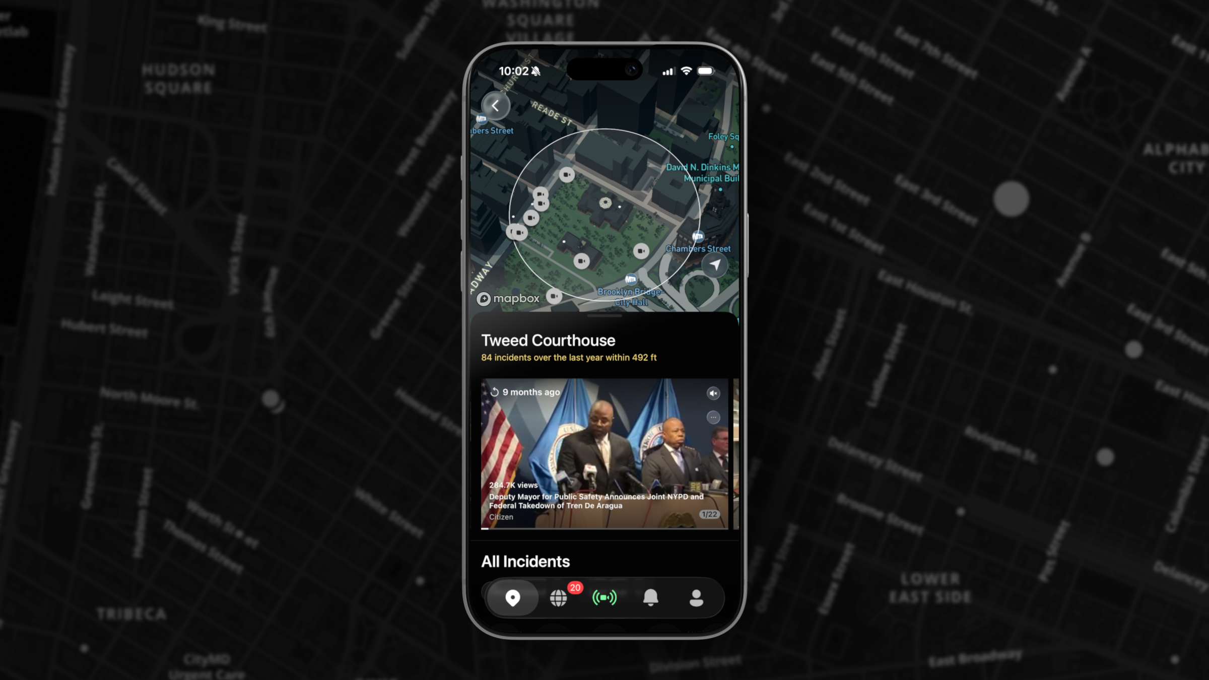
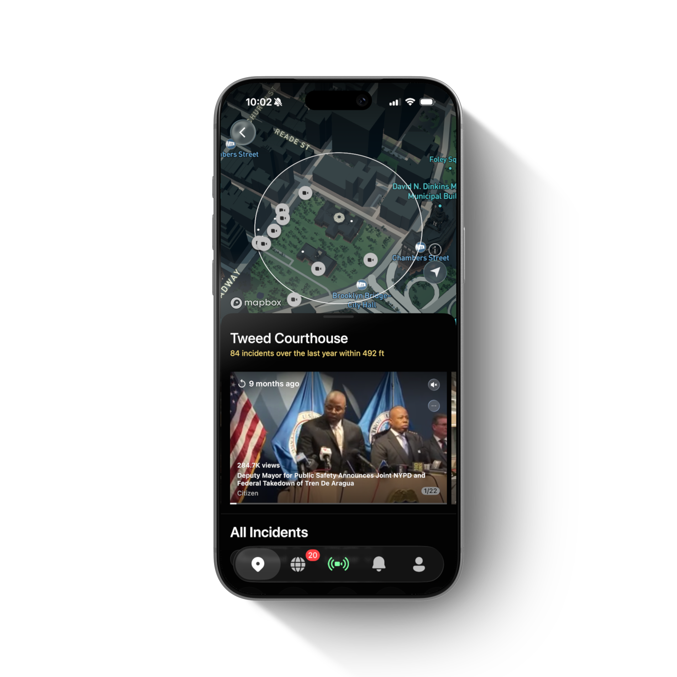
Citizen’s engineering and design teams built their map experience by combining the Mapbox rendering engine with a series of custom data layers that represent dynamic safety information. The system ingests real-time inputs from multiple sources and refreshes incidents every few seconds, updating thousands of markers without lag. Each incident is styled through custom layers that define hierarchy, color, and behavior, making it possible to show safety radiuses, user locations, heat zones, and incident types with remarkable clarity.

Mapbox Studio plays a central role in shaping this visual language. Designers use it to tune the map’s hierarchy so that at every zoom level, incidents remain distinguishable from the surrounding environment. As users move through dense city blocks, 3D buildings and lighting add depth and spatial awareness, making complex urban environments easier to interpret during emergencies. When users tap on a location, Search Box nearby search (reverse search) instantly provides precise address information, while the platform’s rich POI data anchors the map with familiar reference points such as landmarks, public facilities, and key buildings. Together, these elements create a map that reveals context at a glance, even when situations unfold rapidly.
Citizen’s teams describe their experience building with Mapbox as collaborative and empowering. Engineers rely on stable SDKs and clear documentation, while designers appreciate the freedom to experiment, refine, and evolve the map’s visual hierarchy. The result is a safety-focused mapping system shaped directly around how users perceive and respond to risk.
Mapbox rich POI data gives our users instant clarity with location context. It helps users understand exactly where an incident is happening, even in dense urban areas. That level of precision is essential when most people open the app in the middle of an emergency.
Andres Canal, Senior iOS Engineer, Citizen
Positive impact on engagement, clarity, and user trust
Mapbox powers the core map experience within Citizen, driving improvements across core metrics. The transition to Mapbox has delivered faster map initialization times and reduced rendering latency during peak activity, ensuring that critical information appears immediately when users open the app. Visual clarity has improved substantially, with POIs, street names, landmarks, and 3D geometry offering a level of context that was previously missing.
Citizen’s early A/B results show strong gains in engagement and retention: enhanced POI context and map styling drove +6.8% more map interactions, +3.2% higher time spent, and a +6% lift in conversion, while interactive 3D maps with rotation increased incident understanding and led to +4.8% more time spent on incident details. Together, these improvements encourage deeper exploration and more meaningful interaction for users.
Before adopting Mapbox, the map often appeared sparse, lacking POIs and even basic street names. Users were met with an empty canvas at moments when they needed clarity. Today, the richness of Mapbox POI data provides immediate orientation, which is especially important because most users arrive directly from a push notification triggered by an incident. The moment the map opens, they can understand where they are, what is happening, and how close the event is to them.
This improved clarity reinforces Citizen’s competitive advantage. With Mapbox, Citizen delivers a faster, more intuitive, and more context-rich safety map than other providers can offer – making it easier for users to make informed decisions.
Our experience with Mapbox has been consistently positive. The APIs and SDKs are stable, the POI data is precise, the documentation is clear, and the platform gives our designers and engineers the control we need to innovate. Mapbox has also been a responsive, collaborative partner as we’ve pushed into advanced styling and performance work.
Cameron Ward, Senior Product Designer, Citizen
What’s next for Citizen
Citizen plans to continue expanding its Mapbox-powered experience with advanced 3D storytelling for major incidents, richer heatmaps that highlight both historical and real-time patterns, and additional contextual layers that deepen situational awareness. The team also intends to refine performance metrics tied to retention, engagement, and MAU as the map evolves.
With Mapbox as a core technology partner, Citizen is positioned to scale a more intelligent, more contextual, and more reliable safety platform, helping millions of people stay informed and make confident decisions in the moments that matter most.


