Mapbox Boundaries: Examine data across 4 million boundaries

Mapbox Boundaries now includes four million boundaries expertly curated across every country for you to join your geographic data to specific polygons, enabling improved geospatial analysis and visualizations.
Traditional boundary data is overly simplified, which makes analysis inaccurate. However, in Mapbox Boundaries, polygons are perfectly matched to adjacent boundaries so that you can perform consistent binning at any level of granularity.
With the latest update to Mapbox Boundaries, we’ve added a new collection of legislative boundaries at four different levels of US electoral boundaries to improve your data analysis and visualizations. These include Congressional districts and state legislatures.
Behind the data
Our four million boundaries are broken down globally across five data types:
- Administrative: Divisions within a country or territory delineated for the purpose of general administration. For example, a county in the U.S.
- Legislative: Constituency areas for various types of legislative assemblies or regional councils. For example, a congressional district.
- Locality: Like a neighborhood. These are types of places that do not necessarily represent any official boundaries, but are nonetheless commonly used as definitions of “place.”
- Postal: These are approximate areas of mail delivery based on national postal code systems, like a 5 digit zip code.
- Statistical: These are non-administrative boundaries that are most commonly used for statistical purposes. For example, a metro area used for statistical purposes (e.g. Census blocks in the US).
These data types allow you to group and aggregate statistics by any type of boundary, using data-joins of local data, or by matching point features to any boundary from our Tilequery API. Analysts can then extend any custom polygons needed for your application.

Boundary metadata allows analysts to filter across rows of data by the country of interest and across key objects by the matching property to optimize performance. Key metadata fields include:
- feature_id: An integer ID used for each feature in the vector tiles. It can be used for data-joins of custom data as it is globally unique within a worldview.
- worldview: Used to display alternate boundary data depending on regional map display requirements. Including India, China, Japan, and the US.
- name: Local feature name.
- name_en: An English translation or Latin transliteration of the local name. Generally only provided when the name is in a non-latin script, otherwise may be null.
- names: An array that contains additional translations or aliases for the feature name.
- unit_code: The country-specific identifier for the feature, such as postcode or FIPS code.
- description: Atext qualifier of the level respective to each country’s boundary hierarchy. For example, US admin-1 boundaries have a description of states while Italian admin-1 boundaries have a description of regions.
- wikidata_id: The associated Wikidata ID for the boundary.
- iso_3166_1_alpha_3: The ISO 3166–1 alpha-3 country code for the feature’s parent country or territory.
- iso_3166_1: The ISO 3166–1 alpha-2 country code for the feature’s parent country or territory.
- parent_1: The id of the level-1 parent of a feature, if any.
- parent_2: The id of the level-2 parent of a feature, if any.
- parent_3: The id of the level-3 parent of a feature, if any.
- parent_4: The id of the level-4 parent of a feature, if any.
- source_date: Recency of boundary data.
- centroid: An approximate central point of the feature’s polygon as an array of [longitude, latitude].
- bounds: An array of the features bounding box as [minlong, minlat, maxlong, maxlat].
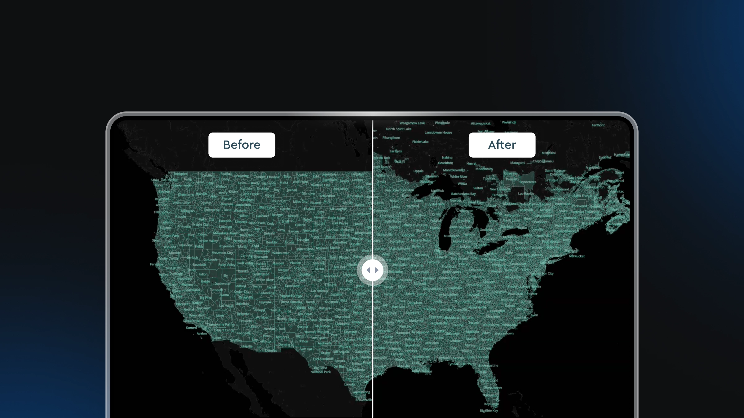
Explore boundaries
You can explore our Boundaries at any time by clicking the image below to search our coverage map:

To learn more, read our documentation, and when you’re ready to get started reach out to our team to request a demo.


Related articles

Drag, drop, edit, publish: A simplified workflow for custom data
Mission-ready mapping: Securely bring together maps, AI, and response