.svg)

Precision that delivers
High volume performance
Continuous updates
Mapbox Geocoding adds 45 new countries and 73.2 million addresses

High-quality geocoding at scale
Practical precision
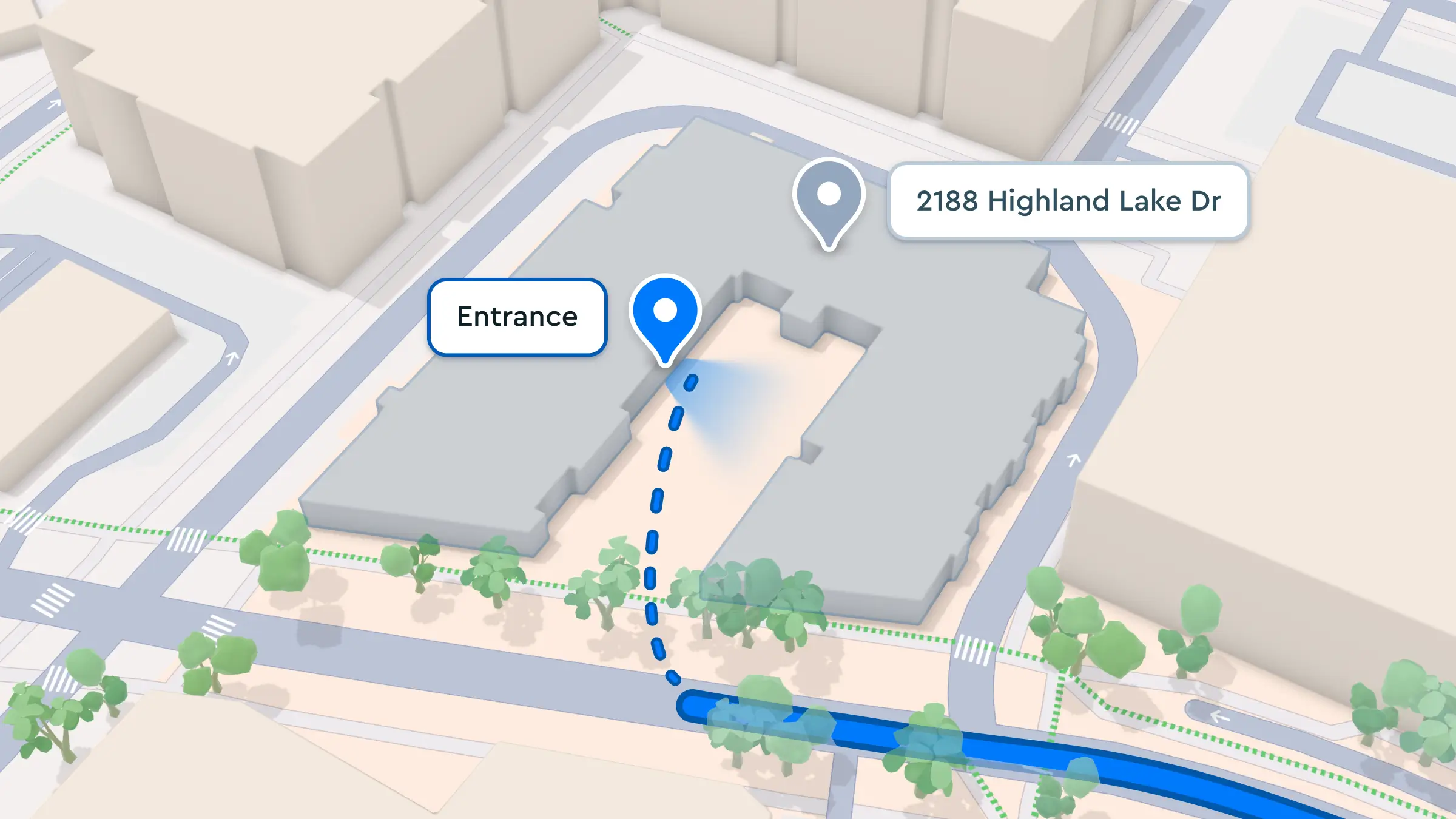
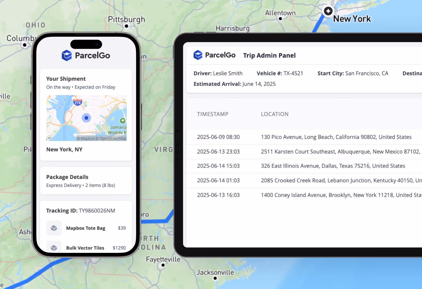
Mapbox Geocoding provides rooftop accuracy, unit-level addressing, and entrances that pinpoint exact pickup and dropoff spots in apartments, business suites, and dense complexes. With routable arrival points, drivers are guided to the correct entrance or parking location when used with Mapbox Directions and Navigation SDKs.
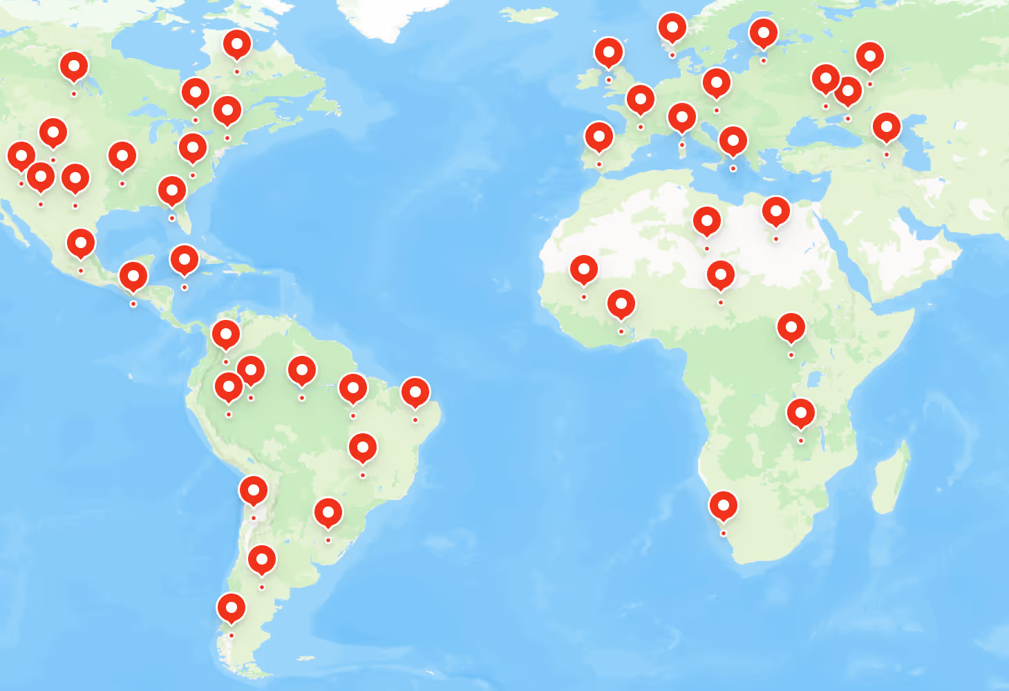
International coverage
Fast and reliable API architecture

Built for smooth integrations

Cost-effective, usage-based pricing
Advanced capabilities beyond basic geocoding
Flexible forward geocoding, in bulk or on-demand
Efficient, high-volume reverse geocoding
Geocode once, reuse forever
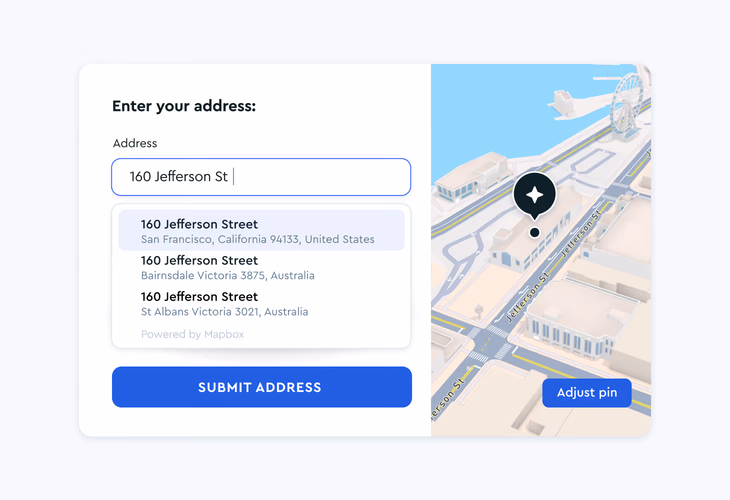
Autofill for smarter address forms
The Mapbox Address Autofill SDK reduces checkout friction and improves confidence by providing fast, relevant address suggestions as users type. It also supports corrections through an integrated feedback map, and allows addresses to be stored permanently for future operations.

Add geocoding to AI agents
Entrance data
Customer stories
Mapbox Geocoding supports companies and developers across diverse industries.
.png)
.png)
.png)
.svg)
.svg)

.svg)


Picnic uses permanent geocoding to store precise delivery locations, helping drivers reach consistent drop-off points across high-volume grocery deliveries.
Read showcase →
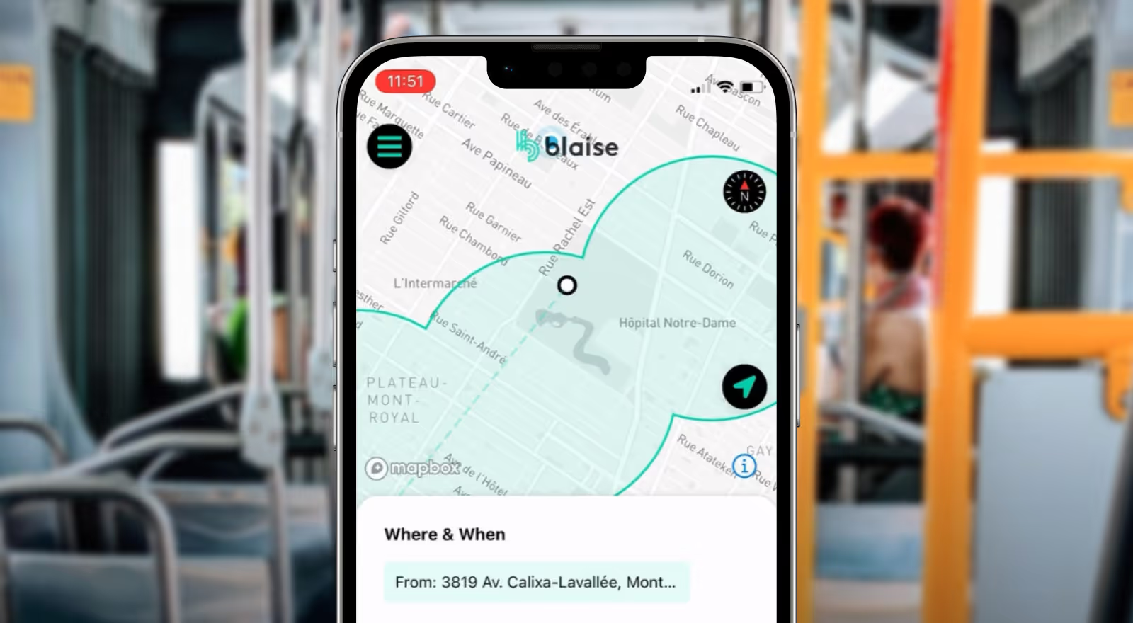
Blaise Transit relies on Mapbox reverse geocoding to power on-demand transit services, supporting accurate pickup and drop-off locations across millions of trips.
Read showcase →
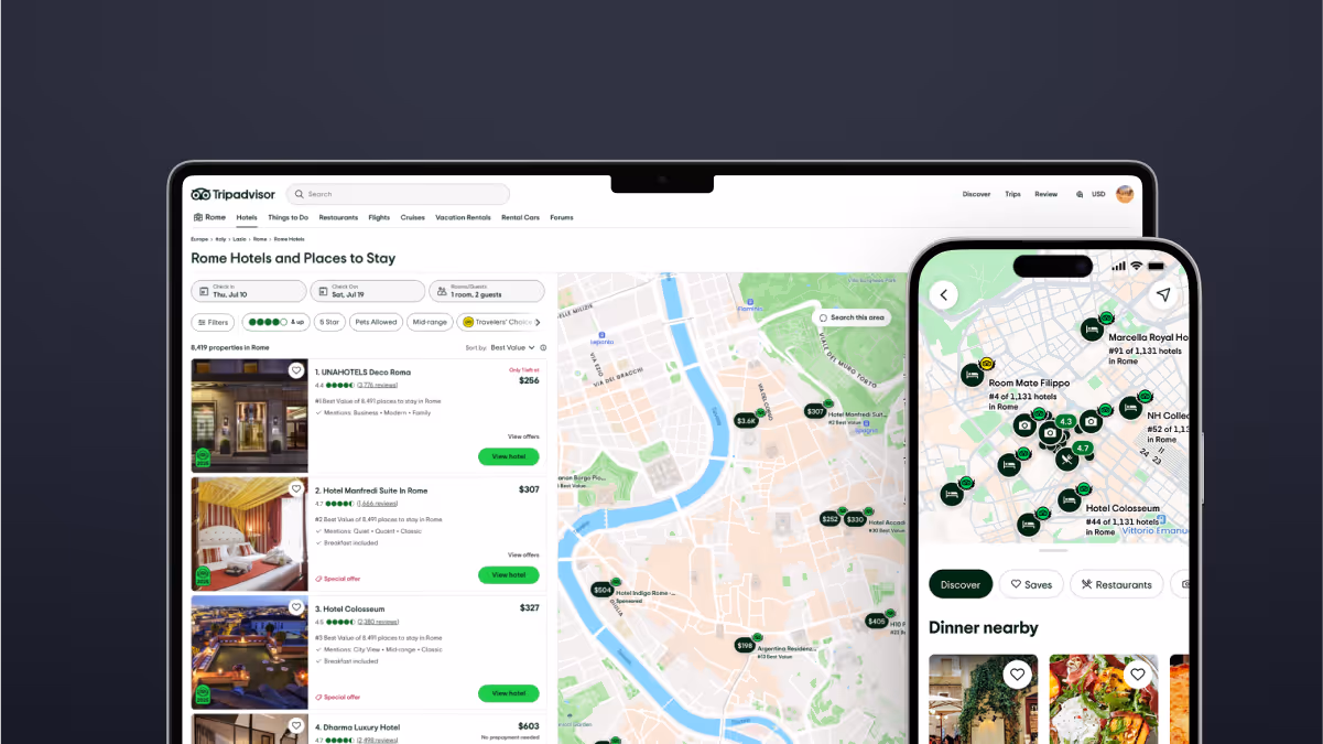
Tripadvisor uses Mapbox Search Box and Geocoding to simplify adding new businesses while maintaining accurate location data at global scale.
Read showcase →
.avif)
Blue Rhino uses Mapbox Address Autocomplete to help customers find propane retailers near them.
Read showcase →
Resources
Geocoding API docs
Introducing Geocoding v6
Mapbox Address Autofill
Mapbox Geocoding 101
Improve asset tracking with precise reverse geocoding
Geospatial capabilities available in Mapbox Snowflake Native App
Frequently Asked Questions
Geocoding is the process of converting addresses into geographic coordinates – and vice versa. The Mapbox Geocoding API verifies and standardizes addresses and converts them into geographic coordinates. ‘Forward’ geocoding converts addresses, such as 1600 Pennsylvania Avenue, Washington, D.C. 20500, into geographic coordinates (i.e., latitude and longitude). ‘Reverse’ geocoding converts a coordinate, such as (-77.03655, 38.89768), into the most relevant address for the location.
Geocoding converts addresses and place names into geographic coordinates (latitude and longitude) that software and digital systems can understand, analyze, and use (such as displaying a point on a digital map). Addresses are often stored as unstructured text data and can change over time, while coordinates are stable and precise. By turning location text into coordinates, or helping to convert unstructured address data into structured data fields, geocoding services support accurate mapping, analysis, routing, and integration across location-based systems.
Companies use geocoding whenever they need to visualize locations on a map, analyze geographic patterns, or connect people, assets, or deliveries to real-world places. Converting addresses into coordinates improves targeting, supports better planning, and helps mitigate operational errors. Common use cases include delivery logistics, fleet tracking/management, content tagging, and location-based analytics, each contributing to higher conversion rates, improved customer experience, and more efficient operations.
Forward geocoding converts addresses (like “1133 15th St NW Suite 845 Washington, DC 20005”) or place names (like “Austin, TX”) into geographic coordinates (latitude and longitude). The coordinates can be used to pinpoint locations on a map or adjust a map's view. For example, a delivery app needs to be able to place a customer's address on a map in order to calculate a route for a driver and display the location as a point on a map. When a customer enters an address, the company would then send that address to the Mapbox Geocoding API, which returns the coordinates of that address, along with other metadata. Read Mapbox documentation about forward geocoding.
Reverse geocoding transforms geographic coordinates (latitude and longitude numbers) into a human-readable address or place name that exists at that location. For example, asset tracking systems convert GPS coordinates into readable place names and addresses, helping fleet management teams understand where vehicles or equipment are located and respond faster. Read Mapbox documentation about reverse geocoding.
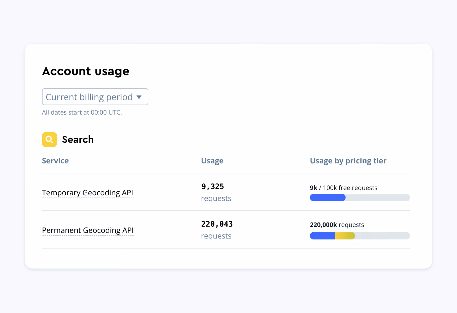
Temporary geocoding is like looking up an address once. You get the answer (coordinates), but do not save it for later. It is useful for showing locations on maps during searches (e.g., finding a restaurant on your phone). Permanent geocoding is like saving an address to look up again anytime without querying the API again. It is helpful for businesses that need to store addresses for future use (e.g., delivery companies storing customer addresses). The Mapbox Geocoding API provides both options. Read the API documentation.
Mapbox Geocoding services are priced per request and offers two options based on how the data is used:
- Temporary Geocoding includes 100,000 free API requests per month, then is billed per 1,000 requests with pricing that scales down as usage grows.
- Permanent Geocoding (for storing and reusing results in databases, analytics, or reporting) is billed per 1,000 API requests, with no free tier. Volume-based discounts are available.
Both options are designed to support everything from early testing to large-scale production workloads. For detailed pricing tiers and discounts, see the Mapbox pricing page.
Mapbox Geocoding is built for precision, scale, and reliability. It delivers rooftop-level accuracy with routable points and building entrance data to reduce failed deliveries and improve on-time arrivals. A low-latency, high-throughput architecture supports high-volume workloads with consistent sub-50 milliseconds response times, while continuous updates from feedback APIs and telemetry across hundreds of millions of monthly active users keep location data accurate and current. Mapbox Geocoding offers highly competitive pricing compared to other geocoding services.
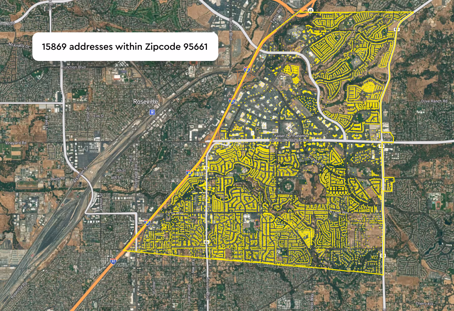
Batch geocoding allows developers to efficiently process large volumes of data for both temporary and permanent geocodes in a single API request. Mapbox allows up to 1,000 queries to be sent in the same request. For example, real-estate companies use batch geocoding to update entire databases of properties for visualization and analysis. Read Mapbox documentation on batch geocoding.
- Forward and reverse geocoding: Convert addresses and place names to coordinates, and/or coordinates to addresses and places.
- Temporary and permanent storage options: Use geocoding results live or store them permanently for analytics, reporting, and repeat workflows.
- Autocomplete and fuzzy matching: Built-in type ahead suggestions and tolerance for misspellings help users find the right location faster.
- Context-rich results: Access hierarchical location context in each API result – such as neighborhood, postcode, region, and country.
- Customizable search parameters: Adjust precision level, storage settings and more.
- Batch geocoding: Process up to 1000 forward or reverse geocoding queries in a single request.
- Smart Address Match: Understand how well a forward-geocoding result aligns with the query submitted.
- Multi-lingual support: Benefit from translation availability for 50+ languages
Read the Mapbox Geocoding v6 documentation
Structured Input is an optional parameter that enables you to pre-parse address data. Instead of querying a string like 1600%20Pennsylvania%20Avenue%20Washington,%20D.C.%2020500, you can query num=1600&street=Pennsylvania%20Avenue&city=Washington,%20D.C.&postcode=20500. Doing so increases query understanding and the likelihood of providing the correct result as fast as possible, with structured queries being processed up to 20% faster. Read the Mapbox documentation on forward geocoding with structured input.
Smart Address Match in the Mapbox Geocoding API consists of a Confidence Score and Match Codes. The Confidence Score assesses how well a query and its individual components match a known result. To determine the Confidence Score, each component of the address is assessed and given a true or false match code. The match code results are then analyzed, providing an overall Confidence Score ranging across Exact, High, Medium, or Low Confidence.
The Confidence Score and Match Codes help fine-tune geocoding results to a particular use case. If you are working in delivery, for example, you can use match codes to ensure that you only use the most accurate results. If, on the other hand, you are analyzing and visualizing a dataset with millions of address records, it may be sufficient to aggregate data at the postcode level. Read the Mapbox documentation.
The Mapbox Geocoding API supports 50+ languages across major global regions, enabling localized address and place search for international applications. In the latest Geocoding API version v6, language support expanded to include Estonian, Ukrainian, Italian, Russian, Malay, Vietnamese, and Hindi, improving global accessibility and search relevance. Full language support details are available in the Mapbox language coverage documentation.
The Mapbox Address Autofill SDK reduces checkout friction and improves confidence by providing fast, relevant address suggestions as users type. It also supports corrections through an integrated feedback map, and allows addresses to be stored permanently for future operations. The lightweight SDK works across web, iOS, Android, React, and Node.js, ideal for checkout, delivery, or registration flows
The Mapbox Geocoding API focuses on address search, while Mapbox Search Box API covers a broader scope and user interface features, including Points of Interest (POIs), location type categories, branded locations, and features like Search Along a Route.