Why Leading Weather Organizations Use Mapbox
Heading
Lorem ipsum dolor sit amet, consectetur adipiscing elit, sed do eiusmod tempor incididunt ut labore et dolore magna aliqua.
Our top 5 best-in-class weather customers and their solutions

When it comes to weather maps, accurate data, fast and reliable performance, and an innovative visualization offering for forecasting are essential. Working with an enterprise grade location services provider transforms companies’ ability to stand out in the weather industry.
Mapbox is at the forefront of solutions for the weather space, catering to a range of customers in the sector. A look at five leading weather customers demonstrates how Mapbox services enhance their operations and improve customer satisfaction in a variety of ways.
Expanded Adoption of the Mapbox Platform: The Weather Company

The Weather Company (TWC) interactive maps, built with Mapbox for mobile and web, provide real-time and forecasted Doppler radar, wind, precipitation, storm alerts, cloud cover, temperatures, UV index, and more for millions of users daily.
TWC began building with Mapbox for the flexible GL library and its ability to incorporate interactive graphics into mobile weather applications. For such a large weather company, the reliable Mapbox infrastructure and cross-platform support for web and mobile are also key.
Over the years, TWC has expanded adoption of the Mapbox platform to streamline map data and rendering services. TWC makes forward and reverse geocoding requests to provide users with weather in their location or a searched location. They use static images to create bite-sized shareable map images for social channels and to load initial lightweight weather maps that link to interactive maps, thereby improving users’ experience of map performance and application speed. Today, TWC has even built a dedicated cloud-based application for broadcasters to use for in-studio weather visualization, with Mapbox 3D terrain base maps as the underlying foundation.
Hyper-engaging maps: AccuWeather

AccuWeather chose Mapbox to enhance their maps and enhance the user experience across their various platforms. With the Mapbox Mobile Maps SDKs, AccuWeather streamlined development cycles, consolidated their mapping providers from six to just one, and created a consistently excellent map experience across web and mobile.
Engagement metrics improved dramatically on AccuWeather websites and apps, with users now spending four times as much time interacting with the Mapbox-powered maps compared to other features. Better engagement means users spend more time on AccuWeather, driving better brand loyalty, and creating better returns for advertisers.
"Our users love maps because of the sheer amount of valuable information we can showcase. We’re investing in best-in-class experiences that further allow weather fans to interact with all our data."
Kurt Fulepp, President, Digital at AccuWeather
On-brand maps: CNN

Location, location, location applies to the news industry as much as real estate. When a story breaks, CNN uses Mapbox maps to provide critical location data, including during major weather events like hurricanes and flooding.
CNN uses Mapbox Studio to equip their Visual News team with a flexible mapping platform that allows for control over every detail of map visuals and rapid publishing of maps and map updates for news stories. Rendering interactive maps with Mapbox GL JS also gives CNN the ability to select a map projection optimized for any data visualizations, across every zoom level.
The flexibility and customizability of Mapbox maps enables CNN to design their maps to match their brand image and design standards, while still publishing stories quickly.
“I really love the control I have over the map features such as land, water and roads in Mapbox Studio. And I can tinker with all of this live, long before working on the front-end display, incorporating feedback from the rest of the team.”
John Keefe, Senior Data and Visuals Editor at CNN
Streamlined data pipeline: Yahoo! Japan
.gif)
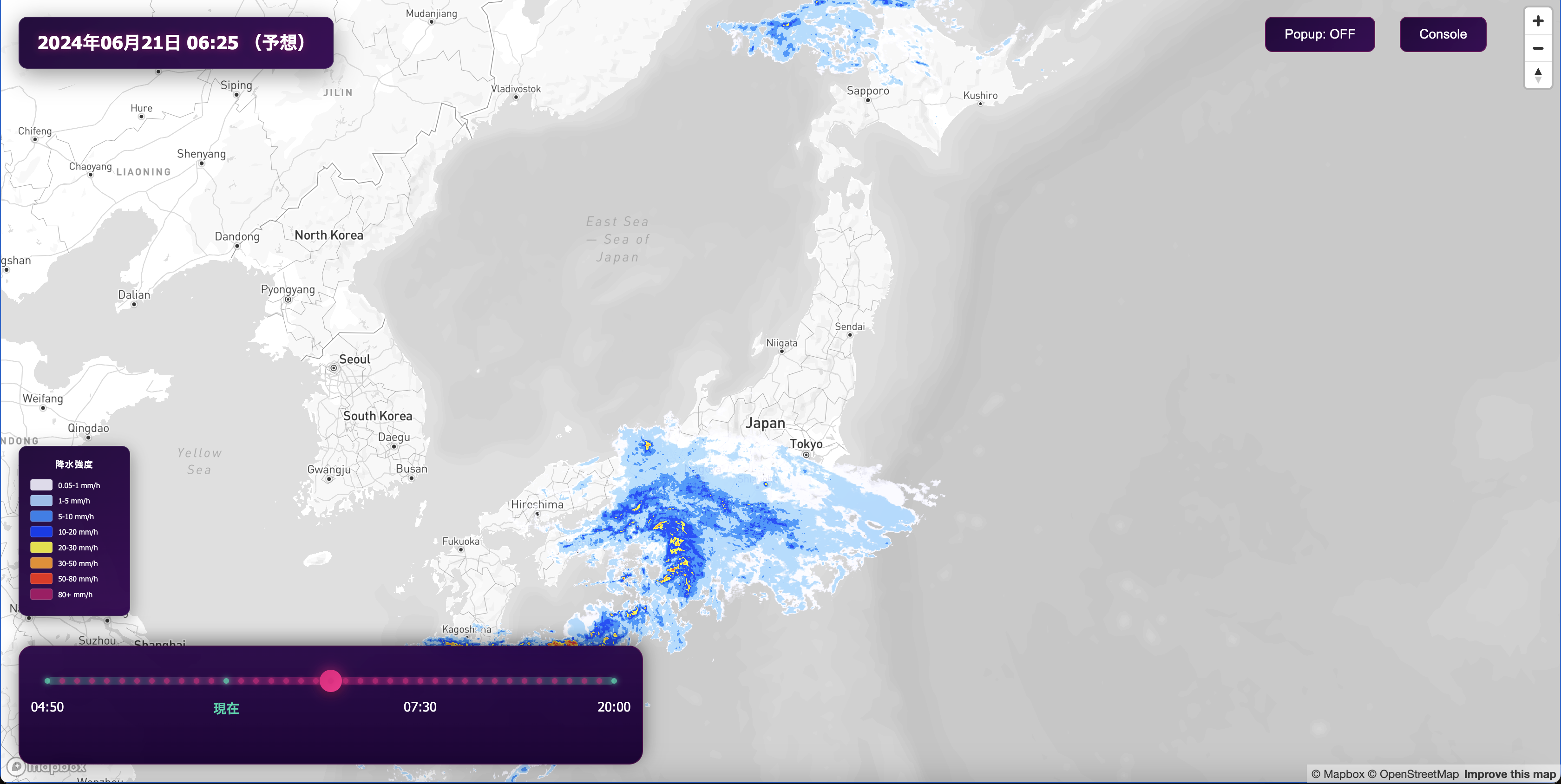
Yahoo! JAPAN expertly uses Mapbox data capabilities to offer hyper-local, real-time performant weather maps for millions of users.
Before choosing Mapbox, Yahoo! JAPAN Weather & Disaster's underlying map data was delivered from on-premise tile servers, with the map images distributed from static image distribution servers. The operation and maintenance cost of these servers kept increasing. Another pain-point was unstable map rendering during spikes in usage.
Mapbox offered a solution for each of the challenges, from data hosting to map performance. Based on positive collaboration experiences between Yahoo! JAPAN Corporation and Mapbox, the map team decided to switch from Yahoo! JAPAN's map platform to Mapbox. This migration replaced Yahoo! JAPAN's large in-house tileservers, managed in the private cloud, with the Mapbox Tiling Service (MTS) and slashed infrastructure maintenance costs.
“By migrating all of our minutely updating weather maps to MTS, we were able to save engineering time and money while providing a better experience for our users.”
Soichi Takahashi, Unit Manager at Yahoo! JAPAN
In addition to cost savings, because MTS converts geospatial data to vector tiles this made it easier and faster to update the applications’ maps dynamically when the underlying data changes, without needing to rebuild map styles. It also provides a high-speed, low-latency cache network to enable scaling in any region, which is especially important for the Yahoo! JAPAN Weather & Disaster team due to the high spikes in traffic that the apps receive during weather or disaster events.
"MTS supports advanced scaling, which helps display detailed information by zooming into a specific area of the map during a disaster, all without extensive load. This feature gives us great confidence despite skyrocketing traffic during an emergency."
Akihiro Kajiwara, Development Lead, Yahoo! JAPAN Weather & Disaster
Live sensor data maps: Tomorrow.io

Tomorrow.io improves on traditional weather forecasting data with a worldwide network of millions of sensors in cell phones, vehicles, airplanes and drones. These sensors relay an enormous amount of dynamic information that is visualized on weather maps built with Mapbox GL JS in a user-friendly interface.
The Tomorrow.io Weather Intelligence Platform uses Mapbox to display dynamic weather patterns in real time and generate high-resolution global models that help companies like JetBlue make decisions around delays and run safer operations. Their MicroWeather API allows companies across weather-sensitive industries to see all of their weather data in one place - with multiple options for numerical weather data and map layers they can embed into their own application. This implementation has even proven helpful for ride-sharing platforms like VIA to predict demand levels based on weather trends.
Build with the best
Mapbox teams work with global, regional, national, and local commercial and government weather organizations every day.
If you work at a weather organization and want to see how Mapbox can enhance your maps and location services, contact us.
Lorem ipsum dolor sit amet, consectetur adipiscing elit, sed do eiusmod tempor incididunt ut labore et dolore magna aliqua.


