Real estate intelligence with the MTS (Mapbox Tiling Service)

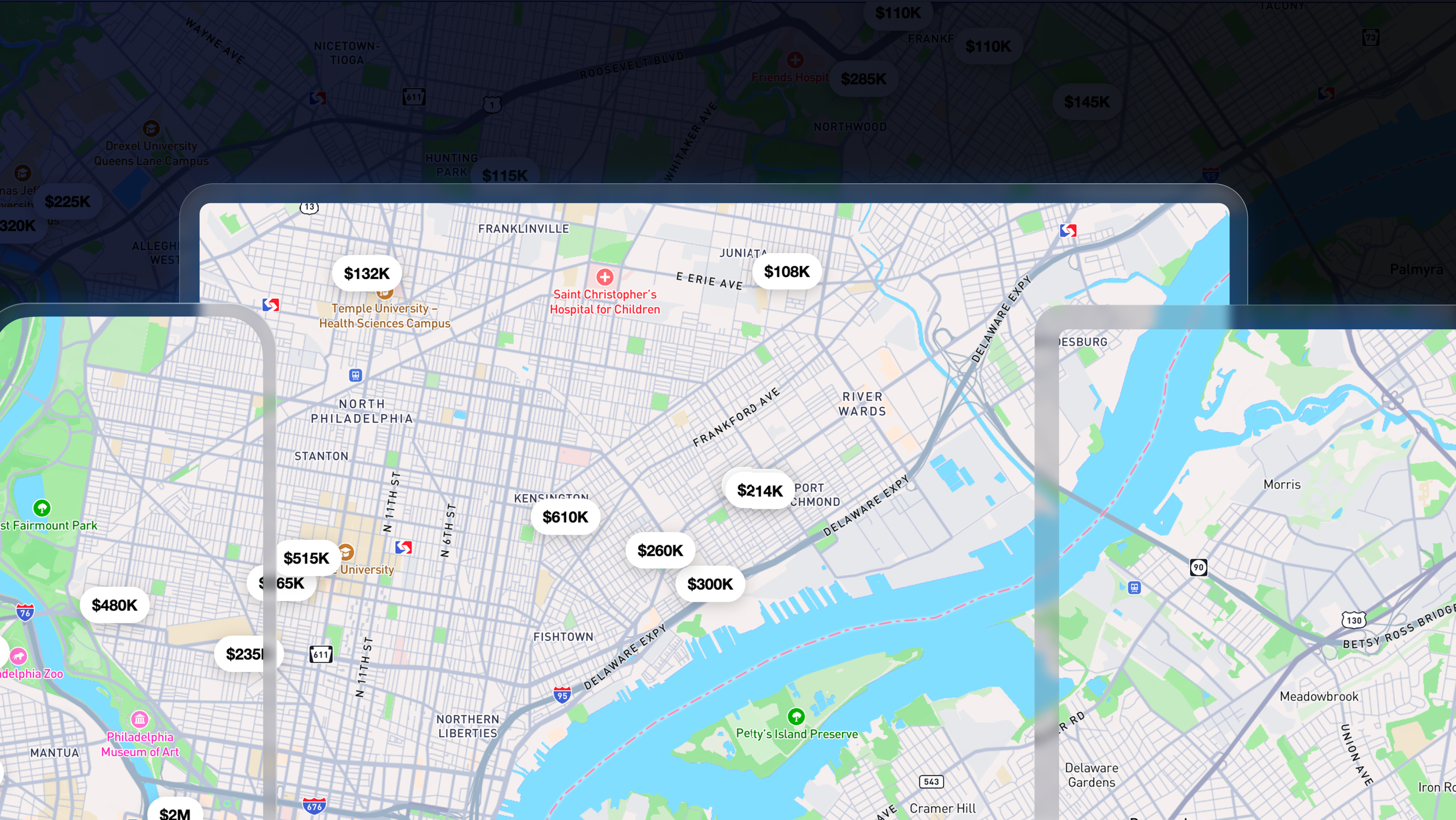
The real estate industry loves to use maps to help people with decisions about buying or selling property. The challenge is that real estate data is detailed, dense, and current to inform decisions on a day to day basis. There are an estimated 155 million property parcels and 166,000 neighborhoods in the US alone. Parcel data is packed with detailed boundaries and property metadata such as ownership information, sales deeds or mortgages, and foreclosure activity. Neighborhood data can contain numerous layers of ever-changing attributes such as crime rates, points of interest, school scores and districts, home prices, flood risk, and pricing trends.
MTS (Mapbox Tiling Service) allows the processing of massive sets of data into custom vector tilesets, continuously updating the maps as the data changes Creating tilesets improves performance: Instead of making multiple API calls and querying a slow backend database, a map that uses preloaded custom layers connected to vector tilesets is smooth and wicked fast.
Scaling location data for Real Estate
Real estate is big business with an estimated $9.6 trillion global market size and in the US accounting for $3.6 trillion (17.4%) of gross state product and it’s growing. Real estate companies and their technology partners need to scale their data offerings and backend infrastructure to keep pace. Mapbox customers are leading the way in harnessing the potential of location data for their customers.
Georadix helps customers in the real estate sector such as CoreLogic elevate maps, leveraging location data through geospatial mapping, visualization, and analytics.
“The value of Mapbox Tilesets API is the Mapbox platform and ecosystem. Real estate data is dense and complex so they need powerful tools to process the data. With Mapbox you can create amazing visualizations, and interactive and dynamic maps after tilesets have been created.”
Anthony MacKinnon, CEO, Georadix
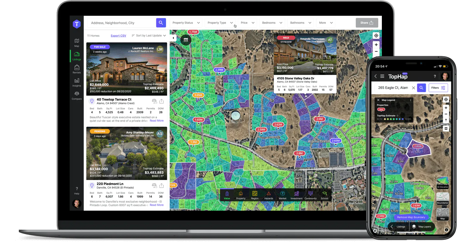
TopHap turns Realtors into territory experts with easy property search, analysis of other territories, and data down to the street level. Meaning they can ensure their clients are getting the best deal on the block.
"When it comes to user experience, nothing else compares to Mapbox. I don’t think there is any other choice today."
Dennis Khvostionov, CTO of TopHap
Deepblocks is a real estate startup with software that performs a complete real-time analysis of financial and market data, in combination with local building regulations, to generate optimal strategies for any real estate development. With a detailed real estate database from cities around the world, Deepblocks provides insights for cities and developers deciding when, where, and what to build.


Utah Real Estate built its "Interactive Parcel Map Layer Search" using MTS. A new product for real estate professionals, the layer is powered by MTS tilesets hosting data such as real estate listings, parcels, counties, bus routes, and rail stops.
“It’s so efficient to use the tiling service. It’s fast on the UI and pretty easy to implement.”
Peter Hammond, Lead Engineer, Utah Real Estate


Real estate companies can leverage Soundscore™ from How Loud to embed a noise map into any brokerage or real estate listing. A Soundscore™ rating is a number between 50 (very loud) and 100 (very quiet) that measures environmental noise.

Brendan Farrell, Founder of How Loud, recently started a flood map project with Mapbox to visualize detailed national flood zones in the US using flood data from FEMA and other sources. Given some 14.6 million properties are at immediate risk of flooding nationally, this map provides valuable information to insurance companies and other organizations interested in managing floods risk.

Distributed and parallelized processing
MTS creates and updates data using distributed and parallelized processing, meaning data is processed much more quickly than is possible with a standard, single server setup with comparable tools. Get started with this step-by-step example of how to create a MTS tileset with building footprint data for high resolution insight of buildings in Rhode Island.
To build custom tilesets of real estate data and more, get started with MTS:
- MTS Data Sync: a no-code tool to publish GeoJSON data as vector tiles.
- Tilesets CLI: a command-line Python tool for creating tilesets with MTS.
- Tilesets API: for increased control, access MTS using HTTP API endpoints to prepare and upload data.
A growing library of recipe examples sharing tips and best practices from other MTS users.
Have questions? Check out MTS documentation site or contact sales for more in-depth product discussion.


Related articles
Build once, run everywhere: Web support comes to the Mapbox Maps SDK for Flutter

From airports to stadiums, maps are elevating the soccer fan experience
