#30DayMapChallenge
Explore the challenges below or begin creating your own map style.
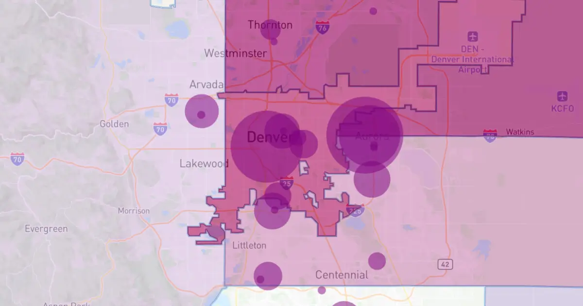
Points
Challenge Classic: Map with point data (e.g., individual locations, points of interest, clusters). Focus on effective symbolization and density visualization.
Air
Classical Elements 2/4: Focus on the atmosphere. Map weather, wind patterns, air traffic, pollution, or airborne transmission (e.g., pollen, sound).
Minimal map
Challenge yourself to use the fewest possible elements (color, line weight, labels) while keeping the map clear, useful, and informative.
Map from 2125
How will maps look 100 years from now? Create a speculative map of what might be (or what you hope will be).
10 minute map
Start the timer! The maximum allowed time to design and produce this map is 10 minutes. Focus on speed, simplicity, and core communication.
Data challenge: OpenStreetMap
Use OpenStreetMap (OSM) data as your primary source. Map your favorite feature, contribute back to the project, or style the map in an interesting way.
Fire
Classical Elements 3/4: Focus on energy, light, or transformation. Map heat, wildfires, energy consumption, population density at night, or volcanic activity.
Cell
Map something composed of small, discrete units or networks. This could be a geographic cell (raster, tessellation), a cellular network, or a biological/social process (e.g., disease spread).
A new tool
Challenge Classic: Experimentation is key! Create your map using a software, language, library, or technique you have never used before.
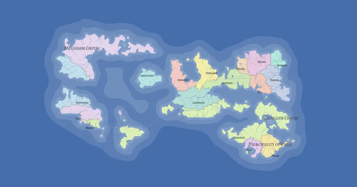
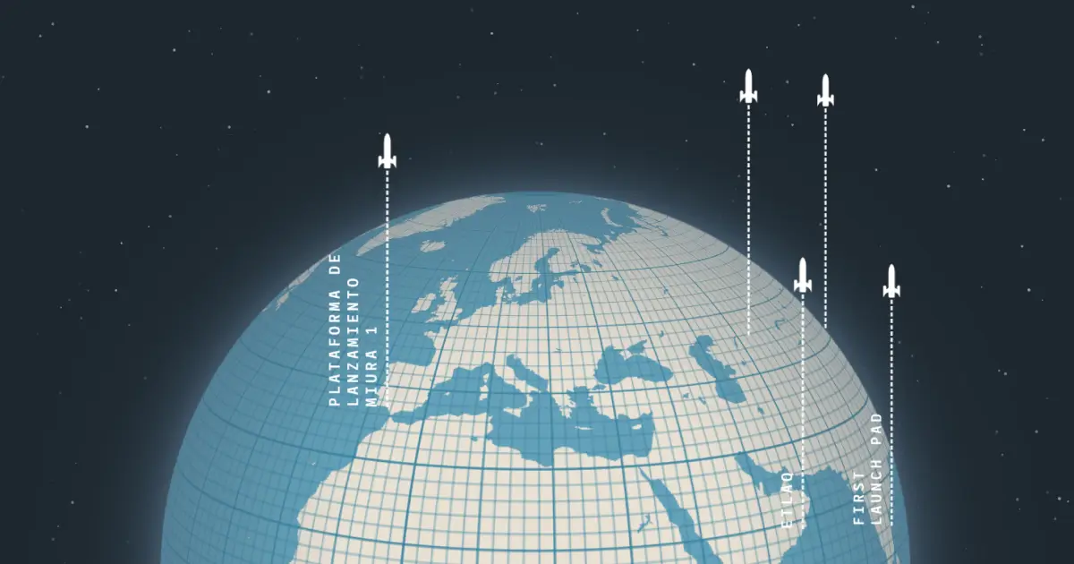
Out of this world
Map something non-Earth: a fantasy realm, an exoplanet, the Moon, Mars, deep space, or a purely conceptual place (e.g., a mental map).
Projections
(GIS Day) Focus entirely on map projections. Choose an unusual or misunderstood projection to highlight a theme, or visualize distortion. (See xkcd.com/977)
Lines
Challenge Classic: Map linear features (e.g., roads, rivers, migration paths, flow lines). Explore line thickness, color, and direction to convey information.
Water
Classical Elements 4/4: Focus on the fluid. Map hydrology, oceans, currents, water accessibility, sea level rise, precipitation, or anything aquatic.
Icons
Create a map where icons, pictograms, or custom symbols are the main focus. Use them to highlight points of interest or replace traditional cartographic features.
Data challenge: Natural Earth
Use the Natural Earth dataset as your primary source for a visually stunning small-scale world or continent map.
Process
Show how you make a map. This could be a tutorial, a step-by-step graphic, a blog post, a video, or a screenshot of your work environment. Combine it with a map from another day!
Places and their names
Focus on toponymy (place names). Experiment with font choices, label placement, typography, multiple languages, or the history and meaning behind a name.
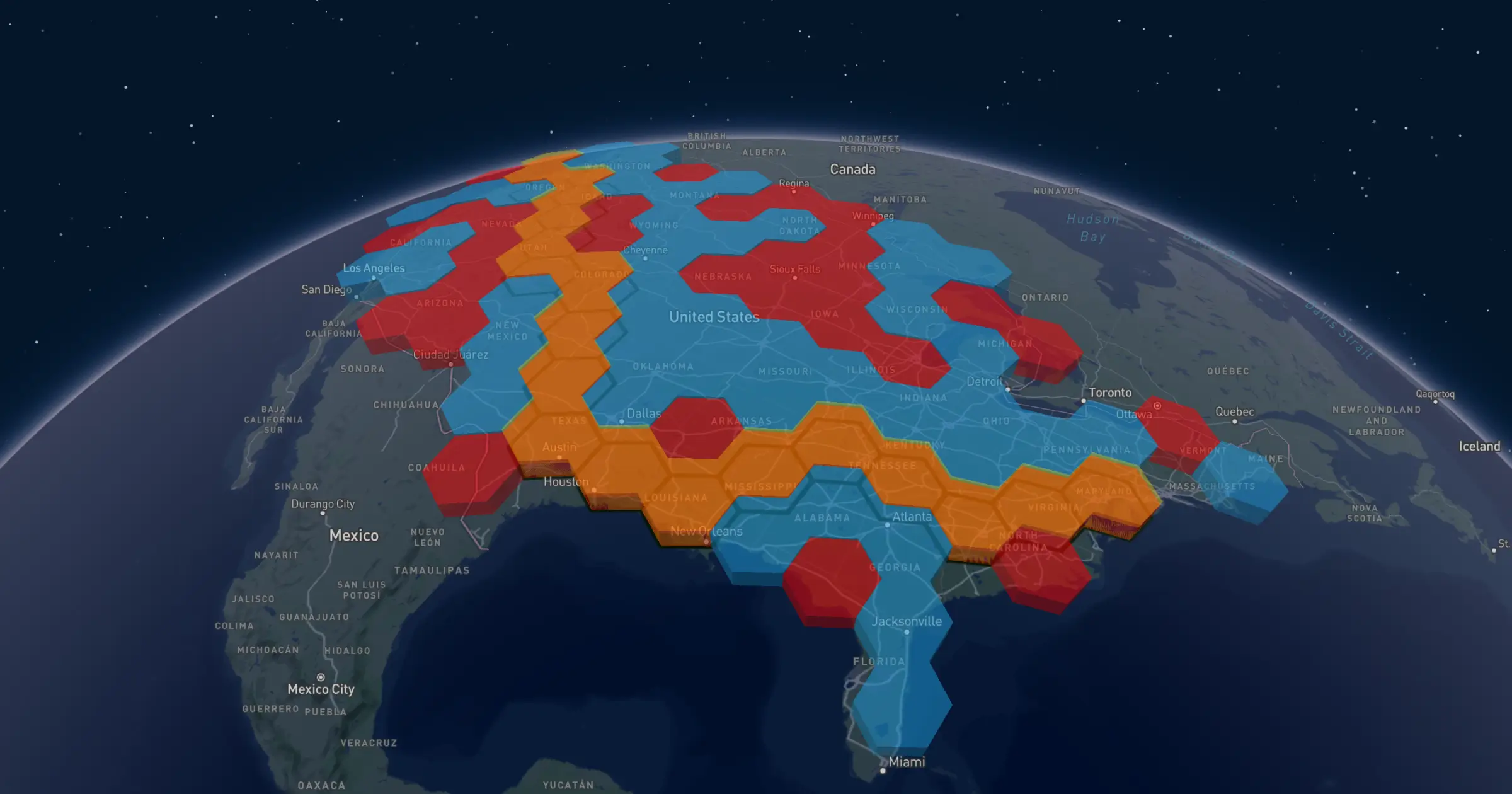
Hexagons
Challenge Classic: Use hexagonal binning (hexbins) or a hexagonal grid system to visualize your data. Celebrate this beautiful and efficient tessellation!
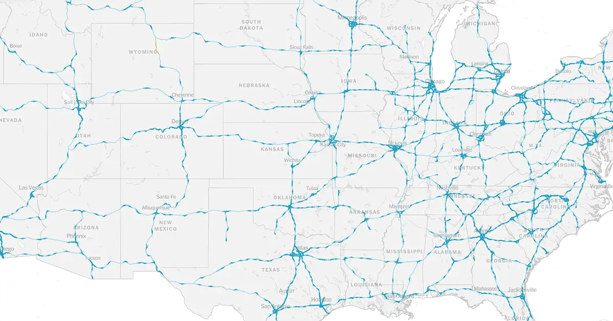
Transport
(World Sustainable Transport Day) Map mobility, traffic flow, public transit networks, logistics chains, or advocate for sustainable transport options.
Boundaries
Map lines of division—political, physical, ecological, or conceptual. Explore the meaning and impact of a dividing line, real or perceived.
Black
(Black Friday) Interpret the theme of Black. The map can be purely monochromatic, represent absence/darkness (e.g., light pollution), or relate to themes of consumption.
Raster
Challenge Classic: Map using raster data. Focus on satellite imagery, elevation models (DEMs), land cover, or pixel-based art.
Polygons
Challenge Classic: Create a map focused on area features (e.g., administrative regions, land use, boundaries). Use fills, patterns, and choropleth techniques.
Makeover
Take a map you made during the month or an older piece and redesign it. Focus on improving the aesthetics, clarity, or data communication.
Data challenge: My Data
Map something personal using your own dataset. Visualize GPS traces, your commute, or a unique, small dataset you created. (Need simple data? Try geojson.io)
Earth
Classical Elements 1/4: Focus on the tangible and grounded. Map landforms, geology, soil, agriculture, elevation, or anything solid beneath your feet.
Dimensions
Map beyond 2D. Visualize data using 3D models, extrusions (building heights), depth, time (as a dimension), or an unconventional multivariate approach.
Accessibility
Map how people (or things) get around. Visualize travel time, barriers, inclusive design, public transport reach, or create a map that is itself highly accessible to all users.
Urban
(World Urbanism Day) Map the built environment: dense street networks, highrises, urban sprawl, city infrastructure, or population density within a metro area.
Analog
Step away from the screen! Create your map using traditional methods (e.g., pen, pencil, paint, collage, physical models). Show the handmade process!
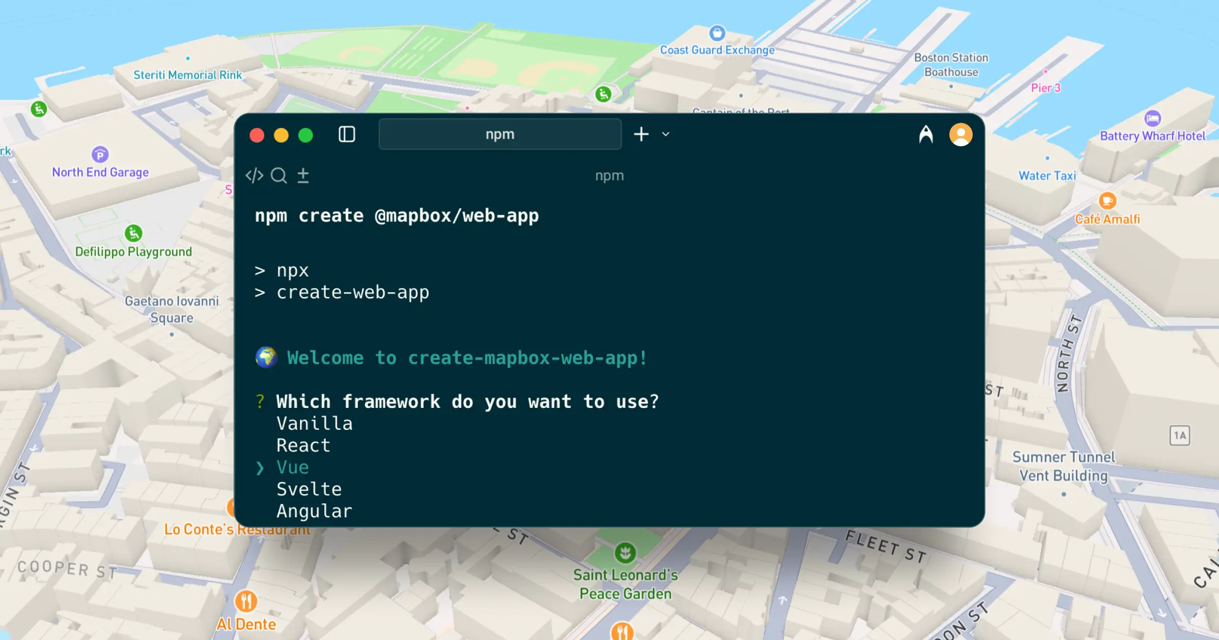
10 second map
Get your web map running in seconds with our new developer tool — just run npm create @mapbox/web-app, choose your framework, and launch a live Mapbox map instantly. Built for developers and designed for simplicity, it’s the fastest way to start building with Mapbox today.
Atlas of Popular Transport
At BUILD with Mapbox, Alberto Meouchi from MIT’s Civic Data Design Lab demonstrated how the Atlas of Popular Transport uses Mapbox tools and GTFS feeds to animate commuting and mobility patterns around the world.
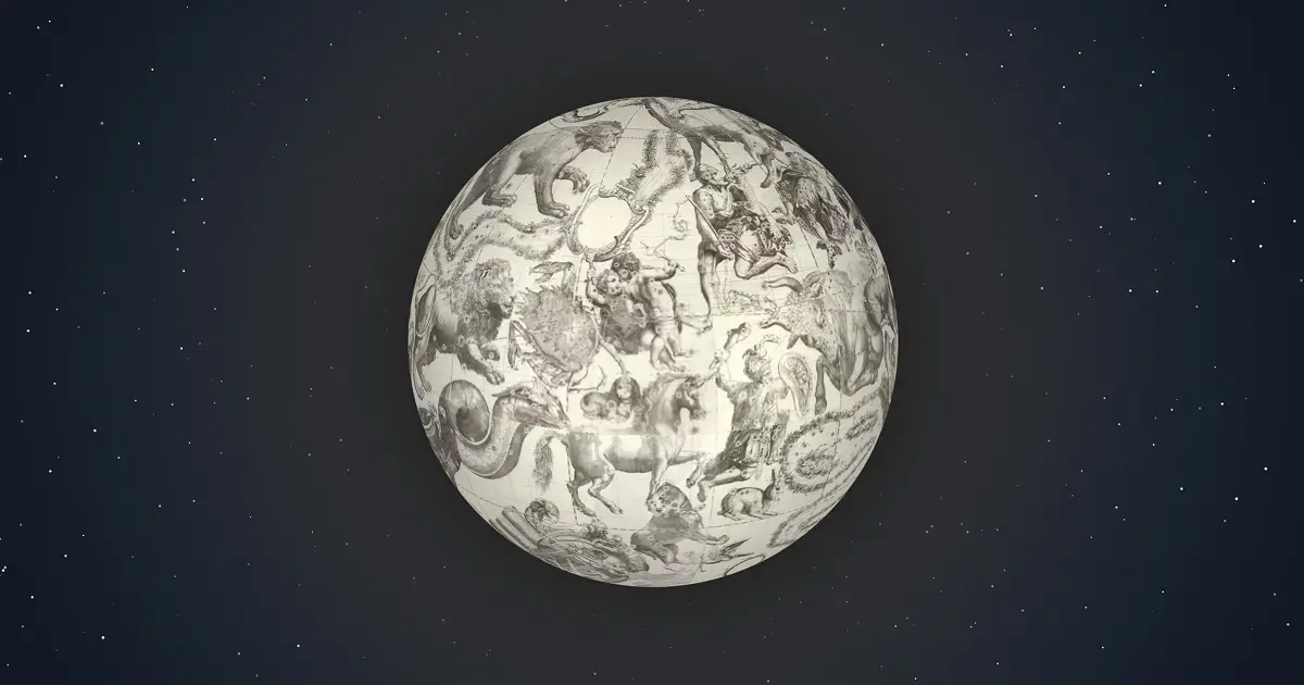
Celestial globe
Using the Mapbox GL globe, this project converts a high-resolution scan of Vincenzo Coronelli’s 1698 celestial globe into an interactive 3D experience, reimagining historical cartography for global audiences in the digital age.
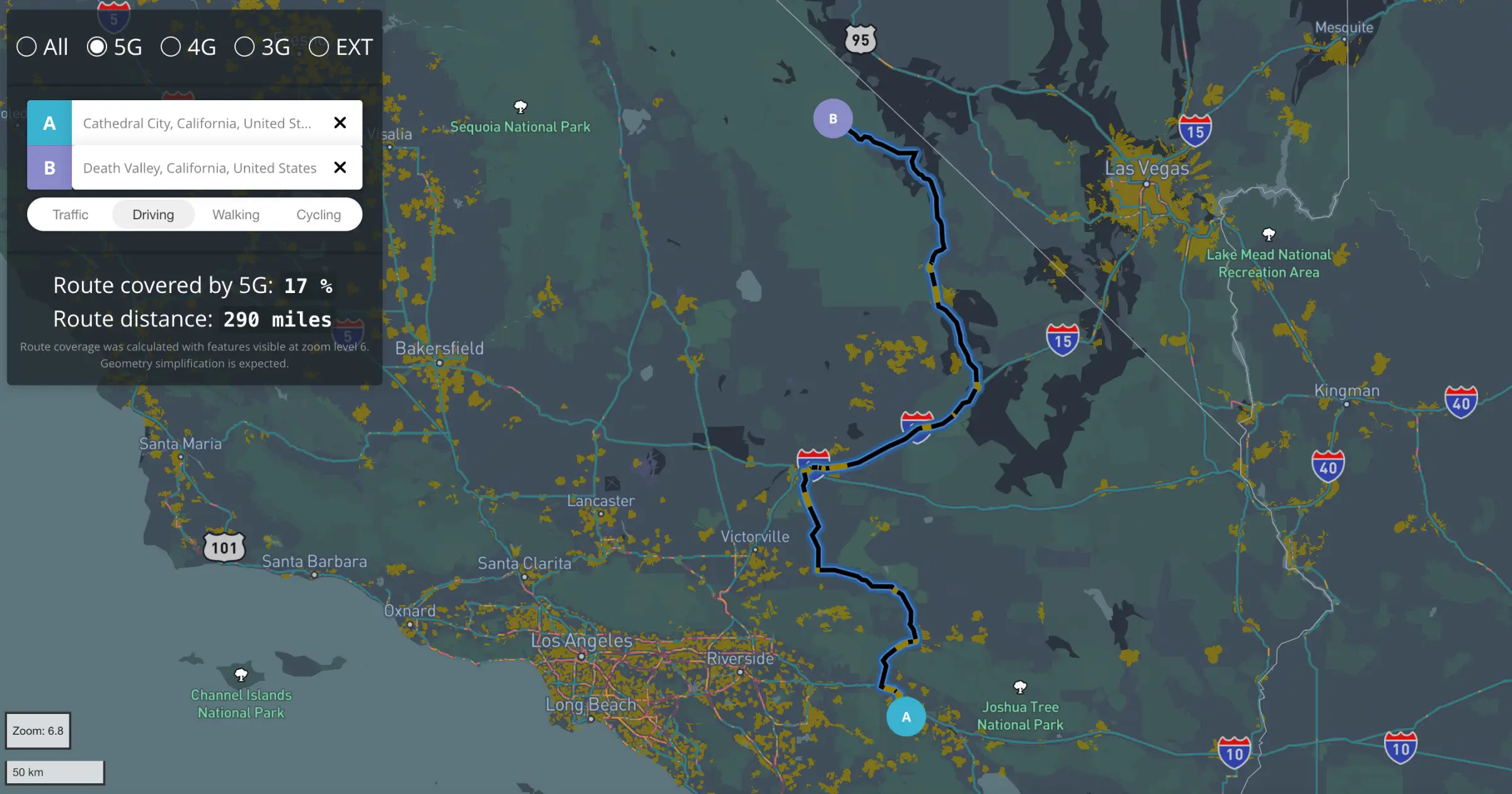
Cell coverage
Maps reveal the reach of cell networks. Using Mapbox GL JS and custom coverage tilesets, Megan White built a dashboard to dynamically calculate and visualize network coverage along a route.
Data for good
The team at DataKind uses the Mapbox Boundaries datasets to build scalable tools that visualize geographic disparities and inform smarter interventions in housing, food access, and community support.
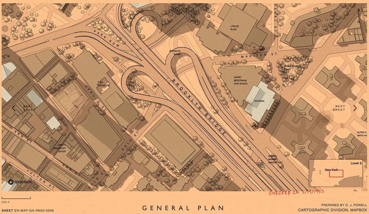
Day 23
In one of the BUILD Show & Tell sessions, Chris Whong walked through how he reverse-engineered a popular SVG fantasy map generator — unpacking its inner workings to understand how fictional worlds get built, one vector at a time.
Display a map
The Mapbox Documentation team makes it easy to start building maps with clear code samples and demos, like this straightforward (and minimal) “Display a map on a webpage” example.
EV road trip
See how the New York Times used Mapbox to visualize America’s expanding EV-charging network. Each line maps distance, density, and infrastructure in motion, showing the evolving dimensions of electrified mobility.
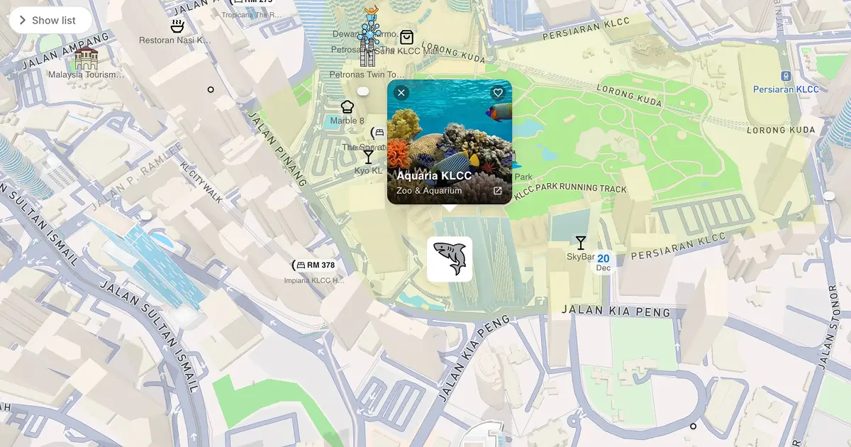
Explore Malaysia
Using Mapbox, Loka.my delivers intuitive visualizations and seamless navigation, helping travelers discover attractions and visualize guided 3D tours like this one around Kuala Lumpur.
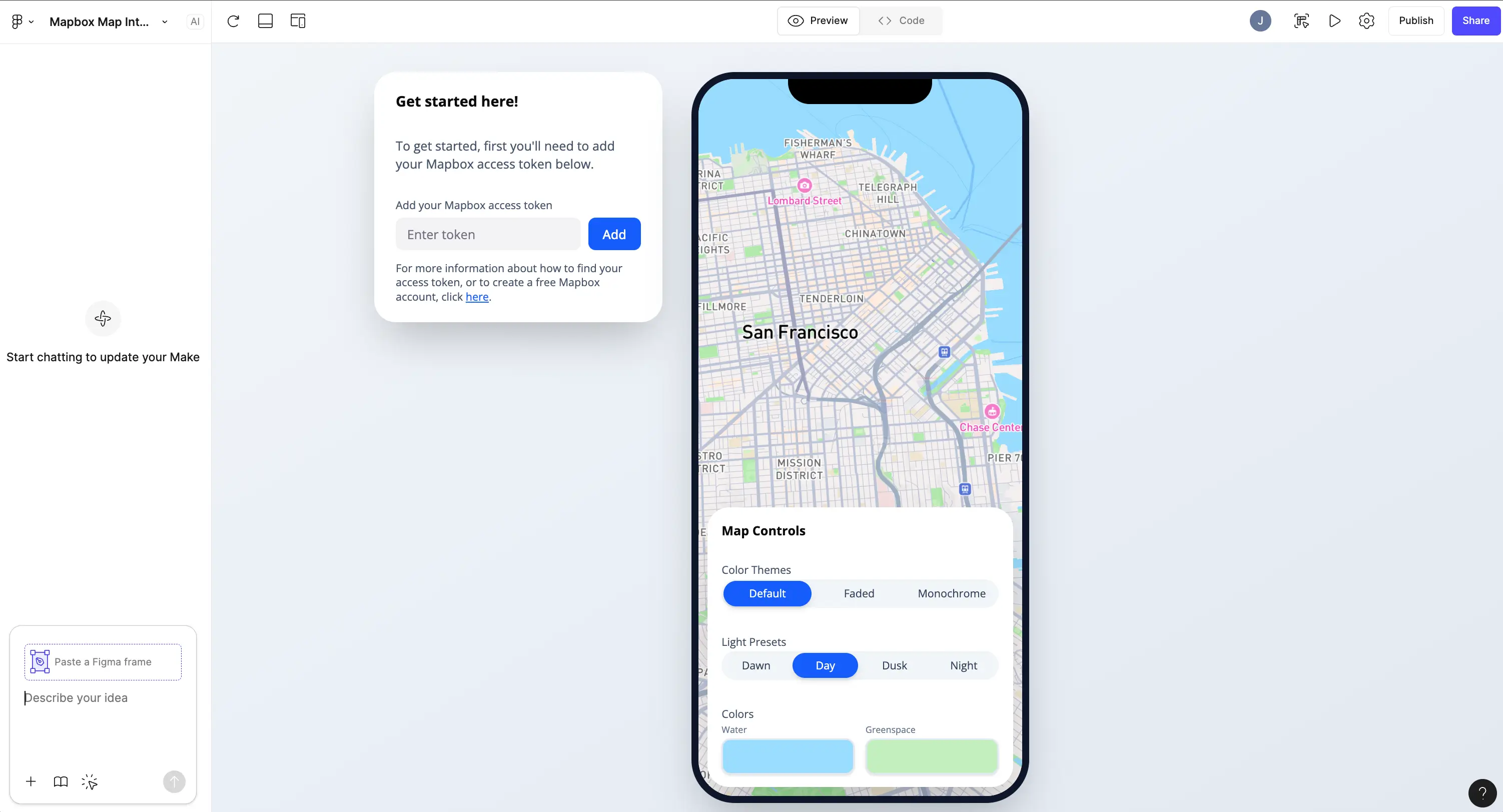
Figma Make
Designers — meet interactive mapping in Figma. You can now make prototypes with live Mapbox maps directly inside your designs. Bring real data, style, and movement to your prototypes without a single line of code.
Golden age of travel
A jet-age–inspired map style celebrates the golden age of travel with low-zoom aircraft icons, flight paths, and airport-code labels. As you “arrive,” the style shifts into a warm mid-century travel-poster aesthetic, with coastal edges, boxed place names, and local icons that bring each destination to life.
Hex game
Hexagons make great maps — and great games! This hex-based map, created by Mapbox aficionado Rafa Gutierrez, shows how the versatile H3js library can help to build puzzles, grids, and interactive experiences.
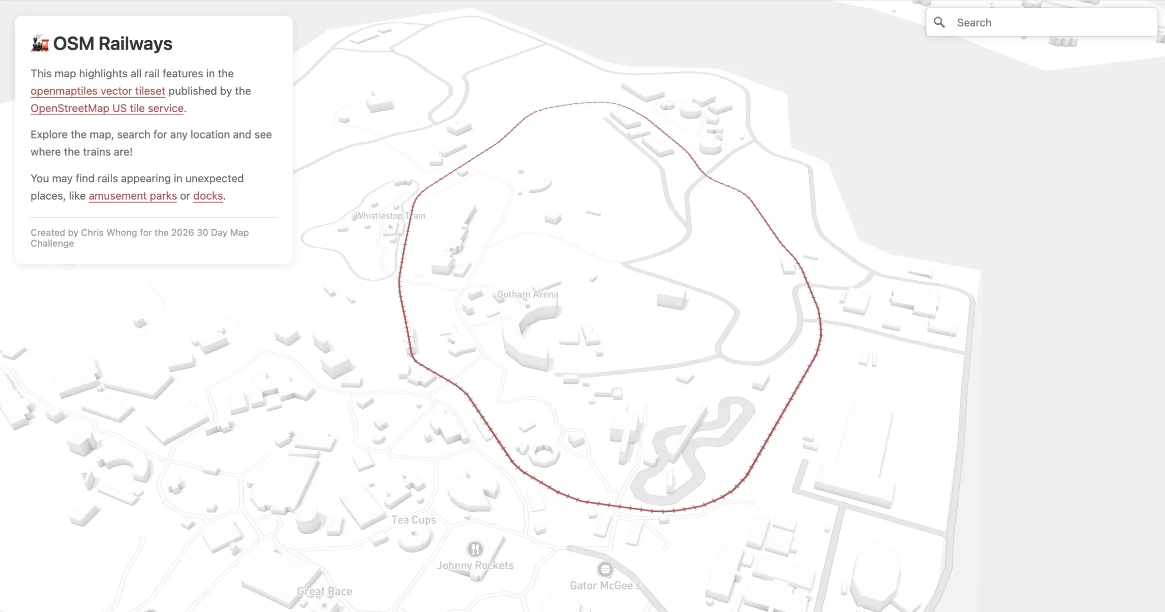
Hidden Rails with OSM Vector Tiles
OpenStreetMap’s new vector tile service now works seamlessly with Mapbox GL JS, unlocking new ways to visualize global data. In this demo, railroads from the OSM tileset come to life on the Mapbox Standard Style — revealing tracks hidden in unexpected places like amusement parks and shipping docks.
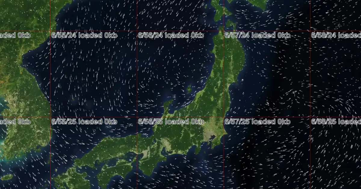
Japan Weather Layers
Check out this demo by Kenji Shima showing off the new Mapbox Japan Weather Layers. Toggle raster tilesets, swap projections, and experiment with particle animations.
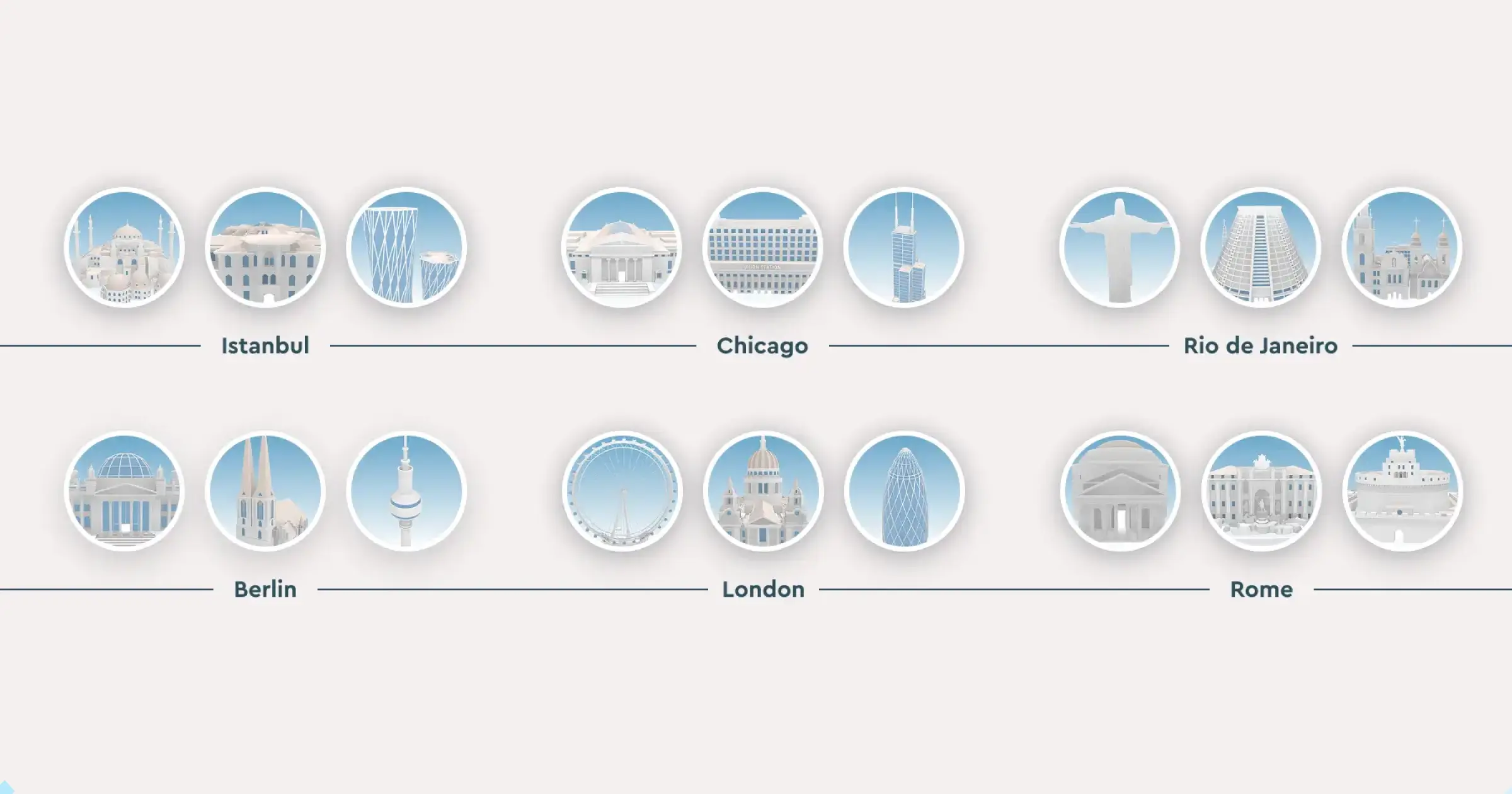
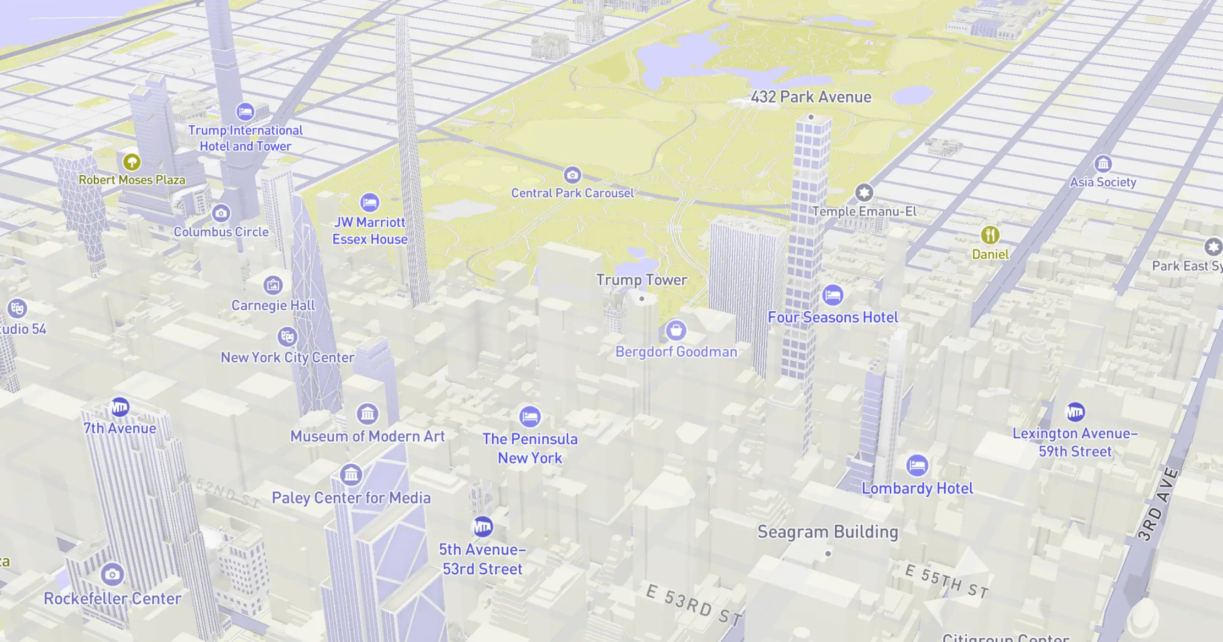
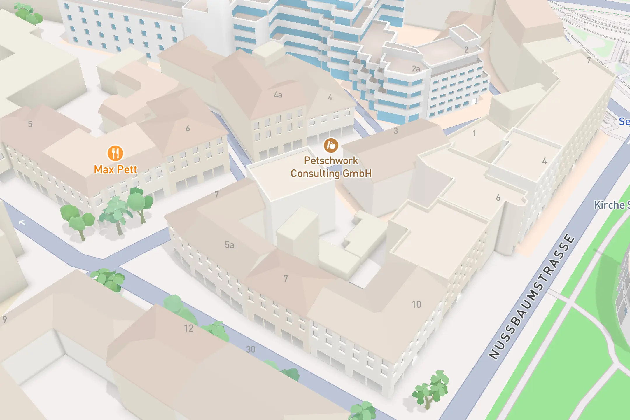
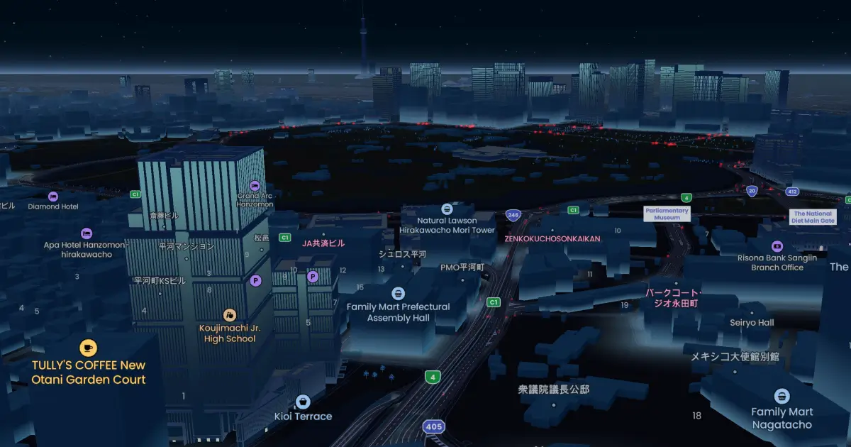
Landmark icons
The Mapbox Standard style features over 1,600 beautifully designed landmark icons across 40+ cities, giving maps instant context and a vivid sense of place.
Map makeover
During BUILD with Mapbox, in the “Streamlined Map Development Part 2” session, @Mathew Anthony showcased an impressive before-and-after — cleaning up styling, simplifying layers, and turning a busy map into a sharp, production-ready design.
Map simulator
The built-in color blindness simulator in Mapbox Studio, helps designers test and refine styles to ensure legibility and accessibility, so maps can communicate clearly and inclusively.
Mario map
Travel to a Mario-inspired world in this custom map style, designed to pair with 3D live navigation. Bold, playful gamer colors set the stage for dynamic karts and favorite avatars.
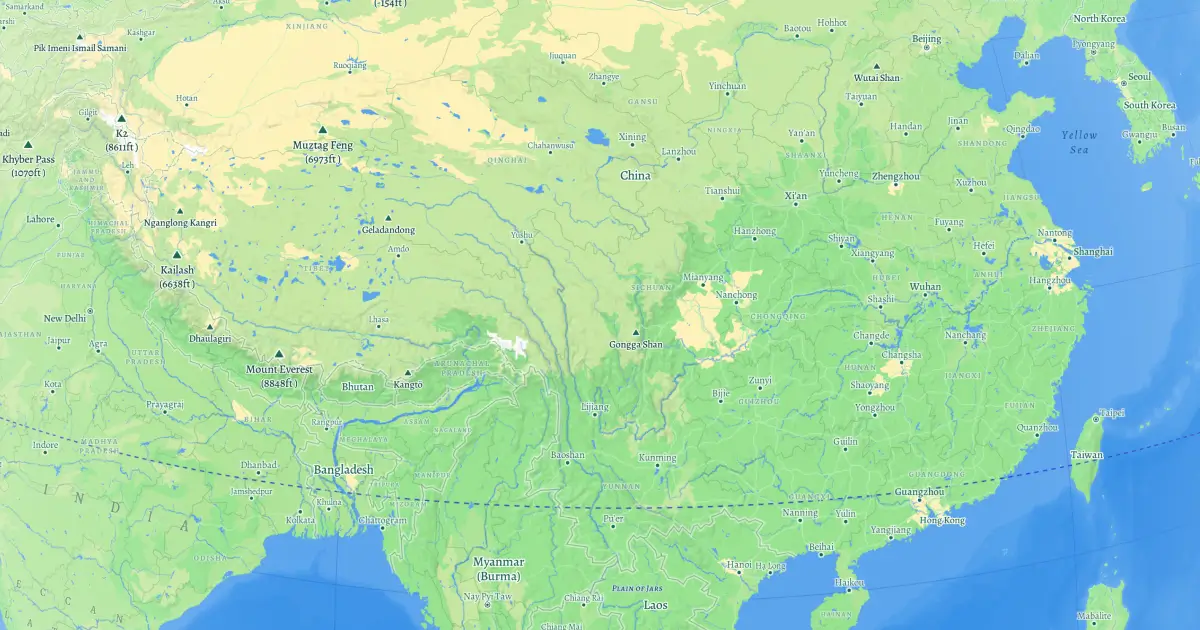
Natural Earth
Natural Earth is a public-domain dataset for global mapping. This map designer integrated its data on riverways, physical feature labels, and graticule lines into Mapbox Standard to create a traditional globe style — shown in the Natural theme.
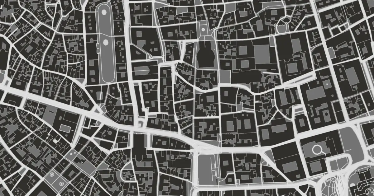
Nolli-style
Inspired by Giambattista Nolli’s iconic 1748 plan of Rome, this style reimagines the mostly-black ichnographic aesthetic that defined one of history’s most influential maps — now brought to life with modern rendering.
Browse our collection to see how to create your own version of this Nolli-style map.
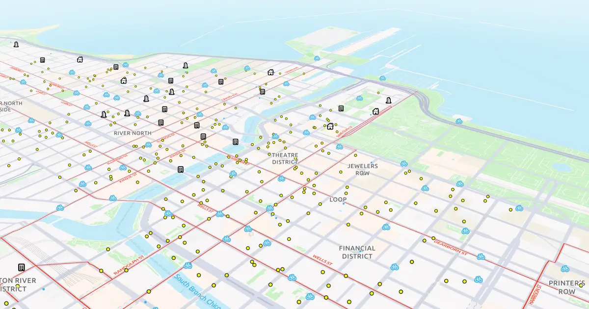
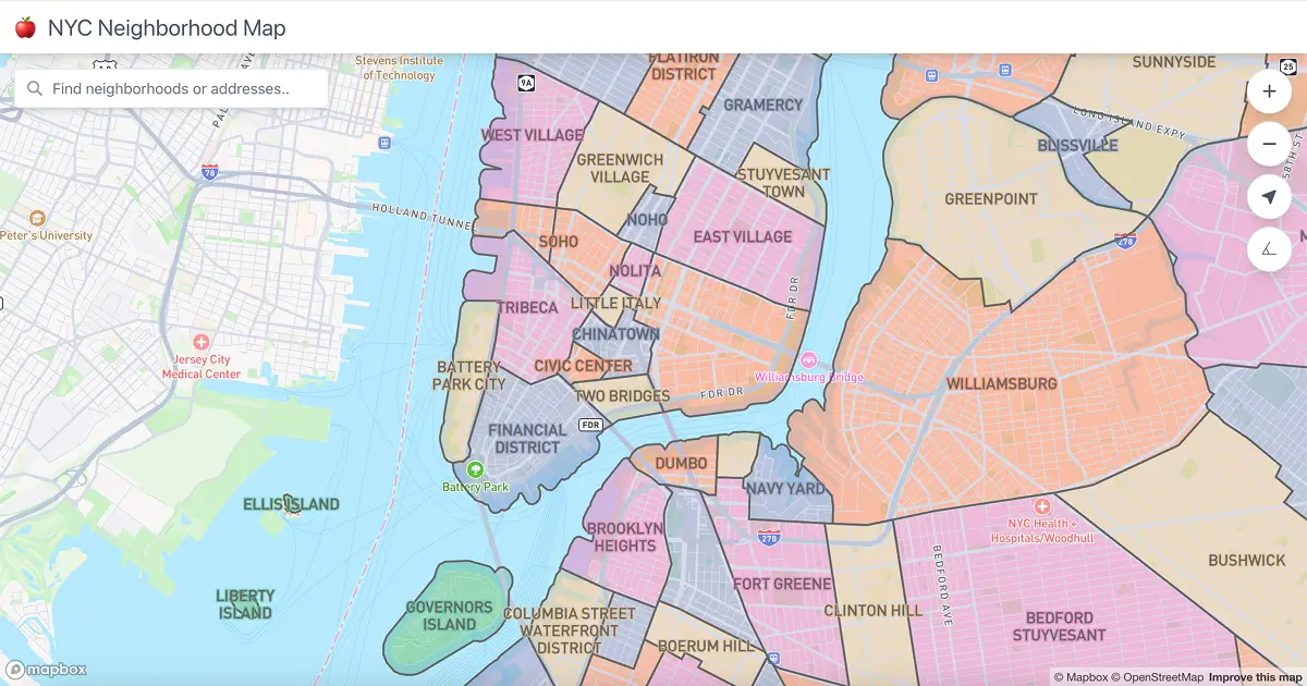
NY neighborhoods
This map explores one interpretation of New York City’s neighborhood boundaries. It visualizes a contiguous polygon dataset using the four color theorem—ensuring no two adjacent neighborhoods share the same color—while interactive hover effects and search combine local data with Mapbox Search Box API results.
Orthographic
The orthographic projection is one of the oldest around. At 0° pitch, it gives a top-down, perspective-free view of Earth that feels both flat and spherical at once.
This retro map inspired Owen to make a 3d map with a plan view drawing style.
Pin-powered maps
Tripadvisor used Mapbox to reimagine how travelers interact with maps — proving that great pin design and smooth interaction can directly drive results: 70% higher engagement. 3.5% more bookings.
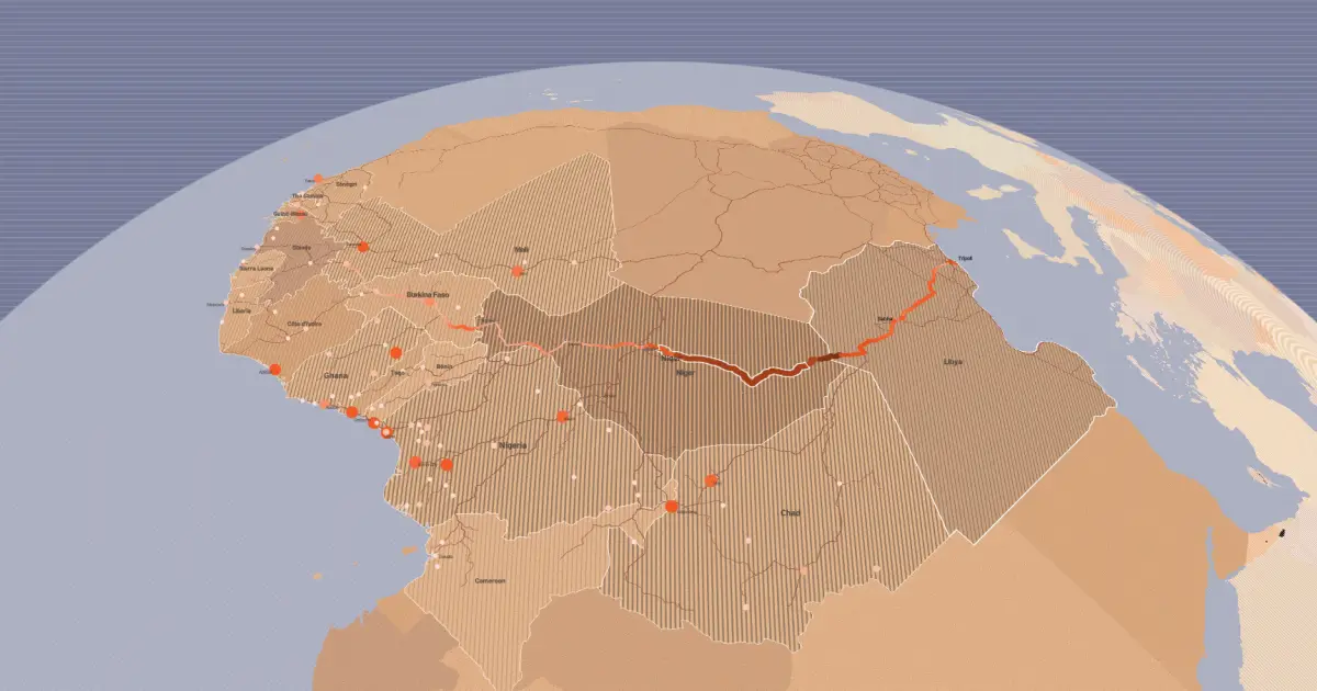
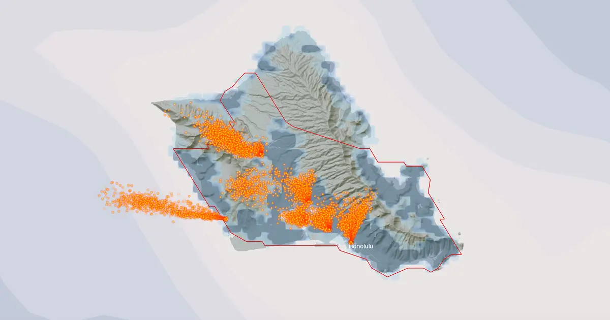
Pollution plumes
Using global emissions data, Climate TRACE visualizes PM2.5 pollution plumes from thousands of industrial sources worldwide, revealing that over 1.6 billion people live within 10 km of these emissions-intensive facilities.
Procedural buildings
Get an early preview of the procedurally generated building details coming soon to Mapbox Standard. Details like realistic roof shapes and facades bring 3D cityscapes to life with texture and depth.
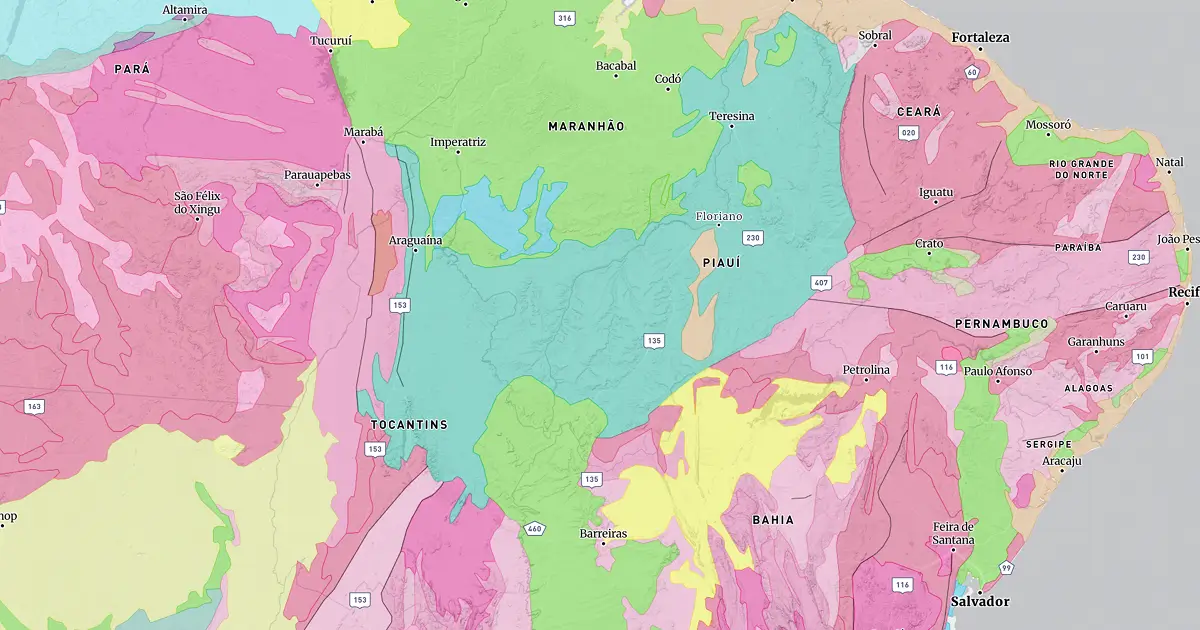
Rock on
Macrostrat uses Mapbox to reveal the geology of the planet in stunning detail. With over 225 geologic maps and 2.5 million polygons, it visualizes Earth’s crust, from bedrock to stratigraphic units, for exploration worldwide.
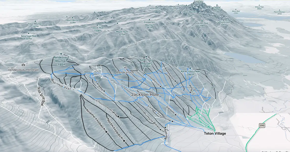
Ski runs
An Outdoors Winter map built on Mapbox Standard uses color-coded lines to show ski run difficulty. A custom expression detects symbols like diamonds, squares, and circles in each run’s name and colors them by regional convention, while unrated runs appear in white.
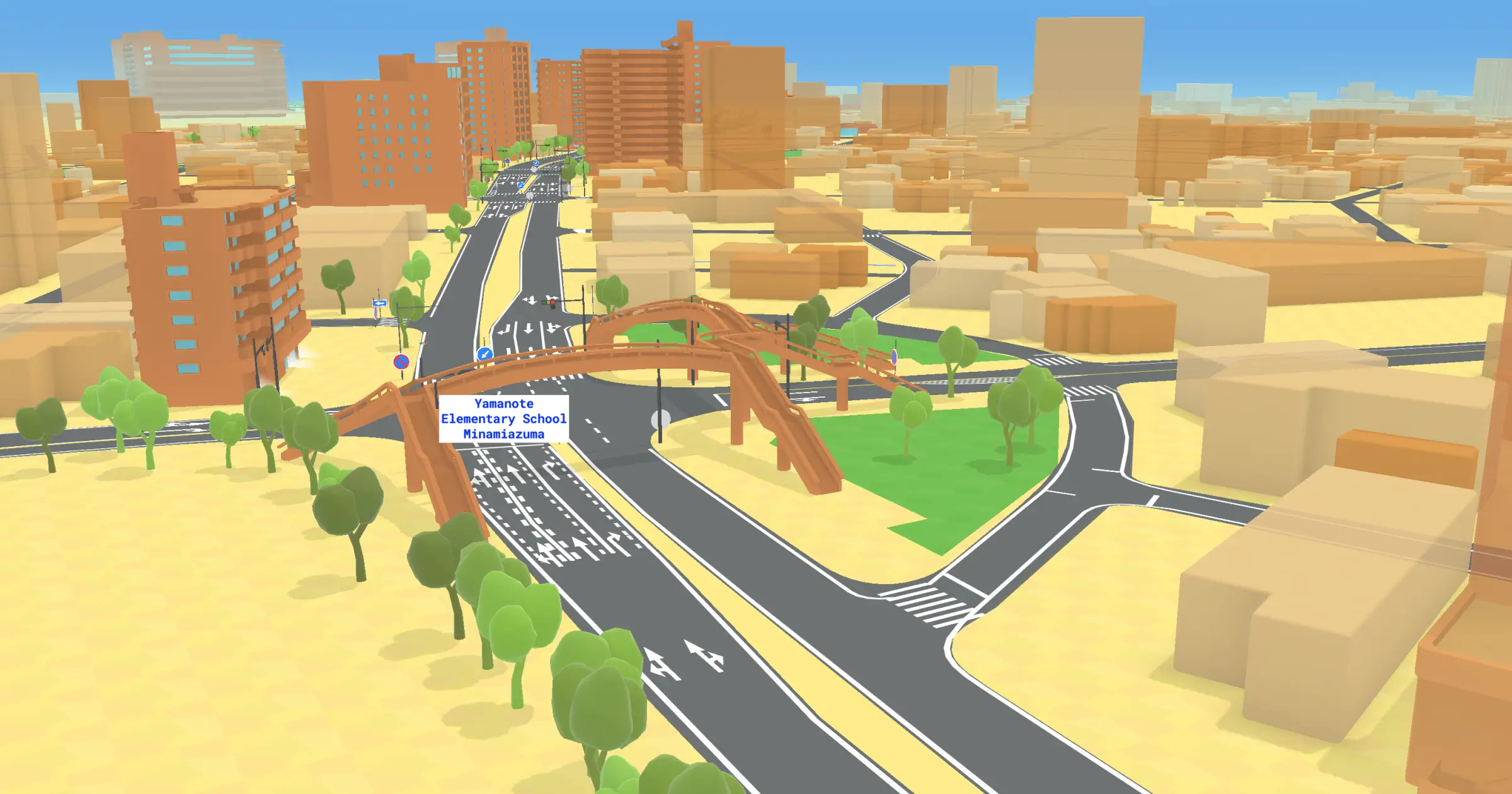
Tron map
A minimalist yet data-rich vision of the map of the future, this “Tron Style” design pulses with LiDAR-driven precision where every line and structure has purpose. Created for futuristic and autonomous vehicles, it merges mapping and technology into a single, seamless experience.
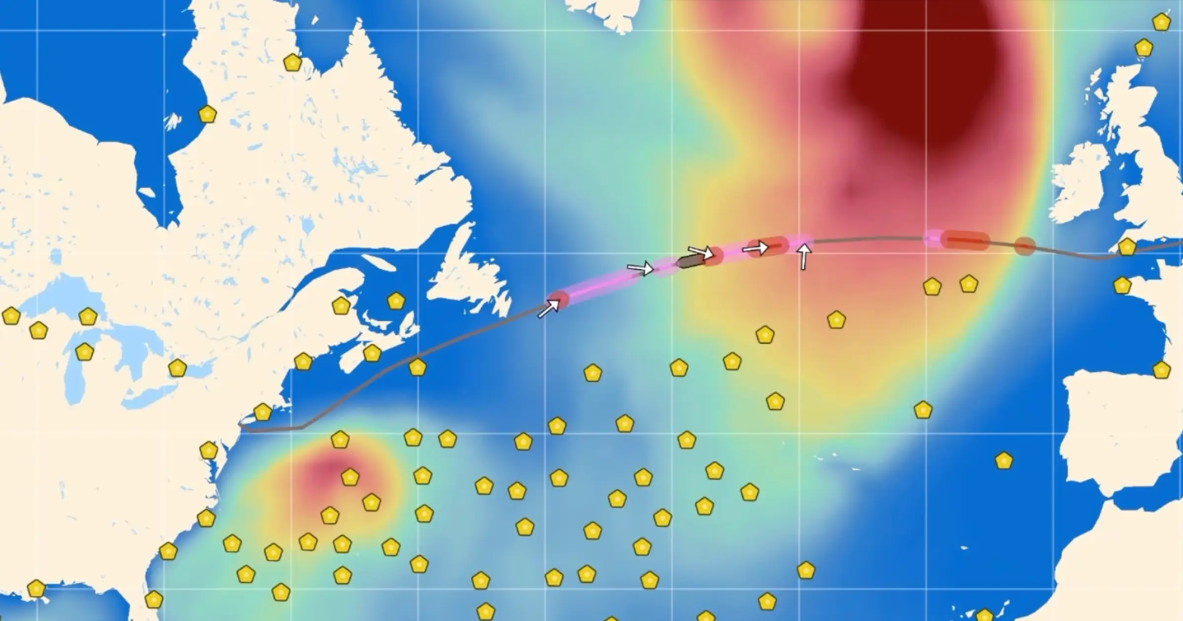
Wayfinder voyage simulator
The Sofar Wayfinder Voyage Simulator lets captains and operators test and compare ocean voyage plans in real time. It runs full-physics simulations in the browser using vessel models and live forecast data — so users can adjust routes, tweak power, and instantly see the impact on ETA, fuel, and weather.
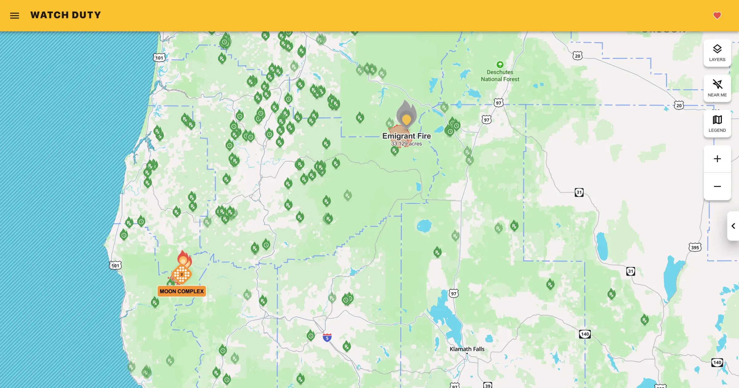
Wildfire alerts
Watch Duty is an award-winning wildfire alert app built with Mapbox, recognized by TIME, Apple, and Fast Company. It helps people stay informed and safe with wildfire updates.
Feeling inspired?
Browse our collection of maps to see what's possible with Studio.