
Maps that impress and reassure
From recreational drone users to commercial teams, deliver smooth and fast maps that get the details right.
User-friendly maps
Mapbox powers sharp, smooth, and highly responsive mapping experiences for web, mobile, and embedded systems.
Take maps offline
With the Mapbox Mobile Maps SDKs, cache offline maps to work in mobile applications. With Mapbox Atlas, take deployments in embedded systems fully offline.

Intuitive in 2D and 3D
Bring natural details right into your map style using curated or custom map styles. Compare captured data to 2D or 3D model data.
Fast data processing
Highly efficient processing and rendering of custom data gets maps updated in minutes.
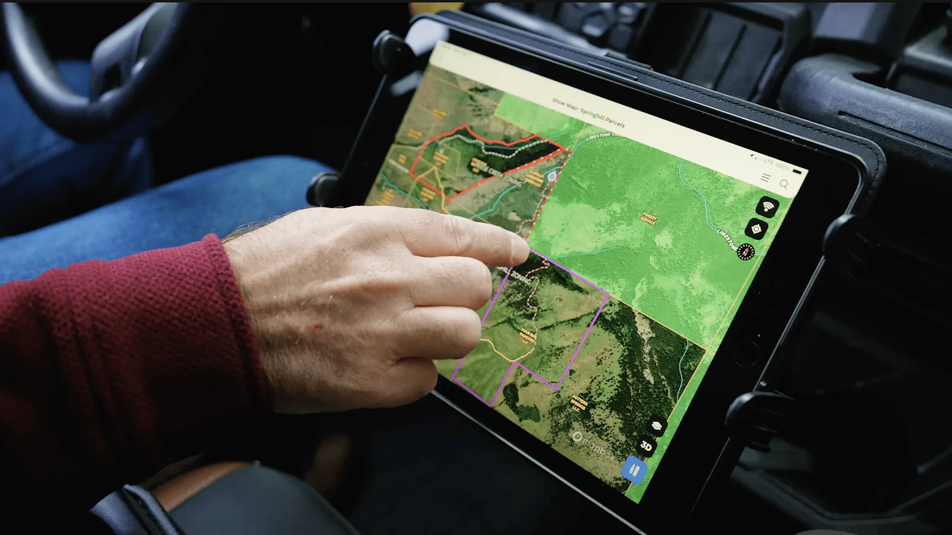
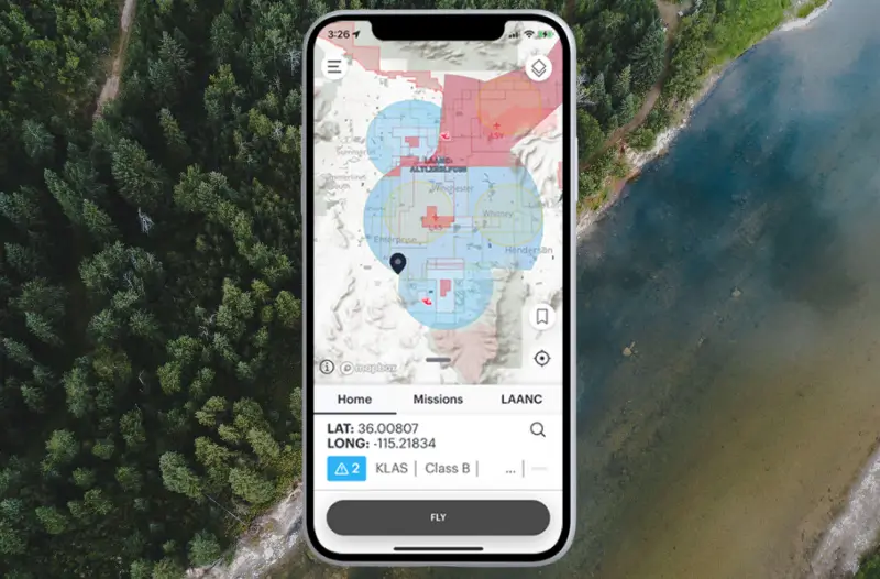
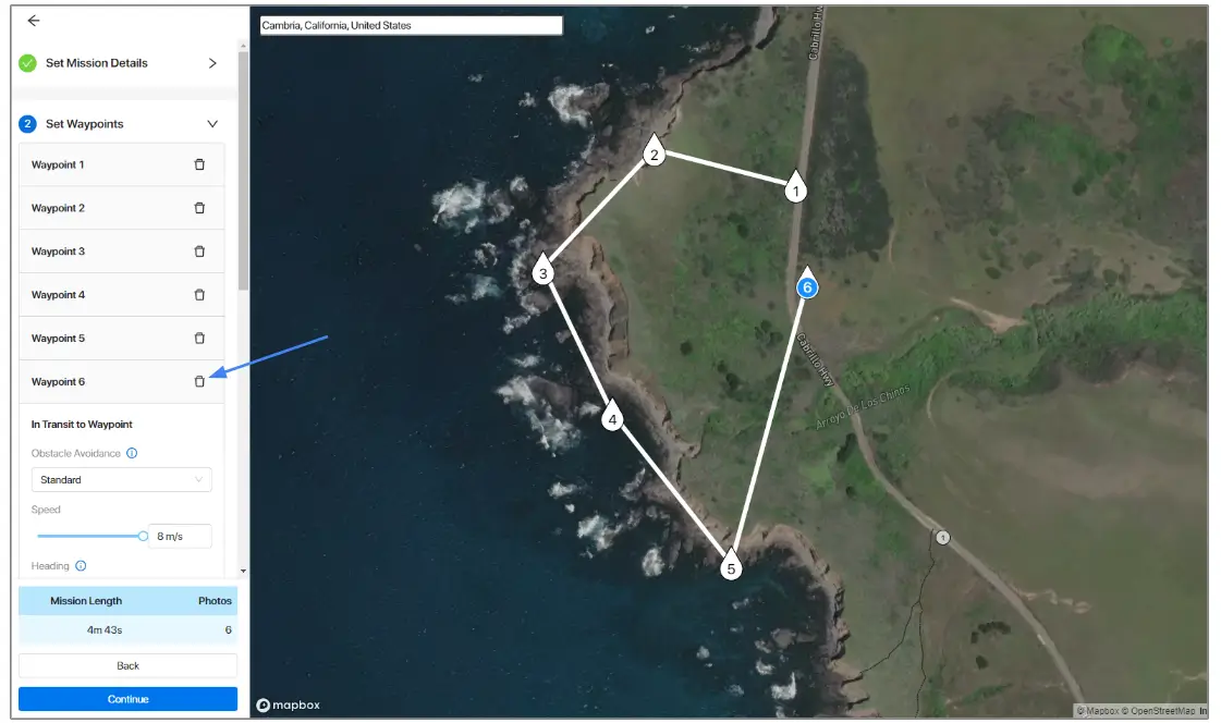
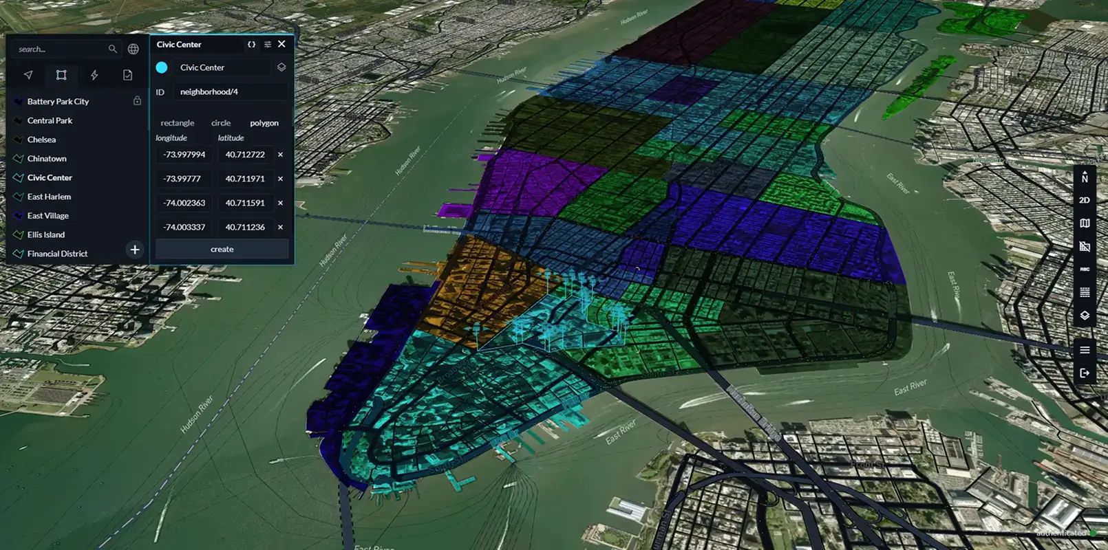
Flight planning and navigation
Support detailed flight planning, including custom zone avoidance using geofencing. Define boundaries, constrain activity, and visualize approved areas. Integrate navigation services to provide routing to waypoints or points-of-interest on the global Mapbox basemap.
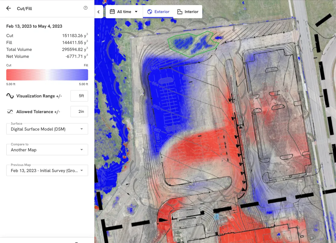
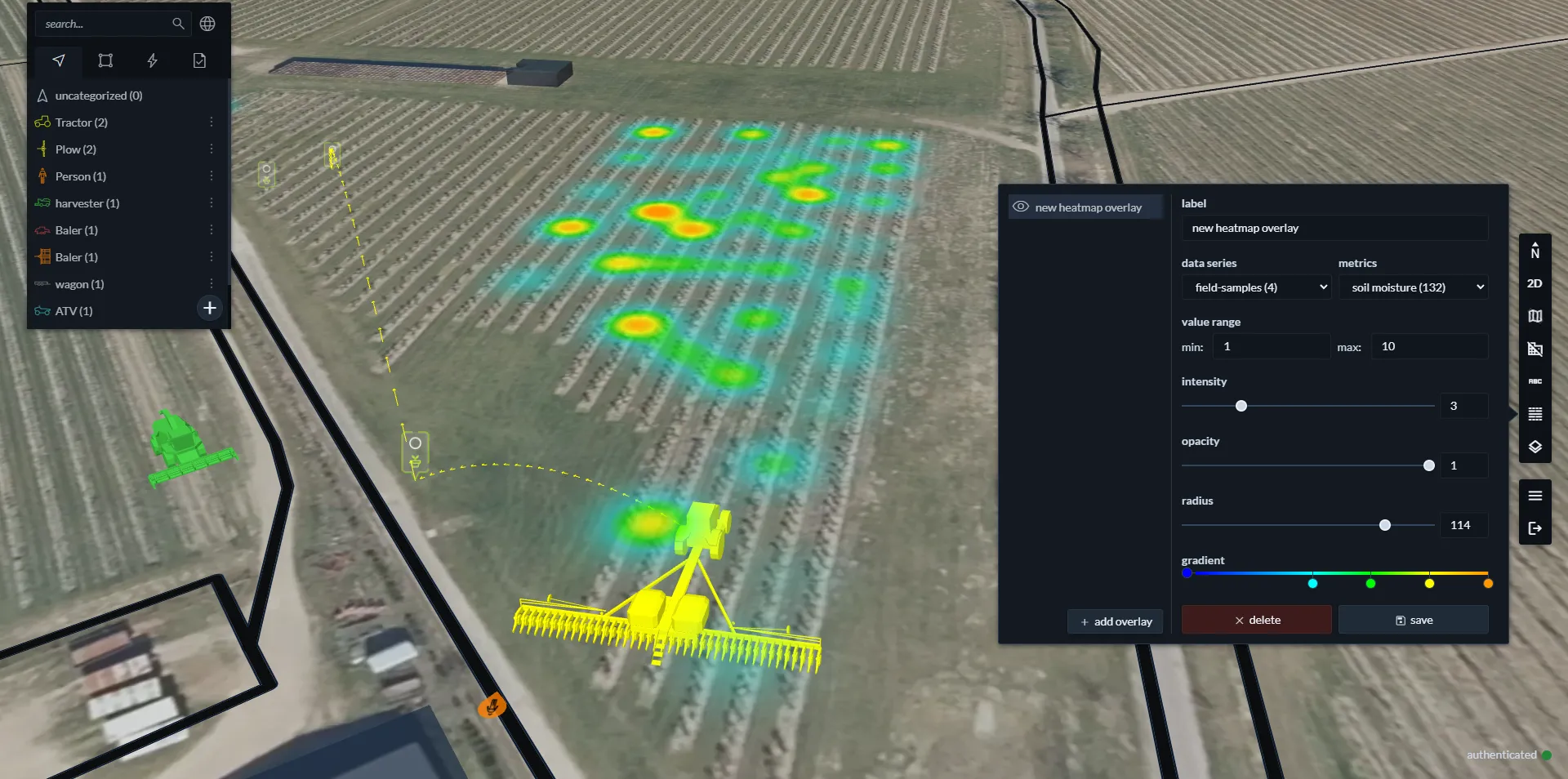
Custom data visualizations
Add imagery and data for rapid display and analysis. Process massive files into efficient hosted tilesets for highly interactive map layers. Merge topographical data, analysis layers, and models of vehicles, tasks, markers and routes
Best-in-class map rendering
Mapbox performance ensures that all layers, including the base map, custom data, and 3D details load smoothly in a polished map experience.
Superior flexibility
Across web, mobile, and integrated systems – and from construction, to agriculture, to emergency response, the Mapbox platform allows the flexibility to build fit-for-purpose features.
Deploy across web, mobile, and beyond
Use one cohesive, yet flexible, platform for applications and integrations across web, mobile, embedded control systems. Integrate Mapbox Atlas for air gapped environments.
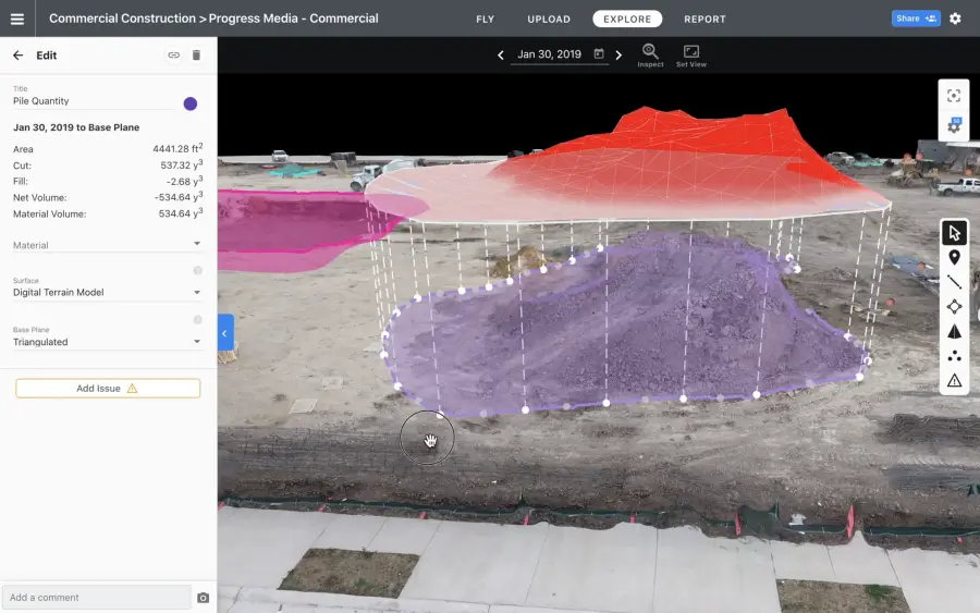
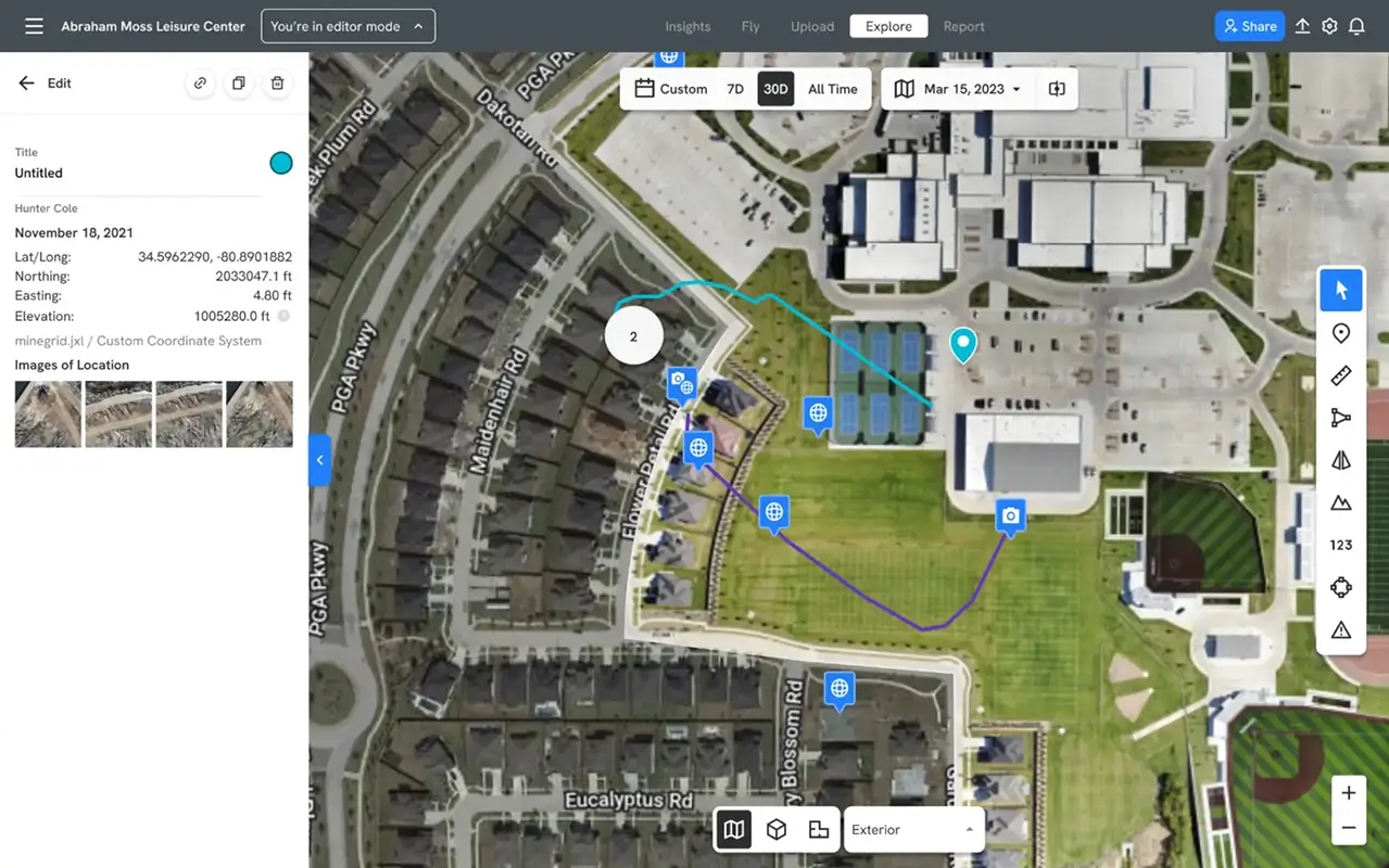
Site planning and monitoring
Impress users with responsive maps that can rotate, accurately visualize file overlays, and quickly zoom in and out of large maps without losing detail and resolution.
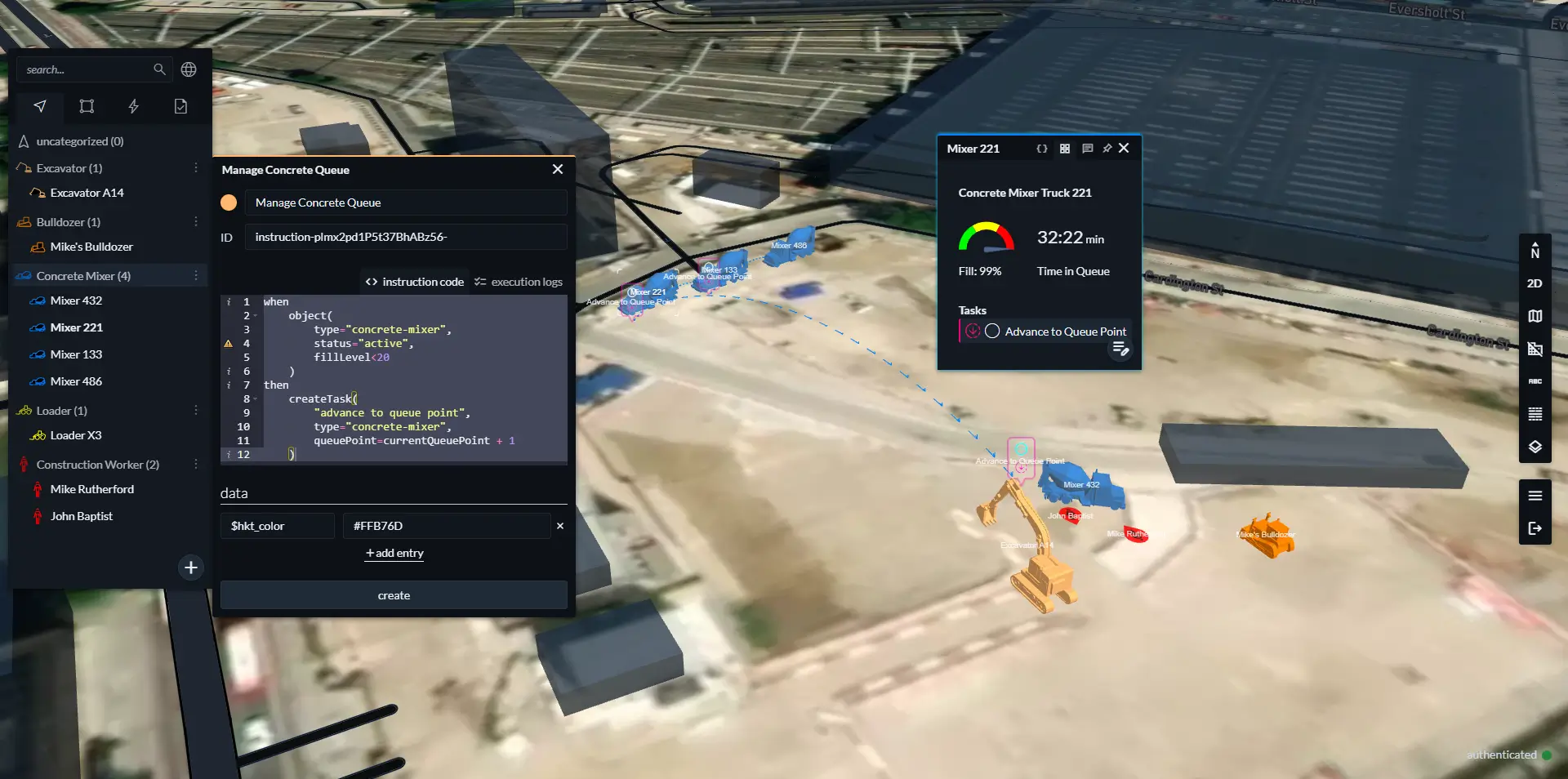
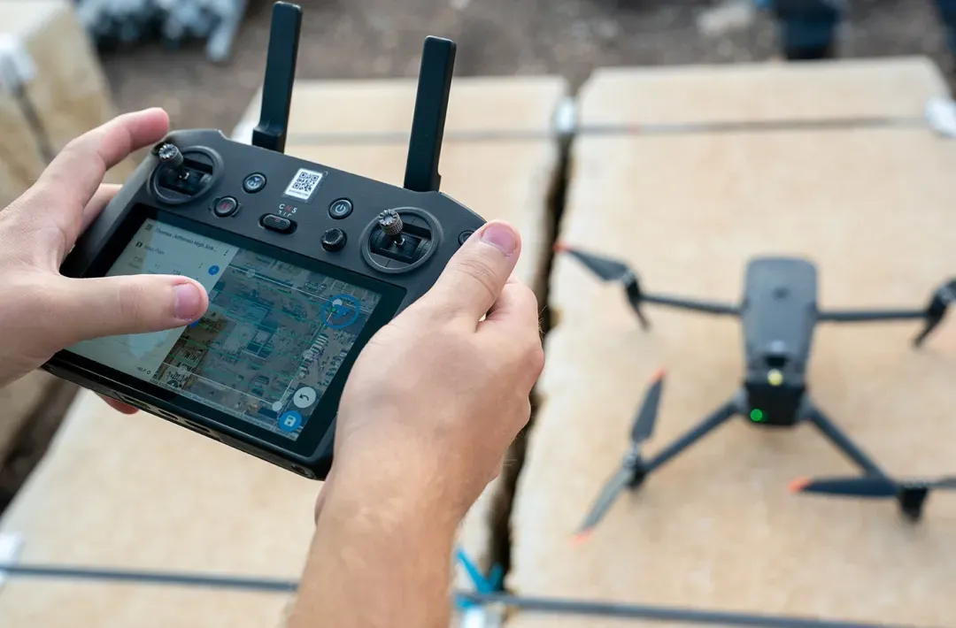
Remote control
Add location context and situational awareness to task management interfaces by visualizing assets and commands in precise detail.
Customer stories


Switching from Leaflet to Mapbox provided DroneDeploy the modern map infrastructure to delight their customers, from recreational drone users to commercial applications in construction, mining, and logistics.
Read showcase →
Mapbox equips the modern operations management platform with maps to seamlessly integrate people, vehicles, equipment, and data into a comprehensive digital twin – from work sites to entire cities.
Read showcase →
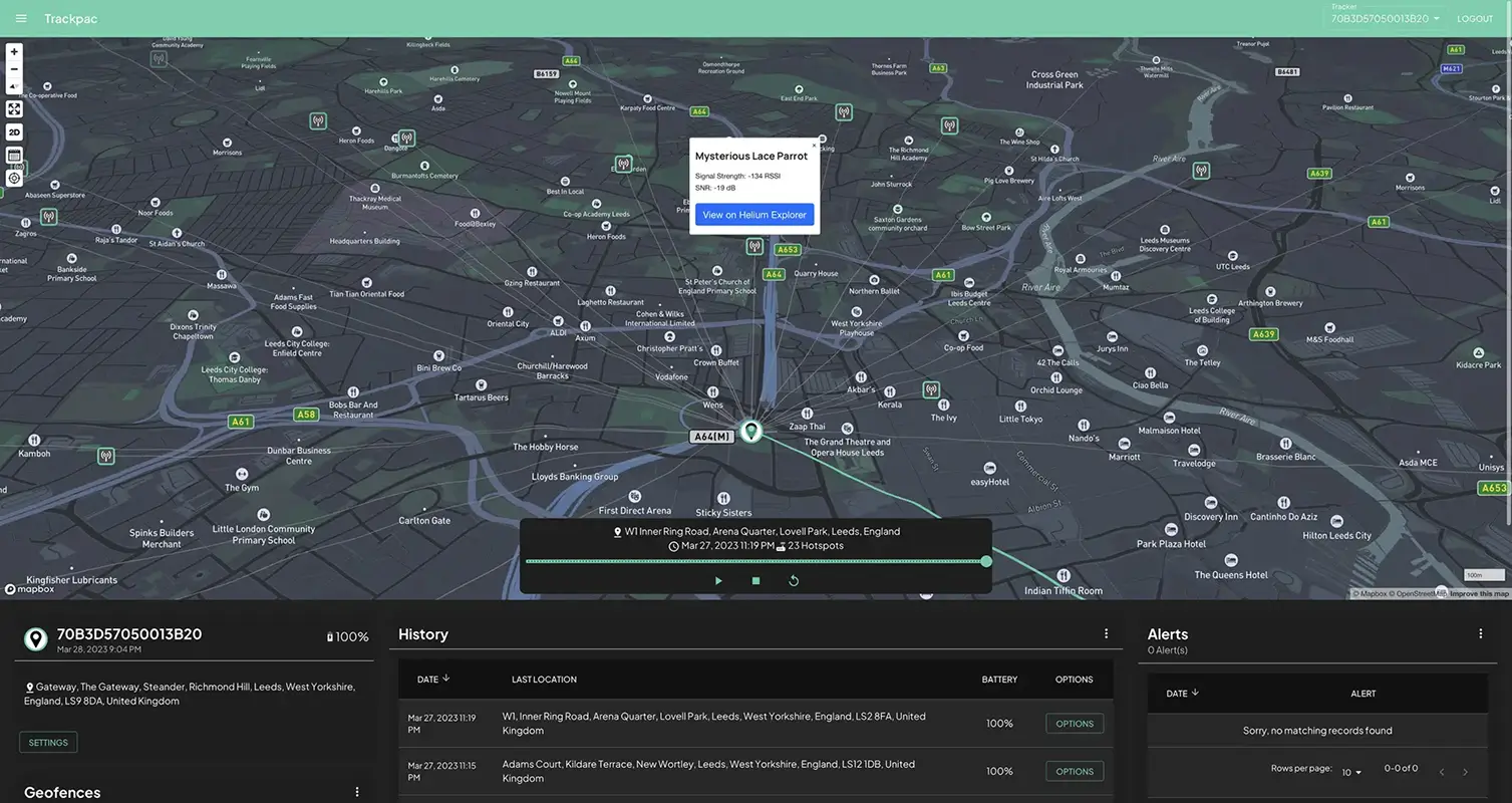
Asset tracking with NanoTags helps businesses gain real-time visibility into inventory levels, detect and respond to theft or loss, proactively schedule maintenance and repairs, and provide real-time visibility into the location and status of shipments.
Read showcase →

As the leading innovator in geospatial disaster assessment and intelligence, MIS saw 5x Enterprise customer growth in just 3 years thanks to tailored insights for damage assessments with Mapbox GL JS and Geocoding.
Read showcase →
Ready to get started?
Create an account or talk to one of our experts.