Powerful, elegant 3D visualizations now available to everyone
-min.png)
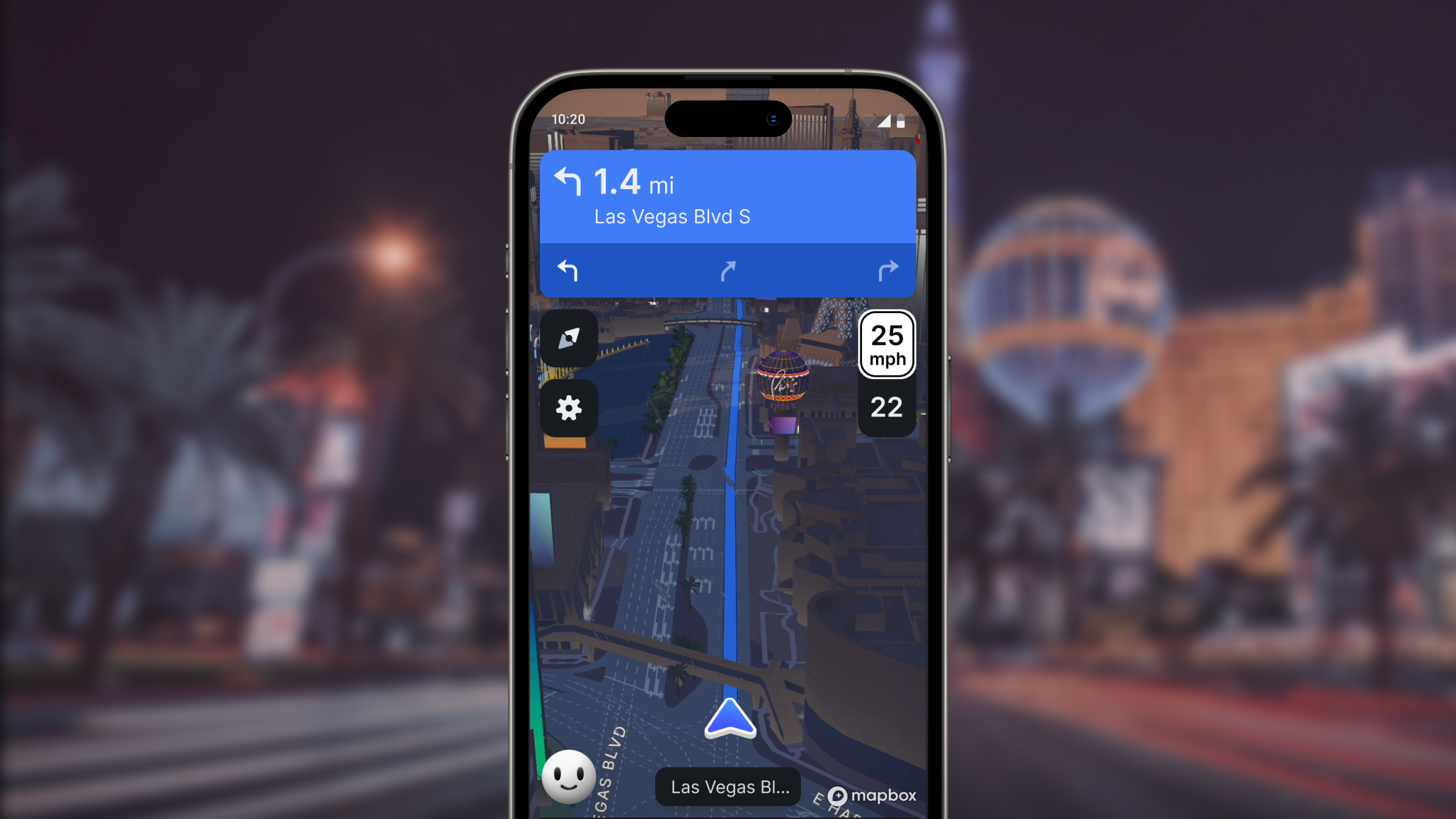
Mapbox Standard is now generally available as the default Mapbox map style, adding powerful 3D visualization to map environments. This momentous launch builds upon existing Mapbox 3D features including terrain, globe projection, and sky and atmosphere styling. Mapbox Standard adds rich detail with custom landmark buildings, elevated symbols, and enhanced use of environmental features like lighting, fog, and depth of field. This experience is available to all Mapbox users in GL JS v3, the Mobile Maps SDKs v11, and Mapbox Studio.
3D For Everyone
Mapbox has always offered powerful map styles out-of-the-box or as a basemap for customization. GL JS v3 and the Mobile Maps SDKs v11 adopt Mapbox Standard as the default Mapbox style. Standard makes carefully curated, performant, and elegant 3D experiences available to all developers with minimal startup effort, developer-friendly tools, and a simplified approach to map style maintenance.

In Mapbox Standard, urban areas are enhanced with custom-designed landmarks that provide more realistic details in a given location, and enhance wayfinding. The map design uses an elegant symbolic realism that provides a perfect canvas to highlight custom location data, instead of distracting from it. Carefully detailed dynamic lighting, natural day-to-night shifts, and atmospheric effects further enhance the real-world feel of the map. Behind the scenes, powerful improvements to rendering the environment and building extrusions ensure quick uptime, responsiveness, and continuity when viewing the map.
Improved wayfinding and location details
Mapbox customers are using Standard to build more engaging and informative location experiences. Real estate companies are enhancing how they visualize property listings in relation to other points of interest. Travel booking companies are more accurately representing the area surrounding their hotels and venues. Auto manufacturers are giving drivers a more true-to-life navigation experience.
The Pursuit app from Pursuit Labs connects users in New York City with events, concerts, restaurants, and more. The Mapbox Standard 3D basemap and landmarks, built-in configuration options, and Pursuit Lab’s own customized location data create a branded and recognizable experience.


"In the Pursuit app, the entire focus revolves around the map. Adopting Mapbox Standard has allowed us to level up the experience for all of our users with 3D buildings and a hand-crafted color palette, all while being able to keep the powerful data visualization features that led us to choose Mapbox in the first place.”
Stephen Silber, CTO, Pursuit Labs
Additional New features for 3d
Building on the features announced in the beta launch of Mapbox Standard, the General Availability (GA) version introduces additional capabilities and refinements that improve the Standard experience. Many of these updates are based on customer feedback.
A new dynamic elevation offset makes it easier to read the skyline and distinguish which symbols and labels belong to which buildings and landmarks.


Stylistically, the dawn lighting preset now includes warmer direct lighting and atmosphere. A new ‘vertical’ fog sets the height of the fog layer so that landmarks are distinguishable from the fog. The night sky view is brighter and landmarks now have nighttime flood lighting. The 3D assets now also include wind turbines.


Mapbox Standard now supports 3D terrain at mid-range zoom levels to enhance the 3D view of rural environments and to connect urban environments to real-world terrain.


The coverage of 3D landmarks in Mapbox Standard is continually expanding around the world, with landmarks recently added to Philadelphia, Sydney, San Diego, Melbourne, Edmonton, and San Antonio.


Streamlined Map Development
Mapbox Standard significantly reduces the technical burden and cartographic expertise needed to maintain a map style. The new ‘Slots’ feature provides well-defined placeholders within the basemap that function as optimized places for adding custom data. Developers and map designers no longer need to parse through 120+ layers to experiment with the best place to insert custom data. In addition, a curated set of configuration options gives developers the opportunity to customize the map to their brand or experience, without needing to harmonize changes across every map layer.

Mapbox can now push updates automatically to the basemap data underpinning the Mapbox Standard style, even when customized. Developers will benefit from new data features, visual improvements to the style, and new configuration options automatically without a time-intensive update that risks breaking changes.
"By leveraging the Mapbox Standard style, we can align our indoor maps with the 3D outside world, building a seamless map environment that mimics the real world in ways never before possible. The ability to bring our own data to the basemap and efficiently manage the style is exactly why we’re excited to keep working with Mapbox."
Christian Christensen, Product Manager, MapsPeople
Design with Standard in Mapbox Studio
Mapbox Standard is now the default style for those designing maps in Mapbox Studio. Within the Studio interface, developers can access Standard configuration options as well as add custom data layers. Custom data can be inserted into the new predefined slots within the style, where they can then be configured with custom styling settings.
Improving performance and the developer experience
The improvements to our latest versions extend beyond the new 3D style. The Mobile Maps SDKs v11 has been built with support for SwiftUI and Jetpack Compose declarative UI toolkits, making it faster for developers to iterate and simplifying development.
The SDKs v11 also introduces APIs (iOS and Android) that equip developers to more efficiently identify and analyze where performance issues occur. The Tracing API offers a detailed overview of the operations performed by the rendering engine. The MapRecorder API enables capturing map interactions and playing them back independently from the application where they were created.
Dynamic View Annotations for Web and Mobile
New options for Dynamic View Annotations (iOS and Android) give developers more freedom to place view annotations using not just point geometries, but also circles, polylines, and polygons. For example, it is now possible to place a label on a polygon (e.g., the corner of a building), or along a route line that will adjust as the camera moves. That annotation will synchronize with viewport updates.
It’s Time to Start Building
It’s an exciting time to bring 3D and enhanced wayfinding to life with Mapbox Standard and the updates to the Mapbox SDKs and Studio. We’ve published documentation about Mapbox Standard as well as guides for migrating to GL JS v3 and Mobile Maps SDKs v11 for iOS and Android.
For customers that have used Mapbox Standard during the beta, we recommend updating to the latest SDK to automatically reference the new Standard style. Prior SDK versions are referencing the Standard beta endpoint, which will no longer receive updates.


Related articles

Tour Osaka in 3D with Mapbox Standard

One Attribute to Rule Them All